Search for ancient iceMarchant explores the past hidden in Antarctic landscape to understand the futurePosted March 13, 2015
The McMurdo Dry Valleys are the largest part of Antarctica not covered with ice. Instead, a seemingly endless carpet of boulders and rocks flows into networks of steep cliffs and valleys – some over a mile deep, recalling the canyons of the American Southwest, but unimaginably more vast. Almost nothing lives there. This is Earth’s most ancient landscape, frozen in time for millions of years. For more than a quarter-century, David Marchant, a Boston University professor of earth and environment and head of the BU Antarctic Research Group, has been exploring the Transantarctic Mountains, methodically piecing together the story of the landscape and past climate change and what it has to tell us about the future of our warming planet. From early November through December 2014, Marchant led a team of graduate students on his 26th trip to the Dry Valleys, where they spent eight weeks living in unheated tents under 24-hour sunlight, doing fieldwork long into the night. For Marchant and his students, each trip begins with a series of questions: Exactly how old are the Dry Valleys? Why did ice first form there? When did the climate cool so dramatically that even the hardiest tundra plants and animals became extinct? What can ancient, buried ice tell us about the future of our warming planet, and the potential threat of sea level rise? 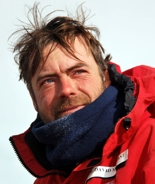
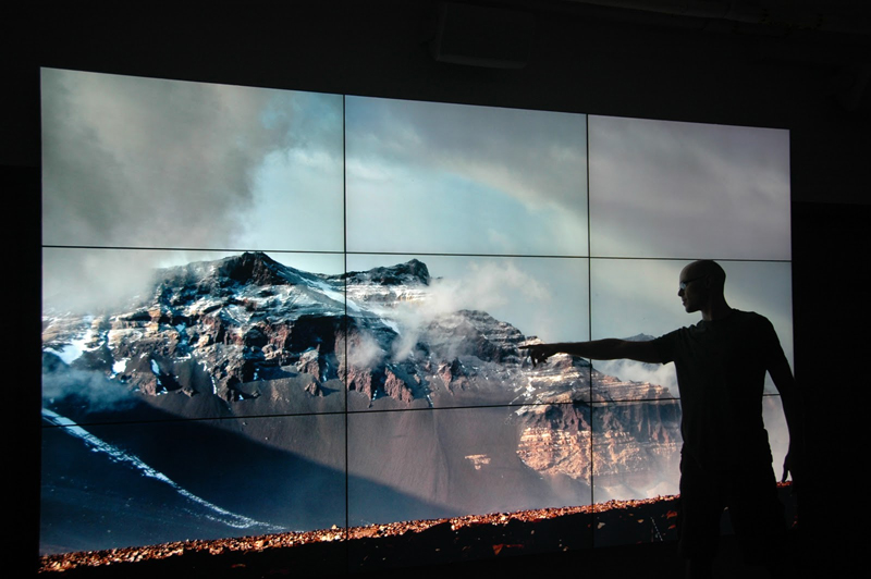
Photo Credit: Sean Mackay
David Marchant
The key question, especially for a geologist like Marchant, is this: What happened to this massive ice sheet in the past? Did some of it melt during natural climate warmings that occurred several million years ago? If it did, does that suggest that it might melt in the future with atmospheric warming created by the burning of fossil fuels? Unraveling the mysteries of the Antarctic Dry Valleys starts at BU in the Digital Image Analysis Lab, where Marchant and his students pace in front of four-meter-tall high-definition video screens, poring over thousands of satellite images and aerial photographs of the Transantarctic Mountains. They are looking for field sites for the 2014-15 expedition. Specifically, they are searching for polygons, networks of cracks in the landscape caused by thermal contraction and expansion. Similar patterns can be seen in landscapes all over the world, but Marchant and his team are looking for “sublimation polygons” – a term Marchant coined – that are indicative of shallow, buried ice, hidden beneath just one or two meters of debris. It’s this ice that Marchant believes may hold the key to the history – and future – of the East Antarctic Ice Sheet. When Marchant first began working in Antarctica, the Dry Valleys were considered ill-suited for glacial studies, specifically because of the preponderance of polygons. The general wisdom at the time was that when polygons form, the layering of near-surface sediments is disturbed by the movement of ice and soil through recurring freeze and thaw cycles – a process known as cryoturbation – that would preclude the existence of any data about the ancient environment. Ultimately, Marchant was able to use the dating of volcanic ash and numerical modeling to show that air temperatures in the Dry Valleys have remained too cold for the past several million years to allow any melting or cryoturbation. He developed a new model for the formation of these sublimation polygons, arguing that they would likely form where stagnant, buried glaciers were covered with one or two meters of surface debris. 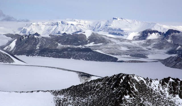
Photo Credit: Peter Rejcek
McMurdo Dry Valleys
In 1993, Marchant’s belief was confirmed when he and Noel Potter, a colleague from Dickinson College, discovered glacier ice buried beneath a vast field of polygons – the very sublimation polygons that Marchant had begun to decode. Since then, Marchant’s expeditions have begun with a rigorous examination of the landscape’s polygons, in the hopes of finding the ideal place to drill for ancient ice. The virtual fieldwork Marchant and his students did back at BU provided them a head start in the search for buried ice. But as valuable as the high-resolution satellite imagery and other modern technology are for this research, Marchant says, there is no substitute for actual fieldwork in the Dry Valleys. “None of the instrumentation leads us to make the next discovery,” he says. “It certainly adds incrementally, but the big leaps we make come from what we observe in the field. We’ll walk and we’ll talk. I’ll point to things, an ancient polygon here, a degraded polygon there; one that has ice underneath, one that doesn’t. You look for spacing and density and subtle, centimeter-scale depressions in the land surface. NSF-funded research
David Marchant, Boston University. “At first the students won’t see them. You’ll say, ‘You just walked over 10 thermal contraction cracks.’ Once you have your eye attuned to it, you start to see them everywhere.” They dig soil pits by hand – and there is an art to digging the pits. In each pit, there is the possibility of a 15-million-year-old record. The potential for daily discovery is a geologist’s dream, says Marchant. Drilling into buried ice itself is tricky. Marchant’s team uses a dry drilling technique to avoid disturbing the pristine landscape, an approach that makes it much harder to drill. Without additional lubrication, minor meltwater generated from friction along the core barrel can instantly re-freeze, shutting down the entire drilling operation in seconds. Sometimes the ice cores fracture and fall apart. When the researchers are able to retrieve an intact core from deep within the ice, it is the culmination of years of preparation and effort. |

For USAP Participants |
For The Public |
For Researchers and EducatorsContact UsNational Science FoundationOffice of Polar Programs Geosciences Directorate 2415 Eisenhower Avenue, Suite W7100 Alexandria, VA 22314 Sign up for the NSF Office of Polar Programs newsletter and events. Feedback Form |