Get crackingMcMurdo mountaineers flag and monitor sea ice routes for safe travelingPosted November 21, 2014
The first stop is Backdoor Bay, an iced-over cove where more than a century ago, famed Antarctic explorer Ernest Shackleton unloaded supplies for his expedition base at Cape Royds on Ross Island. These days the bay is on the sea ice route to the penguin rookery at the cape, where researchers conduct a long-term study on the southernmost Adélie penguin breeding colony. Mountaineers Ned Corkran and John Loomis have driven snowmobiles here about 20 miles from McMurdo Station to survey the area for safety. 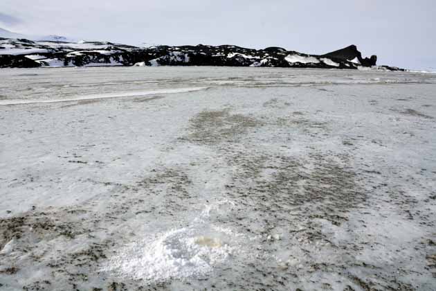
Photo Credit: Peter Rejcek
Rock and dirt debris on the sea ice in Backdoor Bay will likely cause the ice to deteriorate quickly from solar radiation.
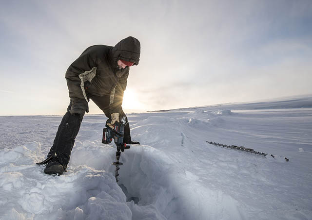
Photo Credit: Alasdair Turner
August Allen drills into the sea ice to test its thickness back during September.
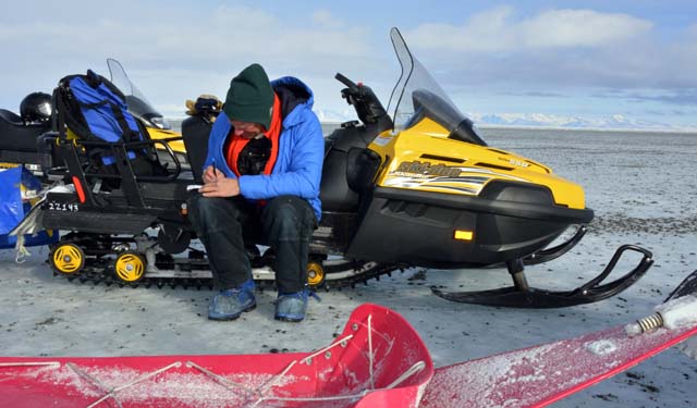
Photo Credit: Peter Rejcek
Mountaineer Ned Corkran makes notes on the sea ice conditions.
It’s not looking too good. The sea ice is plenty thick enough – about six feet or so – based on a measurement from a hole drilled through the ice. But the snow cover that blankets much of the ice farther south, back toward McMurdo, is absent here. Rocks and dirt blown from the nearby coastline are entrenched in the bare ice. The dirty surface will readily absorb the 24-hour sunshine, causing the ice to deteriorate. “This is going to fall apart quickly,” notes Loomis, who also leads McMurdo Station’s search and rescue team. Meanwhile, Corkran makes notes about the thickness of the sea ice, data used to feed into a bi-weekly report about the state of health of the sea ice in McMurdo Sound. Between the few brief months when the sea ice in McMurdo Sound finally solidifies and then starts to fall apart again, scientists and support personnel move back and forth across its ice-covered surface. Snowmobiles and boxy-shaped vehicles like Hägglunds crisscross the sea ice along trails marked by bamboo poles with red or green flags flapping in the breeze. It’s up to Corkran, Loomis and the other mountaineers in McMurdo’s Field Safety & Training (FS&T) department to map and monitor the routes, surveying cracks and even measuring the internal temperature of the ice, a key part of the equation for how thick the ice has to be to support different vehicles. This year the temperature is higher than it normally would be by nearly two weeks, according to Corkran “This job is about finding places where people can travel safely and determining which vehicles can cross which cracks,” explains Corkran, who lives in Driggs, Idaho, where he works in the Teton Range as a climbing instructor and guide when not in Antarctica. Corkran says that while the environments and dynamics are dissimilar – peaks versus sea ice – the risks and the processes for managing those hazards are the same. “You’re going to fall through a crack in the ice or you’re going to fall through a crevasse,” he notes. Sea ice is frozen seawater, and it nearly doubles the size of Antarctica each winter as it forms around the continent. McMurdo Sound itself is roughly 1,000 square miles, with most operational and scientific activity taking place on the east side between the tip of Hut Point Peninsula near McMurdo Station and Cape Royds – about 20 miles apart. Research on the sea ice ranges from studies tracking Weddell seal populations to diving underneath the ice to investigate the marine life on the seafloor. Benthic ecologist Stacy Kim relies on the main route before establishing her own spurs off the main Cape Evans super-sea-ice highway to a field camp or site. “When FS&T flags a route, it is beautifully straight and easy to follow,” she says. |

For USAP Participants |
For The Public |
For Researchers and EducatorsContact UsNational Science FoundationOffice of Polar Programs Geosciences Directorate 2415 Eisenhower Avenue, Suite W7100 Alexandria, VA 22314 Sign up for the NSF Office of Polar Programs newsletter and events. Feedback Form |

