An Airborne Look Through the IcePosted February 24, 2015
Scientists are working to fill in one of the largest remaining blank spots on ocean charts. 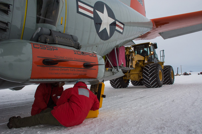
Photo Credit: Michael Lucibella
Members of the Rosetta team run through their final checks of the IcePod as the project’s two gravimeters, protected from the cold by pink shrouds, are loaded onto the plane behind them.
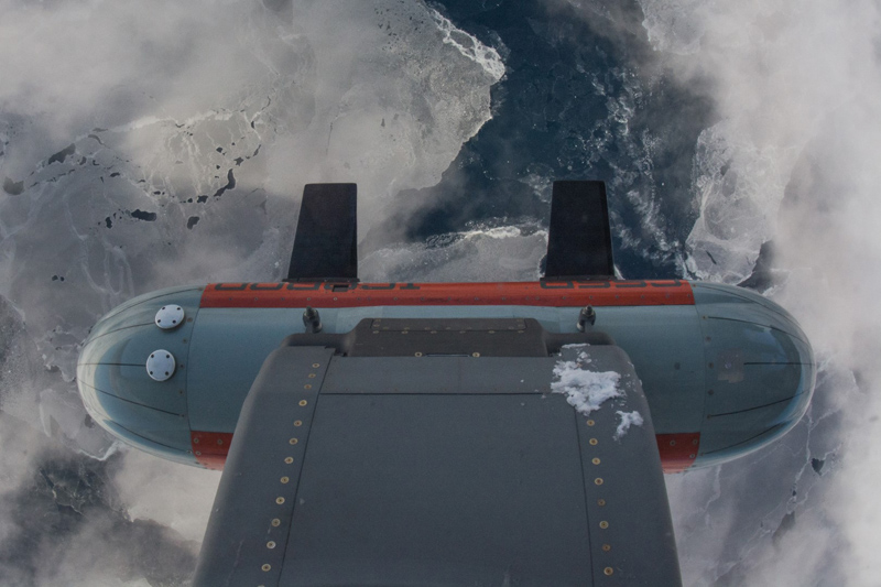
Though researchers at McMurdo Station have been studying the Ross Ice Shelf for decades, the seafloor beneath it largely remains a mystery. “It’s the least well mapped patch of ocean,” said Kirsty Tinto, a research scientist at the Lamont-Doherty Earth Observatory at Columbia University (LDEO). “We don’t even have the surface techniques that you can use in the rest of the oceans available to us where there’s an ice shelf in the way.” Ice up to 750 meters (2460 feet) thick covers the marine region, obscuring the features below its frozen surface. Tinto is part of a survey team using some of the latest remote-sensing technology to peer through the ice. The research is supported by the National Science Foundation, which manages the U.S. Antarctic Program, and the Palo Alto, Calif.-based Gordon and Betty Moore Foundation. The Ross Ocean and Ice Shelf Environment, and Tectonic Setting Through Aerogeophysical Surveys and Modeling (ROSETTA) mapping project uses a newly developed suite of instruments called IcePod to help profile the ice shelf and the seafloor below. About the size of a kayak, the pod attaches to the side of a ski-equipped LC-130 Hercules cargo plane as it flies over the ice shelf. 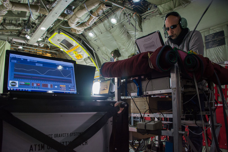
Photo Credit: Michael Lucibella
Fabio Caratori Tontini keeps tabs on the data being collected by one of the two gravimeters while flying over the Ross Ice Shelf.
Radar and other remote-sensing techniques can effectively see through the ice, so the team developed the bright orange IcePod to house a suite of instruments that can pierce the frozen surface. Researchers at LDEO designed and built this new modular system to mount ice and seafloor profiling equipment onto cargo planes. It’s now being deployed by an international collaboration led by LDEO in conjunction with the Scripps institution of Oceanography at U.C. San Diego, Colorado College and the Institute of Environmental Science and Research, or ESR. To put together these new, detailed charts, the New York Air National Guard has been flying the planes carrying the IcePod and its detectors along a giant grid over the ice shelf. On missions lasting up to nine hours, the pod collects terabytes of data profiling the ice and seafloor below each grid line. When stitched together, a three-dimensional model emerges of the seafloor below a comprehensive cross section the ice. The grid the Guard is following is based on a survey of the shelf conducted in the late 1970s. The Ross Ice Shelf Geophysical and Glaciological Survey (RIGGS) used seismic equipment to make what was then the most comprehensive map of the seafloor. The team measured the depth of the ice and the seafloor at 200 sites on a grid around the ice shelf. However, because the shelf is so vast, this amounts to only a tiny glimpse of the complete topography below.
Data collected by IcePod could provide some answers to lingering questions about the long-term
stability of the ice shelf...
“It’s an area the size of Texas and it’s been measured comprehensively in the 1970s where we got one point every 55 kilometers,” Tinto said. “If you take a box that has 55 kilometer sides, you end up with the area of Yosemite National Park. So the state of knowledge of the seafloor under the Ross Ice Shelf at the moment is the equivalent of having one data point per Yosemite.” 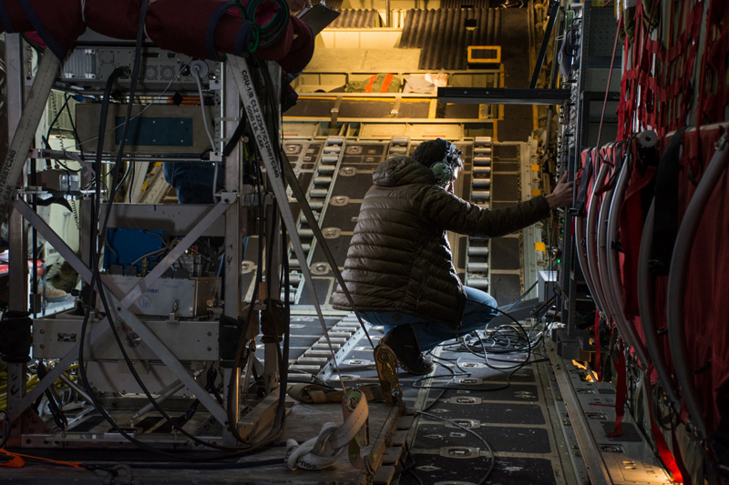
Photo Credit: Michael Lucibella
Chris Bertinato adjusts the settings for the IcePod on its main control panel in the rear of an LC-130 flying over the ice shelf.
It was a labor-intensive, five-year project for the RIGGS team to collect these data. The thick layer of ice necessitated this effort because it prevents the standard method of mapping ocean floor. “What we do in the ocean when we have a ship is send a straight signal to the seafloor. We measure the reflection of the acoustic wave and we can map the shape of the seafloor, it’s a pretty straightforward process,” said Fabio Caratori Tontini, a scientist with GNS Science in New Zealand. “Here, we can’t do that because we can’t go with a ship to the area where the ice is, so we have to circumvent the problem.” These flights will improve the resolution from the RIGGS project by an order of magnitude. In addition, it’s not just the seafloor that the IcePod is now mapping in detail, but also the ice shelf itself. “The Ross ice shelf is a very significant ice shelf in Antarctica,” Tinto said. “It’s gathering ice from East Antarctica and West Antarctica, and it contains the history of those two ice sheets over the last thousand years or so.” 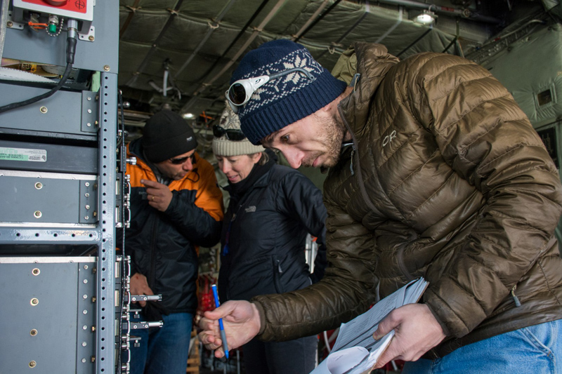
Photo Credit: Michael Lucibella
Chris Bertinato carefully removes the data discs from the IcePod control panel at the end of a flight while Fabio Caratori Tontini and Kirsty Tinto confer in the background.
Data collected by IcePod could provide some answers to lingering questions about the long-term stability of the ice shelf over hundreds of thousands of years. “Geological studies that have cored into the sediment [under the ice] show that this ice shelf does disintegrate,” Tinto said. “We want to know what that takes, we want to know what the conditions are under it so we can model it properly, and just understand the stability of the system.” It’s a question with potentially global implications. The tremendous mass of the Ross Ice Shelf acts as a buttress that slows the glaciers flowing out of the continent. Should the shelf break up, it’s likely that the glaciers’ advance into the ocean would significantly accelerate, contributing to sea-level rise. The idea for Icepod was born out of an earlier airborne geological survey, the Antarctica's Gamburtsev Province Project (AGAP). The project mapped the mountains under the ice in East Antarctica, with smaller Twin Otter planes carrying the instruments, and the larger LC-130s hauling supplies to the distant field camp. “From that the idea was born of how to instrument the C-130 so that it could be used as a long range geophysical aircraft,” Tinto said. “So one of the strengths of this concept was to develop an instrument suite that could go on any C-130.” The pod latches onto the standard rear paratroop door of the LC-130 Hercules, which makes it a versatile instrument. If a specific plane is grounded, for whatever reason, the team can quickly transfer IcePod to a different plane. “That’s one of the things that happens in airborne geophysics, is that your plane ‘breaks,’ and that can keep you on the ground for half a day, a week and a half, depending on how it’s ‘broken’,” Tinto said. “With the pod system, you can pop it all off the plane that it’s all on and install it onto another one.” She added that it’s an ideal system for studying the Ross Ice Shelf as there are almost always multiple LC-130s based at McMurdo Station’s Williams Field skiway. Not only can the pod easily switch between planes but it’s designed so the instruments within the pod can be changed out as well. |

For USAP Participants |
For The Public |
For Researchers and EducatorsContact UsNational Science FoundationOffice of Polar Programs Geosciences Directorate 2415 Eisenhower Avenue, Suite W7100 Alexandria, VA 22314 Sign up for the NSF Office of Polar Programs newsletter and events. Feedback Form |