|
Tiny piecesANDRILL core fragments reveal tectonically active continentPosted July 18, 2008
Antarctic Sun on ANDRILL
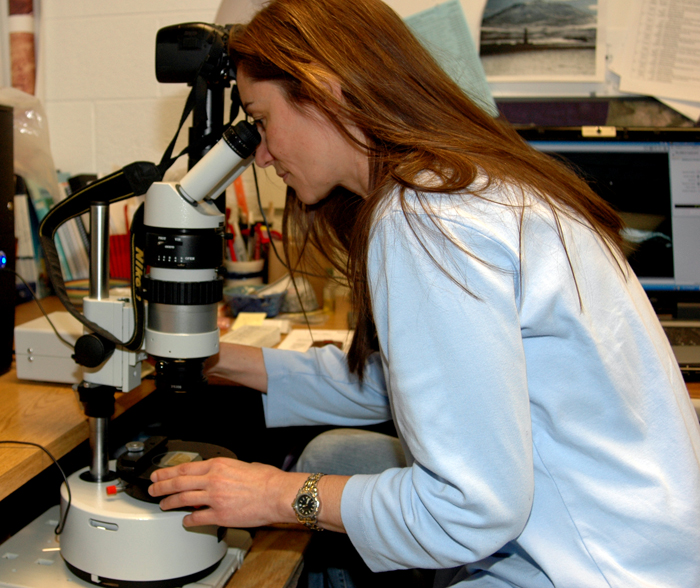
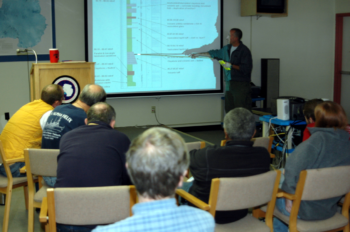
Under Cristina Millan’s microscope, the wafer-thin slivers of ancient sediment appear as monstrous valleys and rocky mesas, like viewing the Grand Canyon on Google™ Earth. The bird’s eye view of the tiny fragments of dried mud and rocks allows the PhD student at The Ohio State University The little bits of sediment once sat hundreds of meters below the seafloor in and near McMurdo Sound. The Antarctic Geological Drilling project known as ANDRILL That information plays a key role in understanding how Antarctica and its ice mass will respond to climate change in the next century when carbon dioxide levels — and, hence, temperature — rise to levels similar to those millions of years in the past. But not all of the core analyses are strictly related to climate change study. Millan and her advisor, Terry Wilson, a principal investigator on the ANDRILL project, want to learn more about the rifting of the underwater basin from which the core was drilled, and the forces that caused it to form, as well as the Transantarctic Mountains that split the continent between east and west. A rift basin is where the crust breaks apart and sinks. Knowing why it formed, and something about its geometry, are not just interesting theoretical questions to ponder. The information is particularly important in selecting future drill sites for the ANDRILL project, as scientists want to find the maximum space where sediment filled the rift, according to Wilson. It’s the sediment that provides the climate record. “This basin is important, because as the ocean floor sank, it formed a hole for sediments to fall into and be preserved, just like a hole in your backyard would get filled in with whatever was blowing around your neighborhood,” explained Tom Wagner, program director of Earth Sciences at the National Science Foundation’s Office of Polar Programs In the case of the basin, it filled with dirt from the ice sheet grinding away at the rocks of the mainland, ash from volcanic eruptions, and the skeletons of dead marine creatures. “All of these things tell us about the history of the area, especially the ice sheet, which is the main focus of ANDRILL,” Wagner said. “But Terry's group is interested in how this hole formed, and by looking at cracks that form in the sediments, she can get some insight into its history, which is fascinating. “We know little about the rifting process, but we also know that it was probably complicated by the volcanic growth of Ross Island, which is heavy enough to depress the area.” The tectonic study has other practical purposes. For instance, earthquakes in North America are not simply caused by ruptures of geologic faults. Ice once covered parts of the continent about 20,000 years ago. The earth is still responding to the lifting of that weight — much as Antarctica is today from when the ice sheets were much bigger in the past. (See related story: Moving experience.] “A lot of the earthquake activity is related to that combination of forces, from unloading of the ice, plus what’s happening at the edges of the plate that North America sits in,” Wilson explained. “If we can understand what’s going on in Antarctica — where we have a modern ice load and that ice load is changing — it allows us to understand better what the evolution of forces are in places like North America, where you have real earthquake risk and hazards that are related to this combination of forces.” And that takes us back to Millan’s microscope slides and the thin samples enlarged on her computer monitor. The material was collected from the first field season, at a site dubbed McMurdo Ice Shelf (MIS). The micro faults are showing up in the upper meters of the 1,285-meter-long core, the youngest section. “Little micro-faults came up very soon, and there were a lot of them,” Millan explained. “The faulting is young, too.” That indicates that the area is still likely tectonically active, she added. “The continent is not passive, it is not static.” ‘Frontier drilling’The young and numerous micro faults aren’t the only surprises turning up in the ANDRILL core, particularly from the MIS site in 2006-07. Larry Krissek, an associate professor of Earth Sciences at OSU and a scientist with the university’s Byrd Polar Research Center Diatomite is a soft, chalk-like sedimentary rock composed of fossilized diatoms (planktonic algae). Their presence indicates marine conditions when ice sheets had retreated, and the ocean was too warm to freeze. A smaller ice sheet may have existed for about 200,000 years based on the thickness of the diatomite. “Those were so different than the glacially deposited sediments, or the mud and sands that were in there as well,” said Krissek, who also participated in an earlier Antarctic drilling program called the Cape Roberts Project. “They were so different from what anybody recovered in any of the other drilling projects. And they were so different from what anybody expected, that even as they were coming out of the ground they were telling you a story of pretty big environmental changes. |


For USAP Participants |
For The Public |
For Researchers and EducatorsContact UsNational Science FoundationOffice of Polar Programs Geosciences Directorate 2415 Eisenhower Avenue, Suite W7100 Alexandria, VA 22314 Sign up for the NSF Office of Polar Programs newsletter and events. Feedback Form |


