|
On the shelfResearch team returns to crack-ridden Larsen C to study its stabilityPosted November 25, 2011
Three years after first visiting the largest ice shelf on the Antarctic Peninsula to assess its stability in a rapidly changing environment, Konrad Steffen, Daniel McGrath and Gino Casassa The diagnosis so far is not encouraging. Cracks are riddled near both the top and bottom of the ice shelf. Changes in atmospheric circulation are driving winds up the western side and over the spine of 3,000-meter high mountains that run the length of the upper peninsula. The dry, down-slope alpine wind — known as a foehn wind — warms several degrees by the time it hits the ice shelf in a region already considered one of the fastest warming on the planet. “For several summers, we have actually seen melt puddling — melt pools — on the ice shelf. If you start to get enough meltwater from summer melt, the meltwater actually flows into these cracks,” said Steffen, director of the Cooperative Institute for Research in Environmental Sciences (CIRES) 
Photo Credit: Konrad Steffen/CIRES, University of Colorado, Boulder
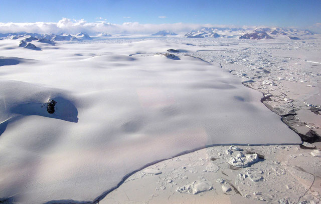
Remaining part of Larsen B Ice Shelf, now dubbed the Scar Inlet Ice Shelf.
Once filled with water, the cracks can open further and fracture deeper. There’s still about 200 meters of ice between the top cracks and those at the bottom, but more melt seasons could mean that the long-term prognosis for the Larsen C isn’t good. “That [melting at the surface] could be a mechanism to actually get it to destabilize,” said Steffen only a few days before leaving on his fourth trip to Antarctica in as many years. He had just given a talk to nearly 2,000 climate scientists at the World Climate Research Programme (WCRP) During his presentation, Steffen noted that ice loss from both Greenland and Antarctica is accelerating, now three times larger than from glaciers and ice caps elsewhere in the world. In particular, West Antarctica and the Antarctic Peninsula are expected to continue that trend in the decades ahead. And few places have offered a more visible display of that change than the ice shelves that fringe the peninsula. The Larsen Ice Shelf was once a series of three ice shelves with distinct embayments in the northwest Weddell Sea. The Larsen A broke away in 1995, and the Larsen B followed in a spectacularly rapid fashion in February 2002, though a relatively small chunk remains that glaciologist Ted Scambos Farther south and larger than the states of New Hampshire and Vermont combined, the Larsen C is likely next in line to collapse. Steffen and his co-principal investigator Eric Rignot 
Photo Credit: Konrad Steffen/CIRES, University of Colorado, Boulder
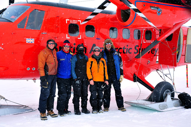
The research team poses next to a BAS aircraft used in the deep field.
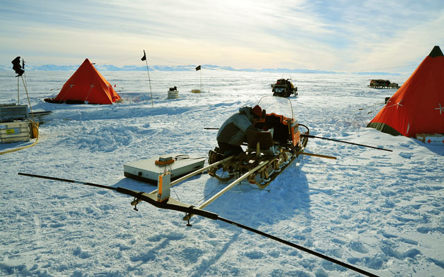
The ice shelves themselves don’t contribute to sea-level rise, but their disappearance allows the glaciers that feed them to accelerate and thin more quickly. In the case of Larsen B, Rignot and his colleagues reported in 2004 that the ice shelf’s glaciers discharged some 27 cubic kilometers of ice per year. In 2008, during the first year of the project, Steffen and his team installed three automatic weather stations (AWS) that collect 32 different types of climatological and glaciological data, including temperature, humidity and wind speed. Each station also contains a GPS receiver to measure ice shelf velocity. [See related article — House call: Larsen C project to monitor ice shelf's health before its eventual collapse.] In addition, the field team has conducted extensive ice-penetrating radar surveys across the ice shelf, pulling instrumented sleds with snow machines. The radar enables the researchers to map the underside of the ice shelf, where they’ve detected bands of marine water frozen to the bottom of the fresh water ice. “We realized that these marine ice bands are important for the overall structure of the ice shelf,” Steffen explained. “The marine ice underneath glues it together.” The concern is that even a slight change in ocean temperature could dissolve the “glue,” which would further destabilize the ice shelf. But whether that’s happening is hard to say, because there are no oceanographic measurements underneath the ice shelf. There has been a slight increase in the ice shelf’s velocity, which is usually caused by a reduction in the thickness of the ice. “It is very important that we increase our collaboration with the ocean community. We can see changes in the Arctic and the Antarctic are ocean-driven,” Steffen said during the WCRP meeting. That’s exactly what is happening in an area of West Antarctica where scientists are also going this year to send instruments through the Pine Island Glacier (PIG) Ice Shelf to measure the ocean-ice interface. Those same atmospheric changes causing the foehn wind on the peninsula are drawing deep, relatively warm water onto the continental shelf and underneath the PIG Ice Shelf. Meanwhile, Steffen’s team will make its last radar measurements on Larsen C and pull out two of its three AWS sites. The British Antarctic Survey “That will be in the northern part where we see the stronger warming and where we want more data,” Steffen said. NSF-funded research in this story: Konrad Steffen, CIRES, Award No.0732946 |


For USAP Participants |
For The Public |
For Researchers and EducatorsContact UsNational Science FoundationOffice of Polar Programs Geosciences Directorate 2415 Eisenhower Avenue, Suite W7100 Alexandria, VA 22314 Sign up for the NSF Office of Polar Programs newsletter and events. Feedback Form |


