|
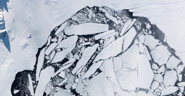
Bits and piecesSatellite image captures further fragmentation of Wilkins Ice ShelfPosted May 31, 2013
A satellite image first captured in March and released this month by NASA Previous coverage
Ted Scambos “I would not characterize this breakup as a direct result of climate warming, but rather an indirect result of the change in the shape of the shelf,” he said. “A breakup changes the stresses within the ice and will cause small retreats that reshape the shelf for several years. These retreats tend to happen when ocean waves can impinge directly on the shelf front.” For more information, go to NASA Earth Observatory webpage on the Wilkins Ice Shelf |


For USAP Participants |
For The Public |
For Researchers and EducatorsContact UsNational Science FoundationOffice of Polar Programs Geosciences Directorate 2415 Eisenhower Avenue, Suite W7100 Alexandria, VA 22314 Sign up for the NSF Office of Polar Programs newsletter and events. Feedback Form |


