Chipping awayRock samples may offer clues to volcanic evolution of Ross IslandPosted November 13, 2014
Kenneth Sims is a geologist who specializes in using naturally occurring radiogenic isotopes to study Earth processes, from the formation of ocean crust to the evolution of volcanoes. His lab operates a nearly $1 million instrument at the University of Wyoming to perform the complex measurements. Not the sort of high-tech job that one would think requires lugging a sledgehammer to a rock outcrop in Antarctica. NSF-funded research
Kenneth W. W. Sims, University of Wyoming, Award No. 1141167
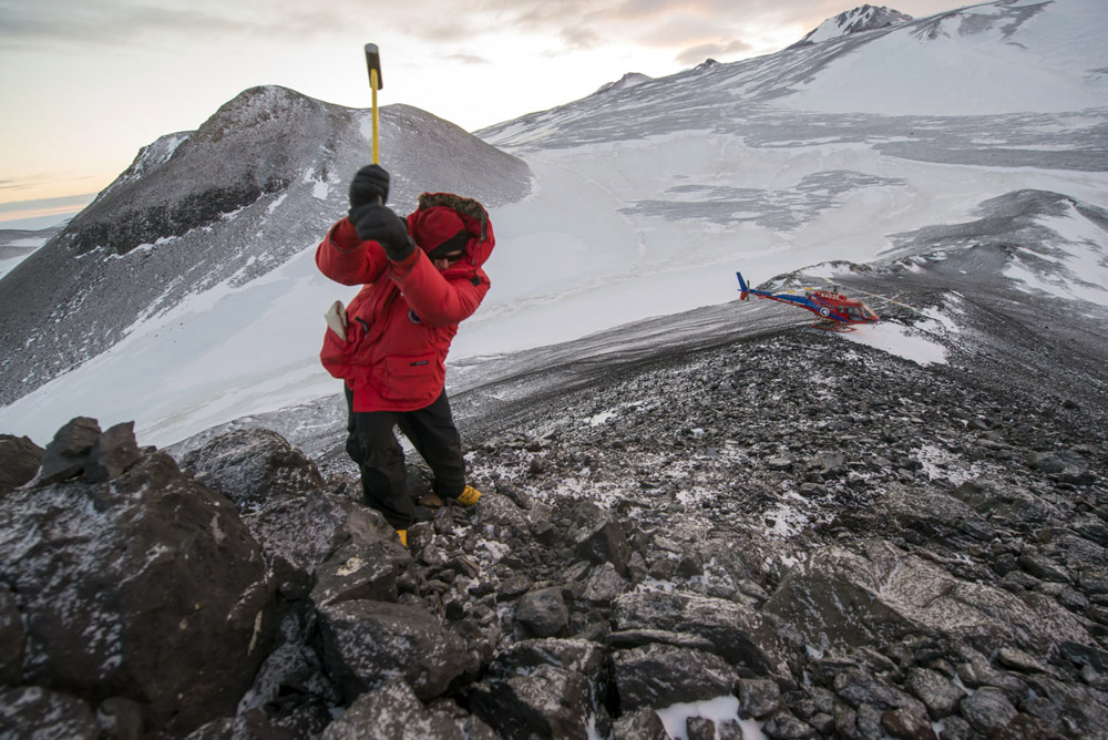
But Sims – like many researchers whose work is funded by the National Science Foundation under the auspices of the U.S. Antarctic Program – is not the stereotypical scientist. A trained mountaineer, Sims has rappelled into the craters of active volcanoes and ridden a malfunctioning submersible 10,000 feet below the ocean surface. His latest project has brought him and his team of collaborators to Antarctica to study a trio of inactive volcanoes that radially surrounds the world’s southernmost active volcano, Mount Erebus, like spokes in a wheel, each exactly separated by 120 degrees. At 3,794 meters high, snow-covered Erebus sits on Ross Island like an impossibly immense pile of whipped cream, with a wisp of smoke trailing from the top as if a match had just been extinguished. Constantly bubbling away inside the crater, like a pot of boiling water, is a lava lake, one of only a handful known to exist in the world. “Mount Erebus is a spectacular, unique volcano,” Sims said. “The [other] volcanoes that make up Ross Island – Hut Point, Mount Terror and Mount Bird – are relatively unstudied. You’re always surprised at how much we know about Erebus volcano for how remote it is.” That’s largely thanks to a team of researchers led by Philip Kyle, a volcanologist with the New Mexico Institute of Mining and Technology and principal investigator for the Mount Erebus Volcano Observatory (MEVO), perched just a few hundred meters below the crater rim. Kyle has conducted research on Erebus volcano for more than four decades. He is also co-principal investigator on a project with Sims to piece together the puzzle of Ross Island’s geologic past. “This project is just trying to understand the evolution of Ross Island and how this system has been changing over time,” Sims explained shortly after returning from hammering samples out of the volcanic sea cliffs of Mount Bird at Lewis Bay. 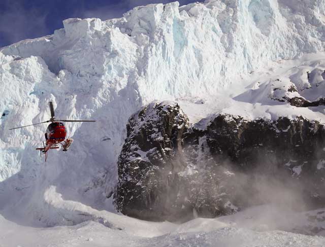
Photo Credit: John Catto/Alpenglow Pictures
A helicopter hovers near an icefall at Lew Bay, Ross Island.
Sims had previously tried to land with a helicopter at Lewis Bay two years ago during the 2012 field season, but thin sea ice in the area prevented a landing. The second attempt, while successful, was no less challenging. Melt pools in the ice near the site required careful navigation. Huge piles of ice debris also attested to active calving from an icefall that loomed overhead. The samples from Lewis Bay are integral to understanding the origin of Ross Island and its volcanoes, according to Sims, because they represent some of the oldest rocks of the region. An analysis of various isotopic signatures may help answer a host of questions, including one really big one: How was Ross Island formed? One theory is that the volcanic island is the result of a mantle plume, an upwelling of unusually hot rock deep within the Earth’s mantle, the thickest layer of the planet and located below the crust. The Hawaiian Islands are also thought to have formed from a mantle plume, though the very existence of mantle plumes is still a subject of debate among scientists. Another hypothesis is that Ross Island is simply the result of the West Antarctic Rift, where the crust of the Earth is being sheared apart due to plate tectonic movement. Many, but not all, volcanoes are associated with rift systems. |

For USAP Participants |
For The Public |
For Researchers and EducatorsContact UsNational Science FoundationOffice of Polar Programs Geosciences Directorate 2415 Eisenhower Avenue, Suite W7100 Alexandria, VA 22314 Sign up for the NSF Office of Polar Programs newsletter and events. Feedback Form |