Anatomy of a deglaciationRocks samples will help scientists reconstruct previous changes to Antarctic icePosted May 11, 2015
A series of recent studies, particularly since last year, have suggested that the question is “when” and not “if” the West Antarctic Ice Sheet will collapse in the coming centuries. There are also hints that the East Antarctic Ice Sheet may not be as intractable to climate change as once thought. But how Antarctica’s ice will melt and disintegrate is still a topic of debate. One way to understand how the process may unfold – which glaciers will recede when – is to look at how it happened in the past. Trevor Williams traveled to a remote mountain range with a small team of scientists and a mountaineer to collect rocks – many, many rocks – to help answer that question for a vast region of ice that drains toward the Weddell Sea. 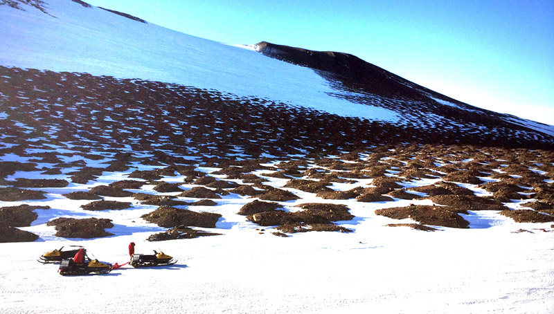
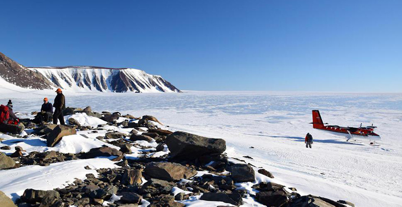
Photo Credit: Trevor Williams
Fieldwork to remote sites in the Allan Hills required the use of snowmobiles.
“The beauty of our method is that you can apply it to previous deglaciations, which is hard to do with other methods that work for the last deglaciation,” explained Williams, a marine geologist at Columbia University’s Lamont-Doherty Earth Observatory, after returning to McMurdo Station in January of this year from the Thomas Hills, located nearly 2,000 kilometers away at the north end of the Patuxent Range in the Pensacola Mountains. The method is complicated and labor-intensive to say the least. It involves camping for weeks alongside massive rivers of ice at one end and drilling into the seafloor from a ship at the other end to collect sediments that were deposited over hundreds of thousands of years. Such sediment cores are already in hand, courtesy of the Alfred Wegener Institute for Polar and Marine Research in Germany, which operates the research vessel Polarstern. It relies on the concept that rocks from Antarctica’s interior hitch a ride on glaciers and ice streams as they flow to the continent’s margins, where they go afloat and merge into ice shelves. Calving at the front of the ice shelves creates icebergs, which still carry their geologic flotsam until the bergs eventually melt at sea. “The only thing left of the icebergs is the rock they carry, and that builds up on the seabed for millennia. That’s the record we have of what the ice was doing,” Williams said. The so-called ice-rafted debris that piles up on the seafloor provides a record of just how quickly the continental ice was draining toward the sea, which is an indirect measurement of how rapidly the ice sheets were retreating and melting. It’s a bit like putting a bucket under a leaky faucet to determine how much water is being wasted. 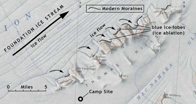
Photo Credit: Trevor Williams
A map shows the Thomas Hills region and the flow of the Foundation Ice Stream.
But Williams and his team are after more detail: They want to know the geographic sources of the ice-rafted debris, which would help them pinpoint the sequence of glacial retreat in the past during previous periods when Antarctica lost ice mass. The most recent deglaciation of Antarctica, which started about 18,000 years ago after the ice sheets reached their maximum extent at the end of the last ice age or glacial period, is fairly well understood based on other records. However, the sequence of how the ice retreated during the previous interglacial periods between ice ages – a 100,000-year global cycle of freezing interrupted by brief periods of thawing – is not so well known. Scientists are particularly intrigued by the last interglacial period, called the Eemian, which lasted from roughly 130,000 to 114,000 years ago, when temperatures were up to two degrees Celsius higher than the present-day Holocene, and there are indications that much of the West Antarctic Ice Sheet had collapsed. However, carbon dioxide levels are higher today than during the Eemian, and temperature rise could exceed 2C. So, if the Eemian is a guide, in the coming centuries, ice loss from Antarctica could raise sea level by several meters, flooding low-lying areas around the world. This is where Williams’ team comes in. 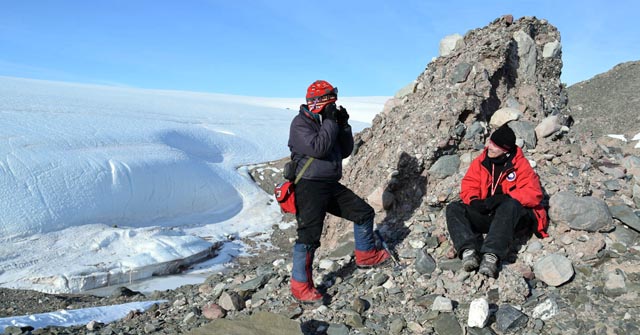
Photo Credit: Trevor Williams
Members of the field team on a rock outcrop.
They collected more than a half-ton of rocks from the margins of three large rivers of ice: the Foundation Ice Stream and the Academy and Recovery glaciers. Geochemical analyses of the samples – mostly exotic rocks or erratics that are different from the local geology and different between each of the three ice catchment areas – will help the scientists characterize the debris and match it to the material found in the sediment cores. “That’s exciting for us,” Williams said. “Anything that will help us distinguish the ice streams is going to be good.” In that way, they can begin to recreate the sequences of changes that occurred during the Eemian and even earlier time periods wrought by the retreat of the ice stream and glaciers. Quantifying the volume of ice loss in the past is tricky, Williams noted. Academy Glacier, for instance, drains ice as far away as the geographic South Pole, a distance of about 500 kilometers. “We have to do this work hand-in-hand with modeling studies,” he said, adding that the region could have accounted for a couple of meters of sea-level rise in the past during the Eemian deglaciation. “We’re going to go through another deglaciation in the very near geologic future,” Williams said. NSF-funded research in this article: Trevor Williams, Sidney Hemming. Tina van de Flierdt and Adi Torfstein, Columbia University, Award No. 1342213 |

For USAP Participants |
For The Public |
For Researchers and EducatorsContact UsNational Science FoundationOffice of Polar Programs Geosciences Directorate 2415 Eisenhower Avenue, Suite W7100 Alexandria, VA 22314 Sign up for the NSF Office of Polar Programs newsletter and events. Feedback Form |