Keeping Scientists AWARE of the West Antarctic ClimateTwo instrument stations gather the most detailed data to date on the weather patterns of West AntarcticaPosted May 12, 2016
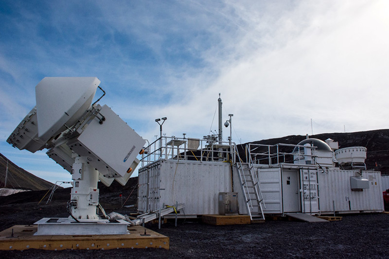
The cluster of white shipping containers perched atop the hill near McMurdo Station may well represent the densest collection of weather monitors Antarctica has ever seen. 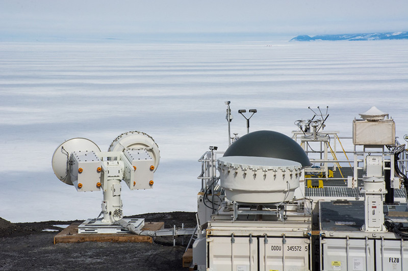
Photo Credit: Mike Lucibella
The project's scanning radar monitors the sky over the Ross Ice Shelf which tells them much about the climate over West Antarctica.
The structures are covered in a multitude of scientific instruments and sensors on the outside. Inside, every available cubic inch is packed with measurement devices and computers processing the prodigious amount of information being collected. “This kind of instrumentation has never been sent to Antarctica before,” said Dan Lubin, a research physicist at the Scripps Institution of Oceanography and principal investigator on the project known as AWARE. “There’s never been this concentration of instruments providing a synergy for atmospheric science.” AWARE, the ARM West Antarctic Radiation Experiment (AWARE) is a part of the Department of Energy’s Atmospheric Radiation Measurement Program (ARM). The National Science Foundation (NSF), which manages the U.S. Antarctic Program is facilitating its installation. “The goal of the Department of Energy’s ARM program is to improve climate-modeling ability by better understanding the physics,” Lubin said. Scientists have been developing detailed climate models for the Antarctic region for years, but these models are only as accurate as the data on which they’re based. Though the models do a good job of predicting broad climate trends, there are still big gaps in data over large regions of the continent. 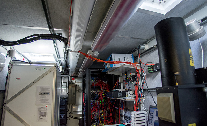
Photo Credit: Mike Lucibella
Inside the main AWARE site at McMurdo station, nearly every cubic inch is taken up by scientific instruments, like the lasers that measure clouds seen here.
“There have been no metrological measurements beyond automatic weather stations in 40 years over West Antarctica,” Lubin said. “We have some satellites but that doesn’t tell us the whole story.” Lubin’s aim is to fill in those knowledge gaps. Understanding the region’s climate patterns is more important than ever. In recent years, climate change has warmed West Antarctica and accelerated the melting of glaciers in the region. Glaciers like the Thwaites, Pine Island and Smith have melted so much that it threatens their stability. It’s the fastest warming region on the icy continent. “There is a big concern over the rapid warming of the West Antarctic,” said Krzysztof Krzton of the Australian Bureau of Meteorology, the project’s lead technician who is also in charge of maintaining it over the austral winter. “The purpose of this deployment is to gather data to try to establish what is going on and try to research the processes that are taking place.” AWARE was deployed around Antarctica in two sections. The larger instrument platform fills six cargo containers, and is currently taking data at the top of the hill between McMurdo Station and New Zealand’s Scott Base. The second, much smaller platform was deployed to West Antarctic Ice Sheet (WAIS), and collected data for almost eight weeks during the austral summer. “That’s directly where the warming is occurring,” Lubin said. 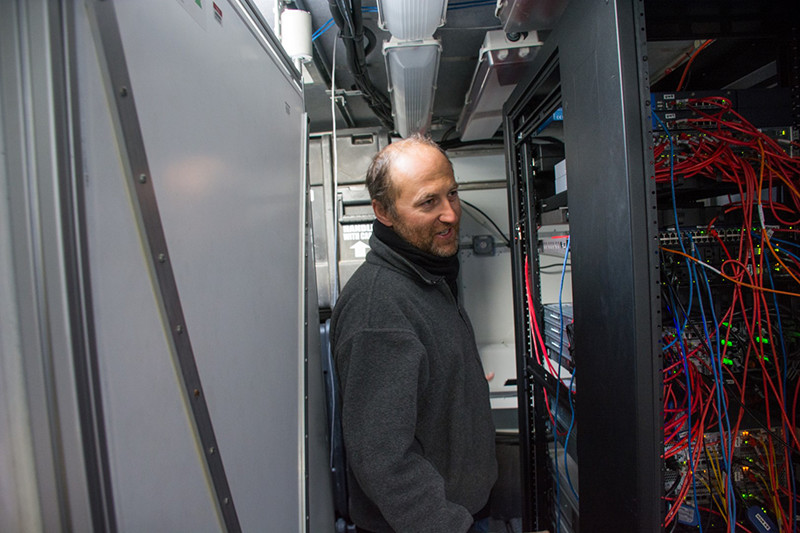
Photo Credit: Mike Lucibella
Technician Krzysztof Krzton navigates the narrow spaces between instruments at the main AWARE site. He’s helping to maintain the site over the austral winter.
Because of the difficult logistics deploying and maintaining such a big suite of instruments at such a remote site, the bulk of the project’s data is being collected at McMurdo. However, even though McMurdo is hundreds of miles from the West Antarctic site, it’s still collecting a lot of remote data about the region. “About a third of the time, the air that comes from the south here is coming off the Ross Ice Shelf and from West Antarctica. There’s a huge loop it makes,” Lubin said. “We’re sampling air that's downstream of WAIS a lot of the time when we have this nice southerly flow. All our instruments, particularly the radars, are pointed in a southerly direction to capture that.” The AWARE sites bristle with scientific instruments. At the McMurdo location there are about 40 different sensors gathering data about the climate of the region. In West Antarctica, there were about a dozen sensors running while the instrument platform was deployed. 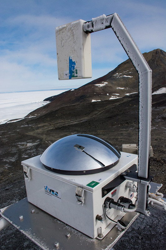
Photo Credit: Mike Lucibella
Instruments like this all-sky camera cover the roof of the AWARE structures at both McMurdo and WAIS.
Walking up to the mobile facility, the most eye-catching instruments are the twin radar dishes that systematically scan the skies over the Ross Ice Shelf. The Scanning ARM Cloud Radar examines the clouds at different frequencies to get a clearer picture of the size of the water droplets and ice crystals inside the clouds and how those particles fall as precipitation. The sophistication of the radars lets scientists scrutinize atmospheric effects and conditions beyond what typical weather radar systems are capable of. “Most of the weather surveillance radars are fairly primitive by comparison,” Krzton said. There are multiple other radar units throughout the mobile platform as well. Other receivers atop the structure capture a wider picture of the clouds directly overhead. Lasers are also monitoring the clouds above. Lidar units shine onto the clouds and record how long it takes for the signal to bounce back. “We have a micro-pulse lidar, which is one of my favorite instruments, that will actually tell us where the clouds are,” Lubin said. He added that based on how the light is polarized when it returns will tell the researchers whether the water particles that make up the clouds are liquid or ice. 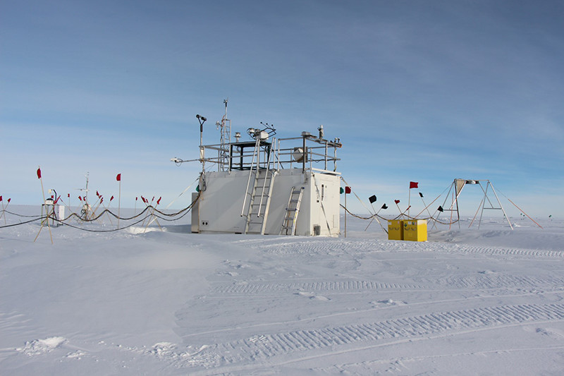
Photo Credit: Dan Lubin
The smaller AWARE structure located at WAIS contained a subset of the instruments that the McMurdo site has, and operated for eight weeks in the austral summer.
There’s an air sampling system which records how many particles are suspended in the air and how much energy from sunlight is blocked from reaching the ground. There are also thermometers, barometers, anemometers, all sky cameras, ozone monitors and numerous radiometers which measure the radiant energy from the sun. While it’s an impressive range of sensors, they won’t help the residents wintering at the station know what the weather is going to be tomorrow. “It’s purely research, it’s not operational meteorology,” Krzton said. “That’s why it’s so detailed.” Ultimately the data will work its way to researchers trying to better understand the climate dynamics of the region. 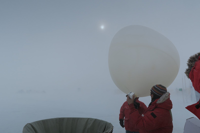
Photo Credit: Dan Lubin
Heath Powers (foreground) and Dan Lubin prepare a weather balloon for launch at WAIS.
For now, much of the data they’re collecting is stored on site until they can physically transport the hard drives it’s stored on back to the United States. Once it returns to the U.S., the ARM data quality team at Oklahoma University will process it, and then Oak Ridge National Laboratories will archive it and make it available to climate researchers. Each day, the instruments collect more than 500 gigabytes of raw data. Though some is sent back over the internet, the vast majority has to be stored on site and returned on the next available flight. “It’s an impressive amount of data,” Krzton said. “It’s a sort of once in a life time opportunity to be deployed down here, so you want to gather everything there is and be able to share it with others so meaningful conclusions can be arrived at.” AWARE is only a small part of the Atmospheric Radiation Measurement program, an effort by the Department of Energy to improve the data behind climate models. The overall program was started in 1989 by the Department of Energy to study how heat transfer affects cloud formation in different regions. Over time, the project expanded to capture nearly all local weather data so researchers could have a comprehensive picture of a region’s climate. The installation at McMurdo is one of three mobile facilities that belong to the program. Each one is set up at a site to collect a full year’s worth of data. They’ve been deployed around the world, including to China, Hawaii, Brazil, Niger, India and Ascension Island in the middle of the Atlantic Ocean. The Department of Energy also operates permanent data collection sites in Oklahoma, the North Slope of Alaska and in the tropical islands of the western Pacific. All of the information they collect is available for free to researchers through the ARM Data Archive. “The ARM Program does a great job getting the data out throughout the scientific community,” Lubin said. “Anyone who’s interested in improving climate models will be interested in this.” NSF-funded research in this story: Dan Lubin, University of California, San Diego, Award No. 1443549 |
"News about the USAP, the Ice, and the People"

For USAP Participants |
For The Public |
For Researchers and EducatorsContact UsNational Science FoundationOffice of Polar Programs Geosciences Directorate 2415 Eisenhower Avenue, Suite W7100 Alexandria, VA 22314 Sign up for the NSF Office of Polar Programs newsletter and events. Feedback Form |