Broad connectionNew communications upgrade benefits USAP, national weather satellite programPosted May 14, 2010
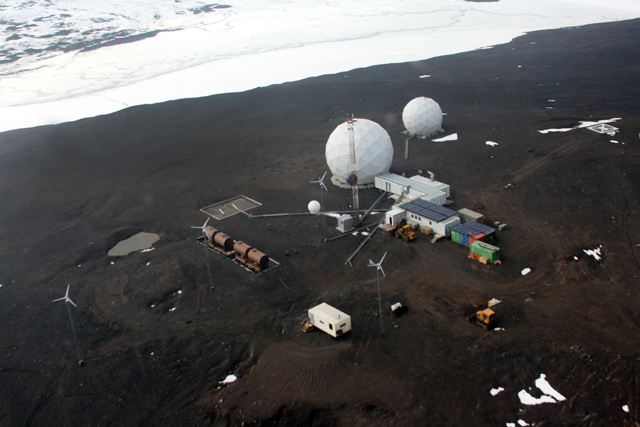
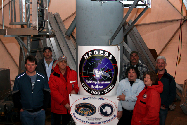
The U.S. Antarctic Program (USAP) The upgrade of the satellite communications link at McMurdo Station’s Black Island Facility (BIF) will eventually support data rates of up to 60 megabits per second for off-continent communications to achieve near-real-time transfer of weather and climate data back to the United States. Inbound traffic will move at 20 megabits per second. The space-based components of the new system will downlink stored mission data to 15 globally distributed ground receptor sites as part of a network called SafetyNet™ The new weather and climate satellite system was originally called the National Polar-orbiting Operational Environmental Satellite System (NPOESS) program However, the White House announced in February a restructuring of the NPOESS program. The decision dissolves the original tri-agency management agreement between the U.S. Air Force The agencies will still work together in those areas that have been successful in the past, such as the shared SafetyNet ground system, according to Doug Whiteley, government Command, Control and Communications lead for the NPOESS program. “NOAA, NASA and DoD will continue to partner to ensure a successful way forward for the respective programs, while utilizing international partnerships to sustain and enhance weather and climate observations from space,” Whiteley said. The National Science Foundation (NSF) “NSF will transfer its NPOESS agreements and joint activities to the JPSS as its organization progresses over the coming months,” said Pat Smith, Technology Development manager with the NSF’s Office of Polar Programs The installation of two SafetyNet receptors at McMurdo Station — one for redundancy in the harsh Antarctic conditions — creates “nice synergy” for all parties involved, according to Smith. “NSF provides the national reach and presence on the continent of Antarctica and utilizes high-capacity broadband satellite communications for the support of its program activity,” Smith explained. “NPOESS requires access and sustaining support in Antarctica in order to meet its mission goals, and it brings high-capacity broadband satellite communications capability as a resource. Two national programs sharing mission capabilities and resources create greater net value — a 1+1=3 effect — hence, the synergy,” Smith said. While ground stations for SafetyNet are spread both north and south of the equator, McMurdo’s location at 77 degrees south latitude helps cut the time in half that the data get back to the processing centers in the United States, Whiteley explained. In addition to supplying the location and existing infrastructure required for the receptor sites and off-continent satellite communications, the NSF also provided housing and logistics support to the ground system project, according to Smith. McMurdo Station, as the largest Antarctic base, offers all the amenities of a small town. “We’re the logistics experts in the Antarctic. We know how to get stuff done. We know how to build stuff. We supply the power,” he said. SafetyNet Sites
Alaska, Arizona, Florida, Norway, Spain, South Africa, India, Australia, New Zealand, McMurdo, Japan, Guam, Hawaii, Chile and Brazil. “All of this is leveraging the Antarctic logistics infrastructure that we have to run our science program, supporting these major, national programs that have benefits to the national economy,” he added. A 2008 government report estimates billions of dollars in direct economic benefits from jobs and procurements, as well as indirect benefits resulting from the data used for better weather and climate forecasting. In return, the USAP will eventually reap 19 megabits for inbound data. Previous NPOESS upgrades bumped up both inbound and outbound data to 10 megabits per second, double earlier capabilities for both directions. “The inbound is where we have our bottlenecks,” Smith noted. Added Whiteley: “We dramatically increased their bandwidth down there to allow them to do more.” The space-based components will provide advanced environmental, weather and climate sensor observations, as well as key communications payloads that support search and rescue, environmental and wildlife data collection. “The new system is vitally important and essential for climate research, as well as operational weather and storm forecasting for civil, military and international partners,” Whiteley noted. Raytheon Company “McMurdo is the toughest” place to work out of all the SafetyNet sites, even compared to Svalbard, Norway, which sits at about the same absolute latitude, Whiteley said. NSF’s assistance in establishing the network’s southern-most site was crucial to the success of the ground system, he added. “It really worked out well for both of us,” Whiteley said.
|


For USAP Participants |
For The Public |
For Researchers and EducatorsContact UsU.S. National Science FoundationOffice of Polar Programs Geosciences Directorate 2415 Eisenhower Avenue, Suite W7100 Alexandria, VA 22314 Sign up for the NSF Office of Polar Programs newsletter and events. Feedback Form |


