Fleeting thoughtsScience and signs of climate change in Antarctica hit home for Palmer Station physicianPosted July 1, 2011
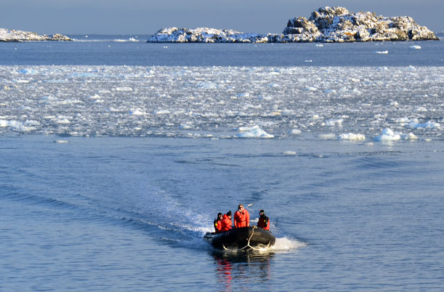
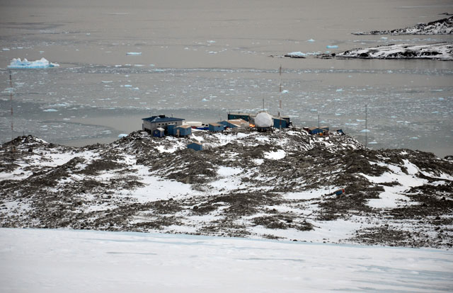
I jumped into the Zodiac with my dry bag: an impermeable sack containing a bottle of fresh water, my camera and a set of dry clothes to change into in case I somehow ended up in the subfreezing sea. Two graduate students from the University of Alabama at Birmingham, Ruth McDowell and Kate Schoenrock Kate backed the boat away from its mooring into Hero Inlet, and then asked if I would “drive.” Enthusiastically, I made my way back to the tiller, trying not to stumble over all of the diving and other equipment occupying most of the 17-foot pontoon around my feet, and slowly turned up the throttle. “We’re going to Spume,” said Kate, referring to an island two nautical miles to the southwest of Palmer Station, the U.S. Antarctic Program’s I eased the boat past Bonaparte Point, the tip of the peninsula on the other side of Hero Inlet. Spume Island came into view — way out on the horizon, all by itself, surrounded by uninviting gray sky and deserted sea. It seemed halfway to New Zealand. From the bow, Kate signaled our heading. Chuck, seated midway up to my left, scanned the island then turned to me and said, “Now speed it way up, Steve. We’re in 200-foot water and there’s nothing around.” Suddenly I longed for places more familiar, like the operating room … or the slope of the slippery glacier where I spent the morning. Marr Ice Piedmont occupies almost all of Anvers Island, except for small rocky outcroppings like Gamage Point where Palmer Station is located. A swath of the ice rising up behind Palmer had been found free of crevasses and safe for hiking. I had headed out to the glacier right after Sunday breakfast. My cleats crunched into the icy incline as I trudged my way up into the howling winds, closing in on the clouds, feeling the strain in my lungs and fighting the fatigue in my legs to get just a little higher where space and time all but disappear. The exhilaration of reaching the crest soon gave way to a surreal, calm sense of being part of this mystical place, as if eons ago I calved off this very glacier, just another blue iceberg floating out into the world. Slowly, peacefully, I scanned the mountaintops, then the endless sea and then, in the other direction, four miles away and 500 feet below, the islands of Arthur Harbor. Suddenly, I realized: I’m late! I scurried back down, my progress impeded by the 500 yards of bare rock and boulders splayed out in peaks and valleys between the foot of the glacier and the station. When Palmer Station was built, the glacier began immediately to its rear, but over the last 43 years, it has receded to its present location, exposing an ever-lengthening stretch of desolation and serving up the only tedious part of its friendship. Out of breath, I made it to the boathouse just in time to go out with the dive team. I had taken Palmer’s boating classes, including the island survival session, but I was still inexperienced at the helm. Now in open water, staring at the distant speck that was Spume Island, I did my best to ignore the cramp in my throttle hand and cranked it up until my knees started shaking. Notwithstanding my trepidation, the Zodiac gained adequate headway and for a spell even skimmed the water’s surface. Halfway to Spume we came upon a field of brash ice, the small bits floating on the surface. Mercifully, I needed to slow way down so as not to damage the propeller on the frozen chunks. We could feel and hear ice grinding the undersurface of the boat. The tiller suddenly jolted to the right as a piece of ice locked noisily in the prop blades, as if some fun-loving fur seal had yanked the propeller shaft the other way. “Rock the tiller sideways a bit,” advised Chuck, who has made more than a dozen expeditions to Antarctica. Free of the ice field, I picked up speed once more and finally reached the southern shore of Spume Island. Kate then relieved me of the tiller so we could survey the area for leopard seals, which would have made diving unsafe. We didn’t spot any of the large predators, but Chuck felt that the surf was too strong for his liking, so we headed back halfway to Janus Island, where the waters were a little less rough. Chuck and Ruth began donning the rest of their diving equipment with the boat now stationary at Janus, except for riding up and down the swells. Kate and I helped them with their heavy gear, and before long, I found myself feeling like I did on the research vessel Laurence M. Gould Chuck and Ruth disappeared into the water, and Kate and I concentrated on following the course of their bubbles as they met the surface. “They’re hoping to collect some Myriogramme smithii,” said Kate, referring to a particular species of red seaweed — called “macroalgae” by scientists — which amphipods won’t eat. [See previous article: Underwater forests of Antarctica.] The amphipods will devour other types of red seaweed such as Palmaria decipiens. But amphipods and their predator fish downright refuse so much as a nibble from the most common macroalgae in the waters around Anvers Island, the brown Desmarestia anceps and D. antarctica. That’s not only good for the Desmarestia, perhaps explaining why they’re the most abundant marine plant here, but it also makes this algal foliage a convenient place for amphipods to hang out and not get eaten. Live-and-let-live ecology. |


For USAP Participants |
For The Public |
For Researchers and EducatorsContact UsU.S. National Science FoundationOffice of Polar Programs Geosciences Directorate 2415 Eisenhower Avenue, Suite W7100 Alexandria, VA 22314 Sign up for the NSF Office of Polar Programs newsletter and events. Feedback Form |


