Restricted airspaceNSF announces limits on use of UAVs in Antarctic program pending formal policyPosted September 24, 2014
They fly over outdoor concerts and battlefields. They come in all shapes and sizes, from futuristic-looking quad-copters to radio-controlled airplanes that sport a classic World War II body style. Unmanned aerial vehicles (UAVs) are increasingly filling airspaces around the world. 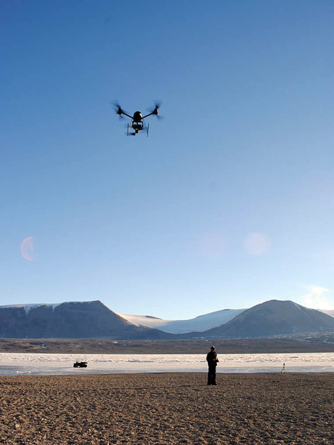
Photo Credit: Michael San Clements
An unmanned helicopter in the McMurdo Dry Valleys.
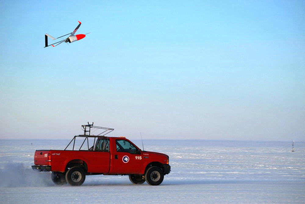
Antarctica is no exception. Researchers are using UAVs to carry high-tech radars capable of making detailed images in order to understand how the Antarctic ice sheets are changing in response to climate change. Other scientists have sent unmanned aircraft over the sea ice and polynyas to map connections between the ocean and atmosphere. Such unmanned aircraft systems offer great potential to collect data in places too dangerous for human pilots or in a much more cost-effective manner. But there is some concern that their unregulated use could be a safety hazard or even cause environmental problems. The National Science Foundation (NSF), which manages the U.S. Antarctic Program (USAP), recently issued a notice “UAVs have a huge potential to improve our ability to do science in Antarctica, and we don’t want to stop that innovation from taking place,” explained Brian Stone, section head of Antarctic Infrastructure and Logistics in the NSF’s Division of Polar Programs. “We need a framework we can use to improve our capability in a way that protects our personnel and the environment at the same time, and that’s what we’re trying to do right now.” During the austral summer, the skies above Ross Island and McMurdo Sound are busy with all sorts of aircraft, from large military cargo planes like the C-17 Globemaster III to deep-field airplanes like the turbo-prop Twin Otter. Helicopters frequently buzz between McMurdo Station and the McMurdo Dry Valleys, often carrying sling loads of cargo. Large balloons carrying expensive scientific instruments launch from the nearby ice shelf. “We have an extremely busy operational tempo with a lot of moving parts, and we are concerned that we could have a safety mishap as a result of unauthorized UAV use,” Stone said. Scott Borg, section head of Antarctic Sciences in the Division of Polar Programs, emphasized that the new restrictions would not affect any projects currently approved to use UAVs for science. “[The restrictions are] not meant to inhibit people from proposing new work that needs UAVs,” he said. “It’s merely a recognition that use of these devices is much more likely given their rapidly advancing capabilities and portability, and the hobby uses they are getting. But we need to be sure that safety and environmental stewardship are considered in how these are used.” U.S. media have documented a growing number of incidents involving UAVs, also sometimes referred to as drones. Last month, for example, a visitor at Yellowstone National Park crashed a UAV into one of the park’s famous hot springs, just two months after the National Park Service banned their use in all national parks. Stone emphasized that the online notice, posted on the USAP’s homepage at www.usap.gov “There are things that UAVs are ideally suited to do for us, and we don’t want to prevent that,” he said. “What we don’t want, however, are people flying them without our knowledge and creating risks to personnel, operations, or the environment. It’s going to be a balanced approach.” In fact, the USAP Air Operations Manual already addresses the operation of larger unmanned aerial systems, such as the ones developed by the Center for Remote Sensing of Ice Sheets (CReSIS) that flew near the Ross Ice Shelf during the 2013-14 field season. 
Photo Credit: Peter Rejcek
Work is done to a UAV developed by CReSIS at McMurdo Station during the 2013-14 field season.
[See previous article — Transformative technology: CReSIS unmanned aerial systems, radars have big impact on ice sheet research.] The concern is more about the smaller unmanned aerial systems and the lack of experience and qualifications of someone operating a UAV, according to Stone. “If you’re going to operate one, we don’t want your first flight experiences to be over a protected area on the ice, or in a sensitive area,” he said. Protecting the fragile environment is paramount to the United States and other nations that operate in the Antarctic. The topic of UAVs and their possible effects on the ecosystem were a topic at this year’s Antarctic Treaty Consultative Meeting held in Brasilia, Brazil, according to Polly Penhale, environmental officer in NSF’s Division of Polar Programs. The United States presented a paper at the conference that stressed the benefits of UAVs for research while also calling for the adoption of best practices to minimize the risk to people, operations and the environment. The U.S. paper noted that risks included “collisions with other aircraft and vital infrastructure; radio signal and electromagnetic interference; and injury of personnel.” Unmanned systems “also put wildlife, especially birds, at risk for disturbance and, in the case of collision or crash, injury or death.” In addition, the paper highlighted the need to protect special areas of historic or scientific interest. Aside from national scientific programs, which may fund research that could employ UAVs for scientific purposes, some tourist companies have been using UAVs. Penhale said a couple of tour operators have applied for permits under the Antarctic Conservation Act in the event that a drone or other unmanned vehicle is lost during a cruise. “They mostly want to shoot great videos over water, showing the ship, and over glaciers,” she said. “I can say that some tour agencies are totally against them if brought by passengers … and others are OK with it.” In one instance, Penhale said, a tourist had brought a small quad copter to the USAP’s Amundsen-Scott South Pole Station in hopes of flying it over the facility. The request was denied. The International Association of Antarctica Tour Operators (IAATO), the voluntary organization of Antarctica-bound outfitters, recently drafted a set of guidelines for its members to follow regarding the use of UAVs. “We had a lively discussion at our last annual meeting on this topic, and after careful consideration, developed draft guidelines,” said Kim Crosbie, IAATO executive director. “These will be tested during the next two seasons.” Crosbie said the use of UAVs is restricted to members’ authorized activities under only very specific circumstances. Their use for filming in protected areas under the Antarctic Treaty is prohibited, nor can they be flown over animal colonies or concentrations of wildlife. “The demand for the use of UAVs for tourism purposes is likely to increase in future, thus the early management of the activity is important to ensure there is no more than a minor or transitory impact on the Antarctic and its environment,” according to the IAATO guidelines for UAVs in Antarctica. |

For USAP Participants |
For The Public |
For Researchers and EducatorsContact UsU.S. National Science FoundationOffice of Polar Programs Geosciences Directorate 2415 Eisenhower Avenue, Suite W7100 Alexandria, VA 22314 Sign up for the NSF Office of Polar Programs newsletter and events. Feedback Form |