U.S. geographic features designated in April 2014Posted July 18, 2014
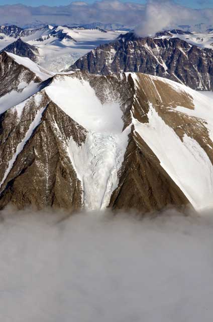
McMurdo Dry ValleysArgo Gully A prominent valley, between Mount Jason and Goldich Crest on the southern slopes of the Olympus Range just north of the east end of Lake Vanda. The valley trends northwest - southeast from the upper slopes of Mount Jason over a distance of 1.8 miles to the northeastern shore of Lake Vanda. The valley is significant for marine sedimentary deposits that lie exposed. The feature is named by ACAN for the ship Argo which is associated with Jason and the Argonauts in Greek mythology and continues the theme of names applied across the Olympus Range. The name is useful for reference in scientific literature. The name has been reported to be in local use. Blood Falls An area of discharge that is a bright orange-red saline iron-rich of subglacial origin that emerges at the snout of the Taylor Glacier at the western end of Lake Bonney. The name is descriptive and named by ACAN for use in scientific investigations and scientific literature. The name has been reported to be in local use. Boulder Pavement A flat approximately 0.3 mile wide and 0.3 mile long along the Onyx River through a relatively flat area of boulders where the Onyx River fans out and flows slowly 1 mile east of Lake Vanda. A descriptive name applied by ACAN and useful for scientific investigation and use in scientific literature. The name has been reported to be in local use. Packard Stream A meltwater stream flowing south from Packard Glacier (q.v.) into Kite Stream, 3 miles northeast of Lake Vida and 5 miles southwest of Victoria Lower Glacier. The name is associative with Packard Glacier (q.v.) and named by ACAN for purposes of scientific investigation and use in scientific literature. The name has been reported to be in local use. Santa Fe Stream A meltwater stream flowing east along the northern margin of the lower portion of Taylor Glacier into the western end of Lake Bonney, 10.5 miles east of Ferrar Glacier. Named by ACAN, the name is likely in reference to the seminal US/NZ McMurdo Dry Valleys Workshop held in Santa Fe, New Mexico, in March 1995, the report from which led to a management plan for the Dry Valleys Antarctic Specially Managed Area being adopted in 2004, the first such area to be agreed by the Antarctic Treaty Parties. The name is useful for purposes of scientific investigation and use in scientific literature. The name has been reported to be in local use. Victoria Dunes A sand dune feature extending approximately 5 miles along Victoria Valley just northeast of Lake Vida and just southwest of Victoria Lower Glacier, approximately 10 miles south of the center of Saint Johns Range. The name is associative with Victoria Valley and named by ACAN for purposes of scientific investigation and use in scientific literature. The name has been reported to be in local use. Photo Credit: Peter Rejcek/Antarctic Photo Library
The U.S. recently adopted several names for geographic features near Palmer Station off the Antarctic Peninsula.
Palmer Station, Antarctic PeninsulaDead Seal Island An island, 300 meters long and 200 meters wide, just southwest of Anvers Island, approximately 0.5 mile northeast of Stepping Stones, and 2.5 miles east southeast of Palmer Station. Named by ACAN as a descriptive name and needed for use as a navigational aid and for a reference in scientific investigation. The name has been reported to be in local use. Diana Island An island, at Anvers Island, just south of Palmer Station, just west of Bonaparte Point, 1.5 miles south southeast of Amsler Island. Named by ACAN as a navigational aid and for use in scientific investigations. The name has been reported to be in local use. Jeffrey Rock A small island, just northeast of Janus Island and just southeast of DeLaca Island, 1.5 miles southwest of Amsler Island, and 1.5 miles west of Palmer Station. Named by ACAN as a navigational aid and for use in scientific investigations. The name has been reported to be in local use. 
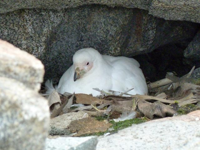
Photo Credit: Jeff Otten/Antarctic Photo Library
The snowy sheathbill has lent its name to a cove near Palmer Station.
Killer Whale Rocks A rocky shoal just northwest of Janus Island, 1.75 miles southwest of Amsler Island, and 2 miles southwest of the coast of Anvers Island. Named by ACAN as a navigational aid and for use in scientific investigations. The name is descriptive after the distinct shape of the rocks, which resemble a pod of killer whales (Orcinus orca) when viewed from a distance. The name has been reported to be in local use. Kristie Cove Bay, on the south side of the peninsula of Bonaparte Point, just west of Palmer Station, 1.25 miles south southeast of Amsler Island, 2 miles east of Janus Island. Named by ACAN as a navigational aid and for use in scientific investigations. The name has been reported to be in local use. Sheathbill Cove The bay is approximately 0.1 mile wide and 0.15 mile long, and indents the east side of Amsler Island approximately 1 mile north northwest of Palmer Station. The name is used by scientists as a needed reference and was selected because of the Sheathbill (Chionis alba) birds frequenting the area. Return to main story — A new standard: U.S. 'raises the bar' on using personal names for geographic features in Antarctica. |
"News about the USAP, the Ice, and the People"


For USAP Participants |
For The Public |
For Researchers and EducatorsContact UsU.S. National Science FoundationOffice of Polar Programs Geosciences Directorate 2415 Eisenhower Avenue, Suite W7100 Alexandria, VA 22314 Sign up for the NSF Office of Polar Programs newsletter and events. Feedback Form |


