Photo Credit: NASA |
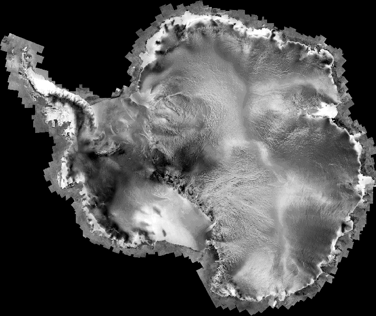
The first high-resolution satellite mosaic of Antarctica was created by Byrd Polar Research Center in collaboration with the Canadian Space Agency. The image revealed features never seen before, such as ice streams some 800 kilometers long. |
The whole picture
Jezek wants space agencies to pull together to create new satellite images of polar regions
By Peter Rejcek, Antarctic Sun Editor
Posted May 23, 2008
A decade after using an Earth-observing satellite to image Antarctica to create the first high-resolution mosaic of the continent, Ken Jezek hopes the world’s space agencies will pull together their spaceborne resources to map the cryosphere in unprecedented detail and breadth.
The International Polar Year (IPY) project will rely on countries from Russia to China to the United Kingdom to use the constellation of Earth-observing satellites to capture data about ice sheets and sea ice in areas undergoing rapid changes. GIIPSY, for Global Inter-agency IPY Polar Snapshot Year, will use a range of satellite frequencies, from microwave to optical, to create a series of different images for a benchmark that scientists can use to track future changes.
“The challenges are formidable,” concedes Jezek, a geophysicist with Byrd Polar Research Center at The Ohio State University in Columbus. “We’re trying to get everyone who currently has a satellite operating to coordinate [their efforts], and to coordinate their acquisitions in such a way that the burden of acquisitions doesn’t fall on any single agency, which may not have the mandate or resources to do that job.”
Jezek sees GIIPSY as an ambitious successor to a project that BPRC coordinated with the Canadian Space Agency and NASA beginning in 1997 called RADARSAT Antarctic Mapping Project (RAMP).
Launched in November 1995 by NASA from Vandenberg Air Force Base, Canada’s RADARSAT-1 satellite featured a powerful synthetic aperture radar that allowed it to image Earth day or night, in all weather and through cloud cover, smoke and haze.

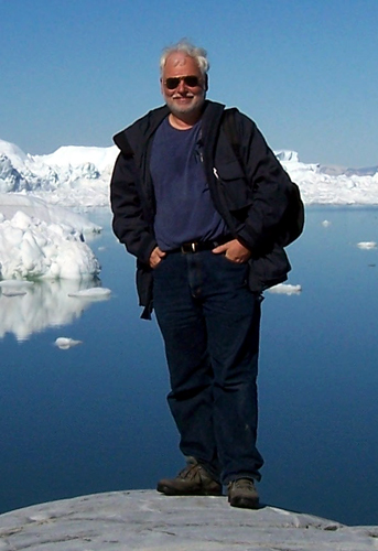
Ken Jezek
In less than a month in 1997, RADARSAT-1 had collected the imagery necessary to create the first high-resolution mosaic of the continent. On each 12-minute pass over Antarctica, the radar imaged 100-kilometer-wide swaths up to 2,500 kilometers long. The mosaic combined more than 4,500 overlapping images with a resolution of 25 meters, each pixel about the size of a classroom.
A second mission in 2000 collected additional imagery around Antarctica’s perimeter and its fast-moving glaciers, to capture data about areas most likely to have changed over the last three years.
“Our observations discovered several very large ice streams, one of which extends an equivalent distance along the Mississippi from New Orleans to Cairo, Ill,” Jezek said, about 800 kilometers long. “These are very large features.”
Scientists also used the imagery to acquire velocity measurements. Jezek explained the satellite detected the motion of the ice during the observation period. That helped the team create a velocity mosaic of most of the continent.
The rate and direction of motion reveals important information about the forces acting on ice sheets and glaciers, as well as about the rate at which ice is pouring into the coastal seas, and enables scientists to predict how the ice sheet might respond to changing global climate, according to Jezek.
He said the project, which is wrapping up after more than 10 years, also taught the team how to manage an instrument that required intensive data collection while competing with commercial interests for satellite time, and how to collaborate with international partners.
He hopes those lessons will help GIIPSY realize its potential. “It’s a significant follow-on from RAMP that sort of builds on our experiences in managing resources, doing international collaboration, and trying to do some interesting science,” Jezek said.
Its goals include taking snapshots of rapidly changing ice sheets and glaciers, areas of high-latitude snow cover that serve as major sources of fresh water, and spatial distribution of permafrost. The imagery will help scientists understand everything from ice dynamics to how permafrost responds to climate change.
“If we use everybody’s satellites, we have a chance to go from the pole to the coast,” Jezek also noted.
Routine, good high-resolution imagery of Antarctica doesn’t really exist between about 80 degrees and 90 degrees South latitude because the orbits of previous satellites used for these types of missions didn’t include those areas. Even the most recently created satellite image of the continent, the Landsat Image Mosaic of Antarctica (LIMA), had to fill in the gap between 82.5 degrees and the pole with lower resolution data.
Jezek said the GIIPSY effort will also provide important data on Arctic sea ice, which many scientists believe will entirely disappear in the summer in the not-to-distant future.
“There hasn’t been a good, internationally coordinated effort to map the dynamics of Arctic sea ice, even though it’s recognized as a major science problem,” he said.


