Balancing actAerial survey to help determine ice loss in West Antarctic regionPosted June 26, 2009
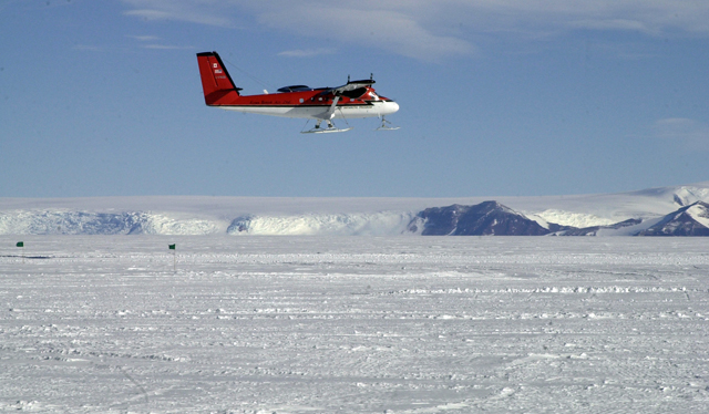
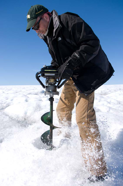
Three years ago, Ian Joughin His upcoming fieldwork in Antarctica — always a challenging environment by dint of its extreme weather and remoteness — would seem to be leisurely in comparison to that nautical adventure. Still, Joughin and his team have a tough job ahead of them: Determine how much ice from a vast swath of West Antarctica is being lost into the Amundsen Sea compared to the amount of snowfall accumulating on the ice sheet. The two-year field project has two goals for what on the surface seems like an easy enough equation. One, calculate the net accumulation of snow over an area of West Antarctica where Ellsworth Land and Marie Byrd Land meet. Second, determine how much ice is flowing into the ocean. Then subtract one from the other to help define the mass balance of the ice sheet — whether it is losing or gaining mass. The smart money is that the ice sheet overall is losing weight, which has implications for sea level rise. “It’s clear that there’s a big imbalance in that region; we just can’t say what it is at this point,” Joughin said. “That’s probably an area where we know less about snowfall in Antarctica than just about anywhere else.” The area is where several glaciers, including Pine Island and Thwaites, drain into the Amundsen Sea. Pine Island, in particular, has drawn much attention from scientists in recent years, with a number of projects under way to study the dynamics of the glacier. Polar researchers believe deep, warm ocean water is thinning the small ice shelf that fronts the glacier, which in turn is accelerating its charge into the ocean. “Pine Island is probably the glacier to worry the most about right now, or perhaps Thwaites might be another big one to worry about,” noted Joughin, a senior engineer with the Applied Physics Laboratory at the University of Washington “Pine Island has sped up quite a bit,” he added, explaining the glacier has nearly doubled its flow since the 1970s, now moving at about 4,000 meters a year. The x and y terms in the mass balance equation are particularly short on data when it comes to snowfall estimates, the net accumulation comprising half of the sticky arithmetic, according to Joughin. To measure the snowfall, he and his team will fly out to Byrd Surface Camp, a field camp in West Antarctica about 1,400 kilometers from McMurdo Station The plane will carry a specially designed accumulation radar developed by the Center for Remote Sensing of Ice Sheets (CReSIS) Joughin explained the accumulation radar targets the top 100 meters of the ice sheet, with the ability to track individual layers of ice over hundreds of kilometers. During the project’s second season, the team will return to drill cores to date the depths of the layers. For example, if the scientists know there is a layer 10 meters deep, that dates back 20 years, they know the annual accumulation has been roughly half a meter over an area of hundreds of square kilometers. The output half of the equation — the amount of ice lost to the ocean, and hence the amount of water added to the ocean — also requires the use of radar but less legwork on the ground. Joughin is an expert in interferometric synthetic aperture radar, which is capable of measuring the speed of a glacier by comparing radar images. [See sidebar article: InSAR on Ice.] Based on the speed of the glacier, and its width and thickness, the scientists can calculate how much ice spills across the grounding line, where the ice transitions from resting on bedrock to floating on the ocean. “Once the ice crosses this line and begins to float, it’s contributed to sea level rise, whether it’s ice or it melts to water,” Joughin said. Data collected by Joughin and his colleagues about the ice sheet mass balance will eventually inform the next Intergovernmental Panel on Climate Change (IPCC) “What happened in the last IPCC is that they have a lot of model-based predictions that don’t have a lot of these fast-changing processes in them,” Joughin said. “A lot of big changes started occurring right at the time people were writing the document.” How far along the IPCC Fifth Assessment Report will go toward reducing the uncertainty about how high the seas may rise by 2100 is still up for debate. “I think qualitatively we’ll have a better idea, but quantitatively I don’t think it will be a whole lot better,” Joughin said. NSF-funded research in this story: Ian Joughin, Howard Conway and Eric Steig, University of Washington, Award No. 0631973 |


For USAP Participants |
For The Public |
For Researchers and EducatorsContact UsU.S. National Science FoundationOffice of Polar Programs Geosciences Directorate 2415 Eisenhower Avenue, Suite W7100 Alexandria, VA 22314 Sign up for the NSF Office of Polar Programs newsletter and events. Feedback Form |


