Moving targetANDRILL heads to edge of Ross Ice Shelf for site survey of possible drill sitePosted April 23, 2010
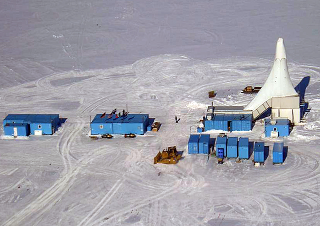
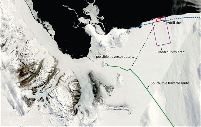
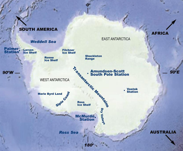
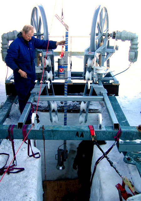
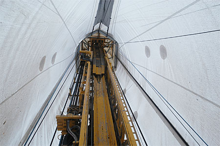
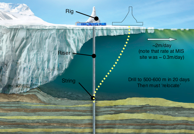
Scientists plan to go to the literal edge of Antarctica in hopes of learning more about its climactic past, long before ice sheets covered 98 percent of the continent’s surface. A team will head to the edge of the Ross Ice Shelf The site, known as Coulman High This international geological program has already recovered more than 2.4 kilometers of sediment cores from two separate sites near McMurdo Station “That was the first geological drilling through an ice shelf that’s been done,” said Frank Rack, executive director of the ANDRILL Science Management Office and principal investigator on the Coulman High site survey grant from the National Science Foundation’s Office of Polar Programs What makes the Coulman High site even more daunting isn’t just that it requires the ANDRILL team to punch through much thicker ice — the Ross Ice Shelf is about three times as thick here, at 270 meters, than at the previous ANDRILL site. No, it’s the fact that the ice shelf is moving at a relatively fast clip, about two meters per day. Why is that a problem? ANDRILL’s drilling platform, which sits on the ice, sends a riser through the ice after first melting a hole with a hotwater drill. The riser drops down through the ice and the ocean below before hitting the seafloor. The drill string itself then snakes down this protective tube and begins its work collecting cores. The tricky part: The seafloor at the bottom of the riser isn’t moving, but the drilling operation topside is sliding two meters each day north toward the Ross Sea. “Once we’ve drilled into the seafloor, the ice is still moving, so the pipe starts to bend,” Rack said. Obviously, that’s not a good thing. Engineers are already working on the problem. One strategy is to drill as deep as possible into the seafloor, and then pull out before the bend becomes untenable. The drillers would then start a second hole, drilling as fast as possible to reach a depth that matches up well with where the first hole left off before returning to coring. “That means we have to drill faster than we core,” Rack explained of the “offset” drilling strategy, the preferred method at this point. Plan B involves reentry of the riser and drill string into the same hole, guided by a reentry cone — sort of like a funnel — left on the seafloor. That’s trickier because it would require pulling the riser back up through the ice and then moving the entire operation back in the direction from which it had drifted. Then the drill team would melt a new hole in the ice and hope to go back into the original hole in the seafloor a second time. “There are a lot of interesting engineering challenges here,” Rack said. Much of the work this coming season will involve collecting data on tidal and ocean currents, as well as making measurements of the ice shelf conditions, to help model the behavior of the riser and how the drilling operation might play out under different scenarios, according to Rack. The team will melt several holes through the ice shelf with the ANDRILL hotwater system to deploy instruments into the ocean. In addition, ANDRILL is interested in using a remotely operated vehicle successfully tested in McMurdo Sound for the last three seasons by Stacy Kim SCINI, for Submersible Capable of under Ice Navigation and Imaging “Our ultimate goal is to create something called SCINI Deep. That would allow us to go full water depth and provide drilling support at the seafloor,” Rack said. Said Zook, during a recent polar technology conference, “We’d love to get deep. That’s what it’s all about, I think. The Ross Ice Shelf seems to be the interesting place these days.” The researchers feel confident the site itself will yield new insights into climate and into the geologic history of Antarctica in a relatively unexplored basin. In 2002, the RVIB Nathaniel B. Palmer Since then the ice shelf has flowed back over the study site. “It now becomes a platform for drilling, if funding [for the drilling] is approved,” Rack said. ANDRILL scientists are able to analyze the material in the core by various methods to reconstruct past climate, detecting when the ice sheet ebbed and flowed over millions of years. The idea is that by looking back in time the researchers can glean insight into how Antarctica’s ice sheets might respond in a future greenhouse world. For example, findings from the McMurdo Ice Shelf (MIS) core published last year in the journal Nature suggested that even a slight rise in atmospheric concentrations of carbon dioxide, one of the gases that drives global warming, affects the stability of the West Antarctic Ice Sheet. Antarctica’s smaller ice sheet contains enough ice to raise sea levels about six meters. Between 2 million and 5 million years ago, according to the paper, evidence indicates that at times Antarctica was warmer than today and atmospheric carbon dioxide levels were higher than the present 390 parts per million. Variations in temperature caused numerous advances and retreats of the West Antarctic Ice Sheet during this period. Earlier ANDRILL projects involved scientists and funding from the United States, New Zealand, Italy and Germany, with NSF providing almost two-thirds of the $30 million for the International Polar Year The Coulman High project will also test and prove mooring technology that interests other science teams working on ice shelf-ocean studies, Rack noted. In particular, his group is collaborating with Woods Hole Oceanographic Institution “This is an interesting study for a lot of the community,” Rack said. NSF-funded research in this story: Frank Rack, University of Nebraska-Lincoln |


For USAP Participants |
For The Public |
For Researchers and EducatorsContact UsU.S. National Science FoundationOffice of Polar Programs Geosciences Directorate 2415 Eisenhower Avenue, Suite W7100 Alexandria, VA 22314 Sign up for the NSF Office of Polar Programs newsletter and events. Feedback Form |

