Antarctic beachcombingScientists seek to reconstruct peninsula ice sheet by dating rocksPosted June 11, 2010
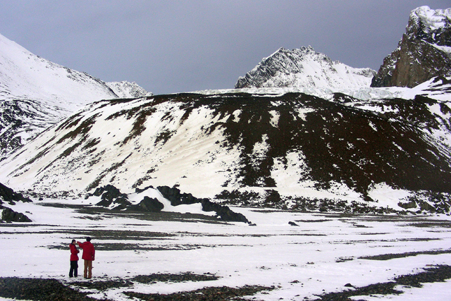
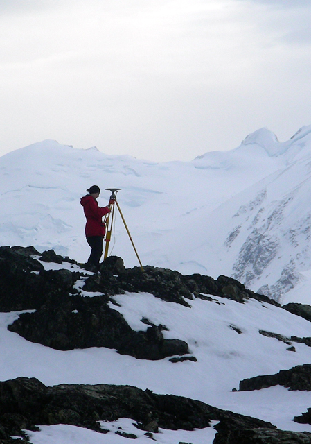
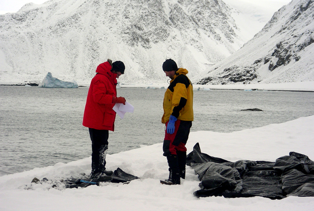
Alexander Simms Of course, beachcombing in Antarctica as winter approaches isn’t exactly a holiday experience. An assistant professor in the Boone Pickens School of Geology “What we’re trying to understand is how thick the ice was during the last ice age, or the Last Glacial Maximum 18,000 years ago,” explained Simms after returning from a nearly two-month expedition during March and April aboard the research vessel Nathaniel B. Palmer The U.S. Antarctic Program Simms and graduate students Lauren Miller and Daniel Livsey hit the beaches at stops during the research cruise, collecting rock samples from raised beaches as high as 41 meters — beaches that waves once pounded at sea level. No, the surf isn’t that good in Antarctica. Instead, as the glaciers retreated — representing millions of tons of ice — the land beneath “rebounded,” rising up as the weight disappeared. Measuring the amount and rate of rebound based on the location of the raised beaches helps Simms and colleagues theoretically reassemble the ancient ice sheet. That information then feeds into other climate models that would help predict how today’s ice sheets may evolve in a warming world based on how the ice sheet looked at a given time in the past. The key to all that number crunching and ice sheet modeling depends on dating the age of the beaches. Imagine the series of raised beaches as the land lifted up as an irregular stairway built with uneven steps from the top down, with each step marked with a date of completion. The oldest step is at top. By measuring the depth of each “step,” or beach alongside a hill, and the time it took to build, researchers can calculate the mass and extent of the ice sheet because they already know how much ice would need to disappear for X amount of land to rise. The trick is getting the date of each “step.” Simms and colleague Regina DeWitt “We’re taking it and applying it in a way that hasn’t been applied before,” noted Simms, who used a Small Grant for Exploratory Research (SGER) from the National Science Foundation (NSF) A physicist working a field dominated by earth scientists, DeWitt said her interest rests with developing new techniques and instrumentation. “I knew that applying OSL to rocks would be very important for many applications,” she said. DeWitt didn’t have a specific application in mind until she talked to Simms. “He was very excited, because he wanted to do the work in Antarctica but did not have a method to date the rocks. It was a real symbiotic process.” Not just any old rock will do. DeWitt, an assistant research professor in the physics department, needs cobbles that contain minerals such as quartz. The quartz essentially captures natural radiation from the surrounding rocks and space, which it releases when exposed to light. “What we’re basically able to do is tell how long it’s been since that quartz crystal has been exposed to sunlight,” Simms said. The lab analysis — a time-intensive technique that takes several weeks to complete — requires the scientists in the field to find cobbles that fit a certain profile. The rocks should appear as if they haven’t moved in the last few centuries or millennia, as the researchers are interested in the material on the underside of the cobbles that haven’t seen the light of day. Of course, the rocks should contain quartz or a similar material that captures the natural radiation. “Not all of the rocks obviously have quartz,” Simms said. “That was the problem in the South Shetlands — finding enough rocks with quartz. This trip we didn’t have much trouble finding rocks with quartz.” Finding the rocks proved to be a far more low-tech method than the one required to analyze them. The scientists would cover an area with a black tarp, working underneath with a red light so as to not expose the rock samples to sunlight, which would free the pent-up radiation before getting it to the lab. “I’m sure the penguins thought we were crazy,” Simms said of the makeshift darkroom created by the tarp. The team spent about five days in a field camp on Calmette Bay in Marguerite Bay, roughly in the middle of the peninsula, where they collected about three-quarters of the more-than-100 rocks for later analysis. Simms said the region had plenty of coastal bays and fjords for beaches to develop. “It probably has some of the best developed raised beaches in the peninsula area,” he said. “Our field camp was in a perfect spot.” In addition, the team made day trips to other islands in the region, often landing via small boats with a team studying the diet of Adélie penguins. Simms said the fickle Antarctic weather was relatively good, though several days of heavy, wet snow slowed their work down at times. “We were kind of lucky,” he said.
NSF-funded research in this story: Alexander Simms and Regina DeWitt, Oklahoma State University, Award No. 0838781 |


For USAP Participants |
For The Public |
For Researchers and EducatorsContact UsU.S. National Science FoundationOffice of Polar Programs Geosciences Directorate 2415 Eisenhower Avenue, Suite W7100 Alexandria, VA 22314 Sign up for the NSF Office of Polar Programs newsletter and events. Feedback Form |


