Unzipping climate changeScientists study how Antarctic ice sheet pulled back from Ross Sea region since Last Glacial MaximumPosted May 13, 2011
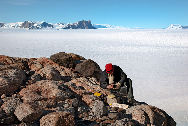
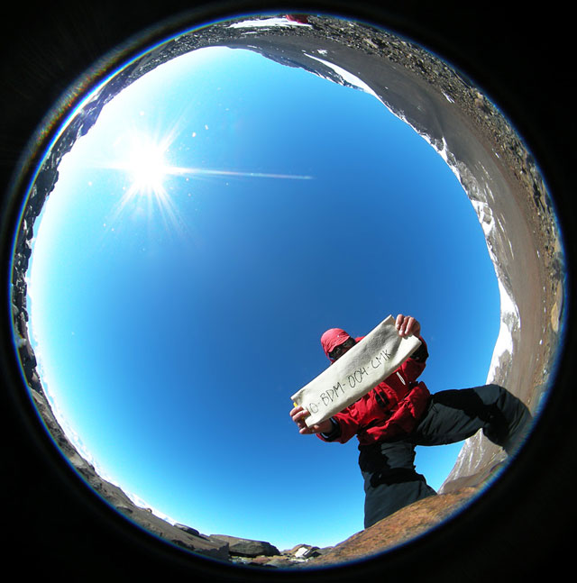
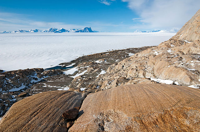
Antarctica holds a lot of ice: About 70 percent of the world’s frozen water is locked up in the continent’s vast ice sheets. About 20,000 years ago, there was even more during what scientists call the Last Glacial Maximum (LGM). Then the planet began to enter one of the short, periodic interglacial blips between so-called ice ages when things heat up a bit. Ice sheets in the northern hemisphere began a relatively quick retreat, as the naturally warmer interglacial got under way. Antarctica didn’t really get going until about 10,000 years ago, at the beginning of the Holocene, the current epoch. But when the ice sheet finally began to pull back across the Ross Sea region, it did so with amazing rapidity. “The history of deglaciation [in the Ross Sea Embayment] is sort of an unzipping of each of the successive glacial valleys as you go along the Transantarctic Mountains,” explained John Stone Stone led a small team of scientists — and one inquisitive high school teacher [See related article: Hope for education: PolarTREC teacher takes Antarctic experience to the classroom] — this past austral summer to the central Transantarctic Mountains, where a large field camp had been set up to support about 18 different research projects, ranging from paleontology to glaciology. His group and colleagues — including Howard Conway The Transantarctic Mountains bisect the continent, separating the eastern and western ice sheets. Huge glaciers — bearing names like Reedy and Scott, Shackleton and Beardmore — slice through mountain valleys. They drain the East Antarctic Ice Sheet into the Ross Ice Shelf However, at the end of the LGM, the Ross Sea was filled by a thick ice sheet, and the glaciers may have flowed through this like ice streams, the areas of an ice sheet that move faster than the surrounding ice. But then the massive ice shrank back, and the grounding line that marks the boundary where the ice begins to float headed south, finally stabilizing about 2,000 years ago. Now, all of the major and minor glaciers along the mountain valleys north of Reedy flow into the Ross Ice Shelf, their elevations much diminished since the LGM. “That’s a recent phenomenon. It’s only within the last 10,000 years that happened,” Stone noted. Stone’s team would like to refine the timeline of the ice sheet’s retreat, as well as its former thickness. The scientists have been making a slow but steady transect of the major glaciers over the years. This season, it was time to visit Beardmore Glacier, discovered by explorer Ernest Shackleton in 1908 during his attempt to be the first to reach the South Pole. The field team’s task was to map out glacial deposits — sediments and rocks — left by the ice sheet. Mapping the distribution and elevation of the till deposits along the glacial valleys provides information about the thickness of the glacier. For example, previous work at Scott Glacier found that it had once been a thousand meters above sea level; today, it’s about 100 meters where the mouth of the glacier joins the ice shelf. It took only about 2,000 years for the drop in elevation to occur, according to Stone. “That can happen when an ice sheet is retreating into a marine basin,” he said, because the ice is grounded below sea level — like much of West Antarctica today. The West Antarctic is the ice sheet most scientists are worried about when it comes to climate change and sea level rise. “What [we] are concerned about is the possibility raised by these rapid collapse scenarios that people have been talking about since the 1970s.” That’s when the late John Mercer from The Ohio State University Refining the timeline requires some backbreaking work and high-tech analysis back in the laboratory. Stone and his team hauled back about 400 kilograms of rocks from the glacial moraines. They will use a technique called surface exposure dating to determine the age of the rocks from the sites they mapped. “That lets us know the speed of retreat and basically how rapidly an ice sheet the size of the Antarctic ice sheet can contract,” Stone explained. The technique determines how long the rocks have been exposed to cosmic rays since they were uncovered by retreating ice. The dating method is based on the build-up of rare cosmic-ray-produced isotopes — the higher their concentration, the longer a rock must have been exposed. “I think the thing that really made a big change down here was the advent of the exposure dating technique, because finally we had a technique to directly date the glacial deposits,” Stone said. The team spent several weeks at three remote sites from the main base camp identifying the glacial deposits and collecting samples. The two critical sites were Mount Hope and Mount Kyffin, located on opposite sides at the mouth of the Beardmore Glacier. The glacial deposits at Mount Kyffin were especially useful because they mark the spot where the glacier had stood at its highest point. “It’s often difficult to do in the Transantarctics, because often the mountains at the mouth of the glacier are too low and were completely overrun [by ice],” Stone explained. That was the case for Mount Hope. However, a long bedrock ridge offered an excellent transect with glacial deposits from high to low, so the researchers could reconstruct the timeline of thinning. “Those two sites give us the glacial maximum and the retreat history,” Stone said. A third mountain called The Cloudmaker about 50 kilometers up the glacier also offered lots of till deposits for comparison to Mount Kyffin in regards to the maximum height of the glacier. It will also give the researchers some ideas of the slope between the areas at the LGM. Next up on the to-do list: Shackleton Glacier to the south. “We want to keep working this transect and see how the ages change from north to south,” Stone said. NSF-funded research in this story: John Stone and Howard Conway, University of Washington, Award No. 0838818
Return to CTAM 2010-11 main page. |


For USAP Participants |
For The Public |
For Researchers and EducatorsContact UsU.S. National Science FoundationOffice of Polar Programs Geosciences Directorate 2415 Eisenhower Avenue, Suite W7100 Alexandria, VA 22314 Sign up for the NSF Office of Polar Programs newsletter and events. Feedback Form |


