|
Not sitting downSEAT researchers snowmobile across West Antarctica to measure accuracy of remote sensingPosted April 27, 2012
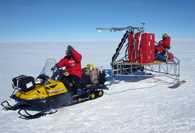
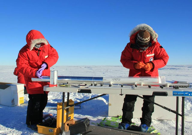
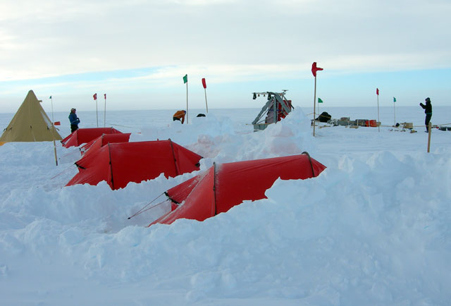
Scientists are generally in agreement that glaciers in West Antarctica are charging ever faster toward the coast, releasing more ice to the sea, particularly in the Amundsen Sea region. What’s far less clear is whether there is enough snowfall on Antarctica’s unstable, marine-based ice sheet to offset the loss of ice, which is slowly contributing to sea-level rise. It’s what researchers call ice sheet mass balance. Ever more sophisticated sensors on satellites and radars flown aboard aircraft are capable of collecting precise measurements that are fed into computer models that spit out mass balance calculations. But what’s the reality on the ground? A science team led by researchers from Brigham Young University (BYU) “It’s really [about] moving toward being able to get broader spatial pictures of accumulation with airborne measurements or space-borne measurements that we’ve never had before,” explained Lora Koenig A big part of fine-tuning that picture also involves collecting shallow firn and ice cores with annual layers of snowfall that travel back in time 30 to 40 years, roughly covering the modern satellite record of Antarctica. “We’re hoping to be able to provide essentially point source data from the ice cores to the radar and remote sensing data,” said Summer Rupper The two-year field project began during the 2010-11 season, operating out of a field camp called WAIS Divide where other scientists have drilled the deepest ice core ever recovered by U.S. researchers to get a detailed look at the past 60,000 years or so of climate. [See recent article — The last core: WAIS Divide deepens borehole for research into climate change.] That season the SEAT team covered 350 kilometers and collected five ice cores. This year, working from the Byrd Surface field camp, they drove their snowmobiles and high-tech radars over some 500 kilometers and drilled nine ice cores in both high and low accumulation areas. The radars were developed at the National Science Foundation The IceBridge flights, originating out of Punta Arenas, Chile, have flown over the SEAT grid to provide additional corroboration of the data. “These radars have very high vertical resolution as they look into the ice sheet. It gives us a resolution that we’ve never seen before. We can almost see individual storm events, as well as the annual layering with these radars,” Koenig said. “It’s one of the first times we’ve been able to independently determine an age-depth scale from the ice cores and an age-depth scale from the radars and see how they match up.” So far, those two high-resolution records are matching up quite nicely, according to Rupper and Koenig. Rupper’s lab team at BYU has processed the first year’s ice cores, melting 2-centimter-long sections to use in a mass spectrometer capable of counting the oxygen isotopes in a given sample. An isotope is an atom that has different number of neutrons. Oxygen has three stable isotopes, and the ratio between O18 and O16 reflects warmer and cooler temperatures, which correspond to the summer and winter seasons. Very preliminary results from the ice cores also show a decrease in the accumulation rate over the last two decades, though additional analyses are still pending, according to Rupper. “Right now we’re definitely not seeing an increase in accumulation. That I can say with pretty high confidence,” she said. “Until we’ve done the full statistics, it will be difficult to say how significant that is, but it definitely isn’t playing in the direction that people expect to be happening.” 
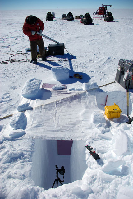
Photo Credit:
Maria-Jose Viñas A camera with an infrared filter shoots an image of the wall of a snow pit. The infrared wavelength is more sensitive to snow properties such as grain size than visible light, allowing the researchers to identify the various snow layers.
Previous climate research has suggested that precipitation would increase by as much as 20 percent as the atmosphere warmed up over Antarctica. However, the complex interplay between atmospheric and ocean circulation around the continent, further complicated by possible influences from the ozone-depleted stratosphere and the tropics, may make such straightforward predictions difficult. Hence the need for the ground-truth data from the ice cores. No one expects satellites and air-borne instruments to do all of the work just yet. “Coming from NASA, I’d love to put Summer out of business, but we’re a long way from that,” Koenig said. “When we’re talking about the total mass balance of Antarctica, we really need accumulation measurements over many areas in space. We always need ground-truth data to extrapolate remotely sensed data over space.” Rupper also noted that there is a reciprocal relationship between the physical ice data and the information gleaned from satellites and radars. From her perspective, the radar profiles are essential for understanding larger regional patterns and if a particular ice core is truly representative of widespread snow accumulation or an aberration. The SEAT ice cores will also fill in an important gap in the temperature and snow accumulation timeline that ended in the early 2000s with International Trans Antarctic Scientific Expedition (ITASE) “Hopefully, this suite of cores will bring everything up to present, so we can see what’s going on and how things are varying over the last decade and a half,” she said. The SEAT project has benefited from the latest technologies, from the Swiss-designed and built drill to the high-precision radars from CReSIS. “One of the unique things about this traverse is that because of our equipment, we’re very fast and light,” Koenig said. “That allows us to cover a lot more ground, and we need that when we’re talking about ultimately calibrating or validating satellite algorithms.” And because the radars are the same ones flown aboard aircraft, the speed of the snowmobiles were limited by the terrain, not the equipment, she added. Student engineers at CReSIS even developed the sleds on which the radars were carried, Rupper noted. “Their radar development is really what will help us to be able to get some of these algorithms from passive microwave satellites that we would like to get,” Koenig said. “Right now, their radars are one of the best sources we have for looking at accumulation rates across spaces that are not a model but a real measurement. “It made the science possible.” NSF-funded research in this article: Summer Rupper, Brigham Young University, Award No. 0944730; and Richard Forster, University of Utah, Award No. 0944653 |


For USAP Participants |
For The Public |
For Researchers and EducatorsContact UsU.S. National Science FoundationOffice of Polar Programs Geosciences Directorate 2415 Eisenhower Avenue, Suite W7100 Alexandria, VA 22314 Sign up for the NSF Office of Polar Programs newsletter and events. Feedback Form |


