|
Light it upLIDAR in McMurdo illuminates upper atmosphere characteristicsPosted October 19, 2012
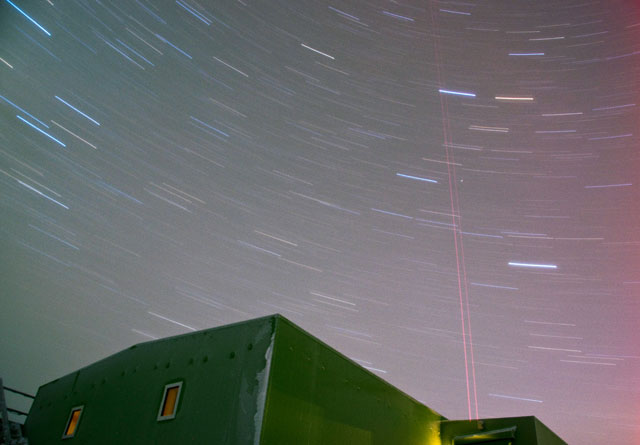
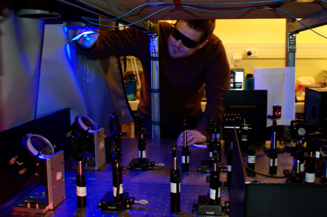
Lasers: They’re not just for evil geniuses with access to an aquarium filled with sharks. It turns out sending pulses of light into the sky is an excellent way to study the little-understood regions of the upper atmosphere. A research team with the Cooperative Institute for Research in Environmental Sciences (CIRES) and Department of Aerospace Engineering Sciences at the University of Colorado at Boulder “It’s pioneering work,” enthused Xinzhao Chu The mesosphere is the layer of atmosphere between the stratosphere and thermosphere, roughly 50 to 100 kilometers above the Earth. Its upper boundary, called the mesopause, is the coldest region of the atmosphere, with temperatures as frigid as 130 Kelvin, or about minus 140 degrees Celsius. It’s in the mesosphere and lower thermosphere where meteors are vaporized, releasing iron and other trace elements the LIDAR can use to study the middle atmosphere. “It’s a region that cannot be reached by airplane. It can be reached by rocket occasionally, but each rocket will only give you about one minute of data when it travels through that layer,” explained Wentao Huang The LIDAR can provide atmospheric scientists like Chu and Huang with quite a bit of high-resolution information from its stream of photons. It can determine temperature by measuring the frequency and power ratio of the backscattered light by an optical receiver system on the ground from where the laser is transmitted. In this case, the LIDAR is tuned to the resonance of neutral atoms of iron floating in the mesosphere and lower thermosphere. The Fe (iron) Boltzmann temperature LIDAR can also detect polar mesospheric clouds, which at about 85 kilometers above the Earth’s surface, are the highest clouds in the world. The clouds are noctilucent, meaning they can be seen from the ground only at night, when they are illuminated by sunlight no longer visible from the Earth’s surface. In the southern hemisphere, the clouds form near the mesopause boundary in the summer, beginning in mid-November and lasting through February. Huang said the clouds are particularly sensitive to changes in ambient temperature, and while the atmosphere may be stratified, the layers are connected, so that warming in the troposphere could actually cause cooling in the stratosphere and mesosphere. The occurrence frequency of the clouds could be an indicator of climate change, Huang noted. “You have to have information from every layer [of the atmosphere] in order to have a working model that tells you what is happening down on the ground,” he said. Similarly, so-called gravity waves generated in the Earth’s troposphere by weather systems can propagate upward and horizontally through the atmosphere, affecting the dynamics of the mesosphere and even thermosphere. The LIDAR can infer when such waves pass through the region by perturbations in the temperature or density of the iron tracers. In fact, one of the major coups by the Fe Boltzmann LIDAR during its first two years of operation has been the discovery of the iron layer well into the thermosphere up to 155 kilometers — the first-ever detection of such by a ground-based instrument. 
Photo Courtesy: Xinzhao Chu
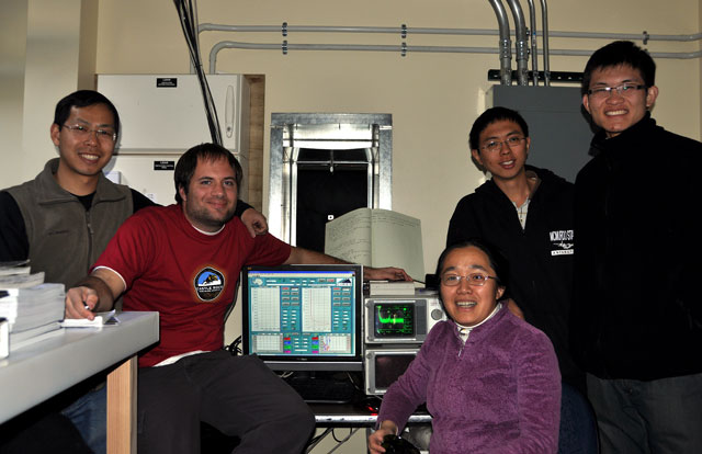
Members of the research team celebrate the first Fe signals in December 2010 at Arrival Heights. From left, Wentao Huang, John A. Smith, Xinzhao Chu, Weichun Fong and Zhibin Yu.
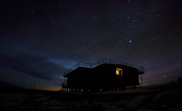
“No one knew that before. It has made quite a big impact on the [science] community,” Chu said, noting that the finding may open up new fields of research by extending observations into the composition and dynamics of the thermosphere. The LIDAR currently at McMurdo — which requires a scientist to be on site even during the winter, when there are rarely researchers at the station — was originally developed by Chu and colleagues more than a decade ago. It is a well-traveled instrument, first deployed at the North Pole in 1999, followed by stints at the South Pole Station The LIDAR was then refurbished and upgraded before its installation at an area called Arrival Heights “You have a picture of the temperature variation of the whole southern polar region,” he said. The Chu research group eventually wants to get an even bigger picture of the atmosphere above McMurdo, with proposals to continue the current project under the hope of getting a dataset that stretches across an 11-year solar cycle. In addition, the team is proposing to install a sodium (Na) Doppler LIDAR at Arrival Heights that is capable of measuring vertical winds as well. “The McMurdo campaign is a new look into the composition, chemistry, temperature and dynamics of the polar upper atmosphere,” Chu said, adding that the measurements are critical for validating global climate models. “The extensive dataset … lends itself to a broad range of important science studies.” NSF-funded research in this story: Xinzhao Chu and Chester Gardner, University of Colorado at Boulder, Award No. 0839091 |


For USAP Participants |
For The Public |
For Researchers and EducatorsContact UsU.S. National Science FoundationOffice of Polar Programs Geosciences Directorate 2415 Eisenhower Avenue, Suite W7100 Alexandria, VA 22314 Sign up for the NSF Office of Polar Programs newsletter and events. Feedback Form |


