|
Bergy bitsRemnants of mighty iceberg B-15 still floating around 13 years laterPosted April 5, 2013
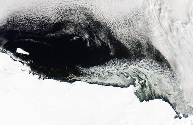
A NASA The Moderate Resolution Imaging Spectroradiometer (MODIS) Iceberg B-15 was the world’s largest recorded iceberg, with a surface area of 11,000 square kilometers, nearly the size of the state of Connecticut. It calved off the Ross Ice Shelf The resulting icebergs were so large that they choked the channel to McMurdo Sound, which leads to McMurdo Station The sea ice dam finally broke at the end of the 2010-11 austral summer when the sound cleared out all the way to the southerly McMurdo Ice Shelf for the first time in more than a decade. [See previous article — Open water: Break-up of sea ice in McMurdo Sound welcomes wildlife, nears airfield road.] Photo Credit: Brien Barnett/Antarctic Photo Library
A team led by University of Chicago glaciologist Doug MacAyeal flew out to iceberg B-15A in October 2003, near Ross Island, and erected a weather and GPS station to track the iceberg. The GPS station finally failed in 2010.
Glaciologist Doug MacAyeal MacAyeal said none of the instrument stations that were installed are still working except one on a site dubbed “Nascent Iceberg,” an area near the front of the Ross Ice Shelf that scientists expected to calve before now. MacAyeal said his team tracked B-15A and B-15J until late 2010 when the GPS stations failed. They were south of New Zealand at the time. Another iceberg tracked by MacAyeal, C16, is south of South Georgia Island after circumnavigating the continent from the Ross Sea to the Weddell Sea. It had calved in September 2000 when B15 collided with the most northerly portion of the Ross Ice Shelf and caused a large chunk to break away, according to a NASA news story. C-16 ended up being “trapped” with several other icebergs — B-15K, B-15A and B-15J — near the Ross Ice Shelf and Ross Island for at least five years. For part of that time, C-16 was grounded in the shallow shoal area between Lewis Bay and Beaufort Island, where it was a target for other icebergs transiting the region — what MacAyeal has referred to as the iceberg equivalent of a mosh pit. All the icebergs were fitted with several instruments: GPS receivers, magnetic compasses and automatic weather stations. In addition, a seismometer used to study calving, drift, break-up and collisions, was placed on C16, as was a camera. “We have data to recover from C-16,” MacAyeal noted, “so if anybody gets out there near it (a cruise ship), we’d be happy to tell them where the data recorders are [located].” The icebergs and calving events have offered researchers a wealth of information about ice dynamics. MacAyeal’s own work has suggested that the eventual break-up of B-15A in 2005 was caused by a large storm in the Gulf of Alaska that generated a trans-Pacific ocean swell. However, other scientists have argued that the iceberg broke apart after repeatedly grounding near the coast. Research on the bergs continues to this day. A poster presented by University of Chicago undergraduate student Sarah U. Neuhaus at last December’s American Geophysical Union |


For USAP Participants |
For The Public |
For Researchers and EducatorsContact UsU.S. National Science FoundationOffice of Polar Programs Geosciences Directorate 2415 Eisenhower Avenue, Suite W7100 Alexandria, VA 22314 Sign up for the NSF Office of Polar Programs newsletter and events. Feedback Form |


