|
Movers and shakersUNAVCO assists Antarctic researchers with tectonic, glacial studiesPosted April 19, 2013
Once upon a time, in the age of brick-sized mobile phones and big-hair bands, a high-precision GPS It was at that time during the 1980s when the organization that would eventually become UNAVCO “We have members on every continent except Antarctica – and we do a lot of work there,” said Meghan Miller, UNAVCO president, during an interview at the Boulder, Colo., headquarters. That’s a bit of an understatement. During the 2011-12 Antarctic field season The National Science Foundation (NSF) “There’s nothing else quite like UNAVCO in terms of being a geodesy facility for researchers,” Miller added. Geodesy refers to the study of Earth’s shape, gravity field and rotation. Much of the research UNAVCO has supported since its creation in 1984 through the turn of the century involved using high-precision GPS receivers to monitor plate tectonics. 
Photo Credit: Peter Rejcek
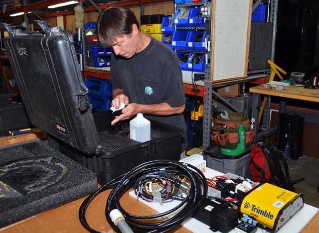
UNAVCO technician Scotty Coleman assembles a GPS field unit for deployment to Antarctica.
In recent years, the applications have broadened considerably, from using GPS to measure moisture in the atmosphere through the attenuation of the signal from the satellites to monitoring the vertical lift of the Earth itself as heavyweight ice sheets thin. The latter is a particularly important field of research, as scientists attempt to gauge the changes under way in Antarctica, which stores 90 percent of the world’s ice. “There seems to be a growing interest in using GPS and other geodetic measuring tools such as Terrestrial Laser Scanning, for science. And the way we use traditional GPS is changing,” noted Joe Pettit, project manager for UNAVCO’s Polar Services department. “It’s been really interesting watching the trend of GPS transitioning from positional and navigational purposes into novel approaches to other scientific research. It’s even possible to repurpose old data to help with new science.” The original Navstar Global Positioning System was a satellite-based navigation system made up of a network of satellites, initially 24, placed into orbit by the U.S. Department of Defense The system quickly outgrew its original purpose as a more precise way to navigate. Today, the world is literally synchronized to run on GPS, from cell phones to ATMs to the Internet itself. That’s because all of these technologies are governed by atomic time, which comes from GPS satellites. UNAVCO’s biggest project is the Plate Boundary Observatory (PBO) The Boulder-based consortium is also involved in building a network in the Caribbean called COCONet (Continuously Operating Caribbean GPS Observational Network) Meanwhile, a nascent network has also been started in Africa, AfricaArray 
Photo Credit: Seth White/UNAVCO
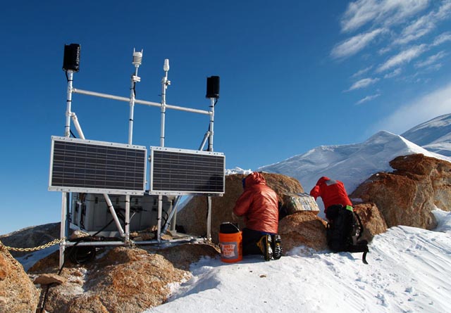
Two people Install a GPS station in the Whitmore Mountains for the POLENET project in Antarctica.
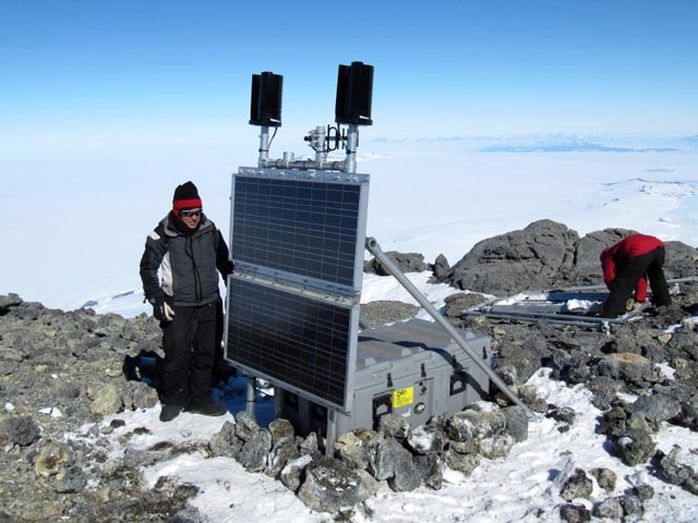
On the world’s coldest continent, UNAVCO supports a different GPS network called POLENET POLENET actually encompasses both Greenland and Antarctica. The latter observation network is called A-NET Those measurements will be useful in building realistic models of the ice sheets as the climate changes, which most researchers believe will include higher sea level due to ice sheet melt from Antarctica and Greenland. Pettit said more polar projects are going the way of POLENET — installing GPS stations for long-term, continuous measurements. That’s a shift from the “campaign-style” projects that involved taking measurements over just a few weeks or months. “The complexity of what we’re doing as a group has increased enormously in the last few years,” he said. In response, Pettit’s team has developed standard GPS stations that are pretty much plug and play, getting away from custom jobs in recent years. It takes less than four hours to set up a site in the field. Some research teams have clocked in at less than two hours to install a station with its insulated box and solar panel array. “It saves us a ton of time, and it makes it much more reliable,” Pettit said of the off-the-shelf system. “And [scientists] love it because they know what to expect, and it’s easy to deploy.” 
Photo Credit: Karen Hilton
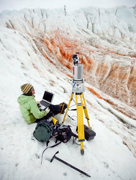
UNAVCO's Marianne Okal performs a LiDAR scan at Blood Falls in the Taylor Valley.
One of the biggest challenges has been power. The southern sun provides all the juice in the Antarctic summer while it shines 24 hours a day. The long polar night is another story, with some interior GPS sites blanketed in darkness for six months at temperatures dipping below minus 100 degrees Fahrenheit. Now, the continuously operating GPS stations work over winter with few problems, as batteries have proven more reliable, if still bulky and heavy. Not that there aren’t still challenges, according to Miller. “When you’re working in extreme environments like that, it’s never really routine, because there are always new applications, new tools, new technologies, upgrades, new ways of getting data out that are either faster or lower power or less expensive,” she explained. “You’re always learning and you’re always innovating because that’s the only way to increase the capacity of how much research you do.” For example, UNAVCO has embraced the use of terrestrial laser scanners (TLS), or ground-based LiDAR. LiDAR uses laser pulses to create high-resolution 3D maps of surfaces and objects. Scientists have used it in the Antarctic to map everything from volcanic ice caves to the morphology of snow and rock surfaces in the ice-free McMurdo Dry Valleys UNAVCO first deployed the TLS system during the 2008-09 system. It was used by seven projects during the 2011-12 field season. “Things have changed really fast in the last five years. We’ve had to work pretty hard to keep up with it,” Pettit said. “The scientific community is demanding that — and they keep us on our toes in that regard.” |


For USAP Participants |
For The Public |
For Researchers and EducatorsContact UsU.S. National Science FoundationOffice of Polar Programs Geosciences Directorate 2415 Eisenhower Avenue, Suite W7100 Alexandria, VA 22314 Sign up for the NSF Office of Polar Programs newsletter and events. Feedback Form |


