|
Breaking awayGiant iceberg calves from Pine Island Glacier Ice ShelfPosted July 12, 2013
Nearly two years after NASA Scientists at the Alfred Wegener Institute-Helmholtz Centre for Polar and Marine Research broke the news 
Photo Credit: German Aerospace Center (DLR)
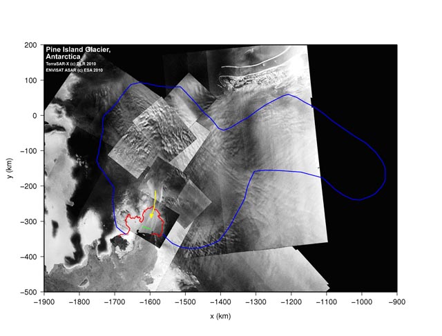
The combination of several satellite images gives an overview of the glacier (red outline), the flow direction (yellow) and the position of the crack (green).

Photo Credit: August Allen/Antarctic Photo Library
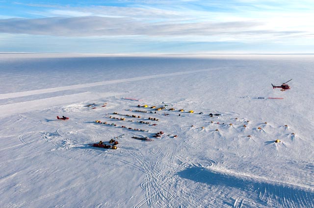
A field camp set up during the 2012-13 Antarctic season on Pine Island Glacier, near the ice shelf where an iceberg recently calved off.
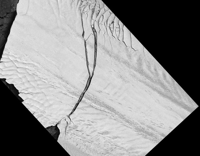
The iceberg measures about 720 square kilometers (Chicago is about 600 square kilometers). Scientists at the Polar Geospatial Center (PGC) Pine Island Glacier (PIG) is the fastest flowing glacier in Antarctica, moving about 4,200 meters per year where it feeds into the ice shelf, which floats on the ocean. While PIG has been the focus of climate change studies in recent years, the calving of the ice shelf is believed to be a natural phenomenon. The crack was first seen and photographed on Oct. 14, 2011, by scientists aboard NASA’s DC-8 The six-year airborne campaign has conducted measurements of ice in the Arctic and Antarctic since 2009 after the Ice, Cloud, and land Elevation Satellite (ICESat) The IceBridge project has been based out of Punta Arenas, Chile, during its previous field seasons. This year NASA plans to base the mission out of McMurdo Station During the 2012-13 season, U.S. and British scientists collaborated on a logistically intensive field project called PIG The field work took place more than 15 kilometers south of the crack where the iceberg broke away from the ice shelf. The thinning ice shelf allows the glacier behind it to flow faster. PIG, along with nearby Thwaites Glacier, are draining the most ice from the West Antarctic Ice Shelf. The entire ice shelf holds enough frozen water to raise sea level by an estimated five meters. The much larger and higher — and more stable — East Antarctic Ice Shelf would raise sea level by about 60 meters. |


For USAP Participants |
For The Public |
For Researchers and EducatorsContact UsU.S. National Science FoundationOffice of Polar Programs Geosciences Directorate 2415 Eisenhower Avenue, Suite W7100 Alexandria, VA 22314 Sign up for the NSF Office of Polar Programs newsletter and events. Feedback Form |


