|
Getting at the root causeSeismic network to get better picture of how the Transantarctic Mountains formedPosted December 20, 2013
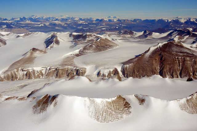
The Transantarctic Mountains are the world’s third longest mountain range, stretching some 3,500 kilometers to bisect the coldest continent into West and East Antarctica. Yet it is perhaps the least understood, largely due to the fact that most of it is buried by Antarctica’s thick ice sheets. Geologists don’t even agree on how the mountain range first formed. Samantha Hansen “By looking at characteristics of the crustal and upper mantle structure, you can infer which model may be more applicable to their formation,” Hansen explained during an interview at McMurdo Station 
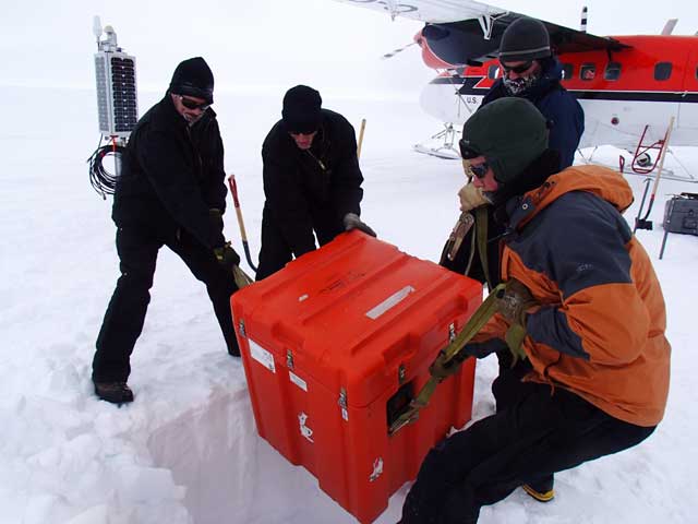
Photo Credit: Lindsey Kenyon
The large orange box shown here contains all the electronics for the seismic station, such as batteries, storage devices, and other instruments. Each box weighs nearly 300 kilograms. A solar panel to the left provides power during the summer months.
Understanding the geological history of the continent will also provide insight into Antarctica’s glaciological evolution and even its climate, Hansen added. Many of the world’s best known mountain ranges – the Himalayas, the Alps, and the Appalachians – were the product of a collision between tectonic plates or land masses, the compression forcing the rocks to thrust upward. Whether that’s the story of the Transantarctics is up for debate. A number of theories have emerged to explain their evolution. Some have argued, such as Audrey Huerta at Central Washington University Another possibility is what Hansen calls a flexure model. East Antarctica is thought to be a craton, which consists of stable, older rock. Meanwhile, West Antarctica is believed to be a continental rift system, where the crust is being pulled apart and supported by a hot upper mantle. The mountains are at the boundary between the two, with the hot mantle beneath West Antarctica pushing the edge of East Antarctica upward. A third hypothesis involves what geologists refer to as an isostasy model, with a big “root” system of crustal rock that buoys up the mountains. The isostasy model is a bit like an iceberg, which always floats with a certain portion of the ice below the surface. If more ice is added, the iceberg will sink lower; if it somehow loses ice above the water surface, the iceberg will rise higher. 
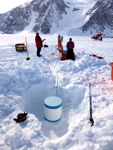
Photo Credit: Doug Bloomquist
Scientists install a seismic station during the 2012-13 season. The seismometer is underneath the foam cylinder in the snow hole. A helicopter was used to reach the site.
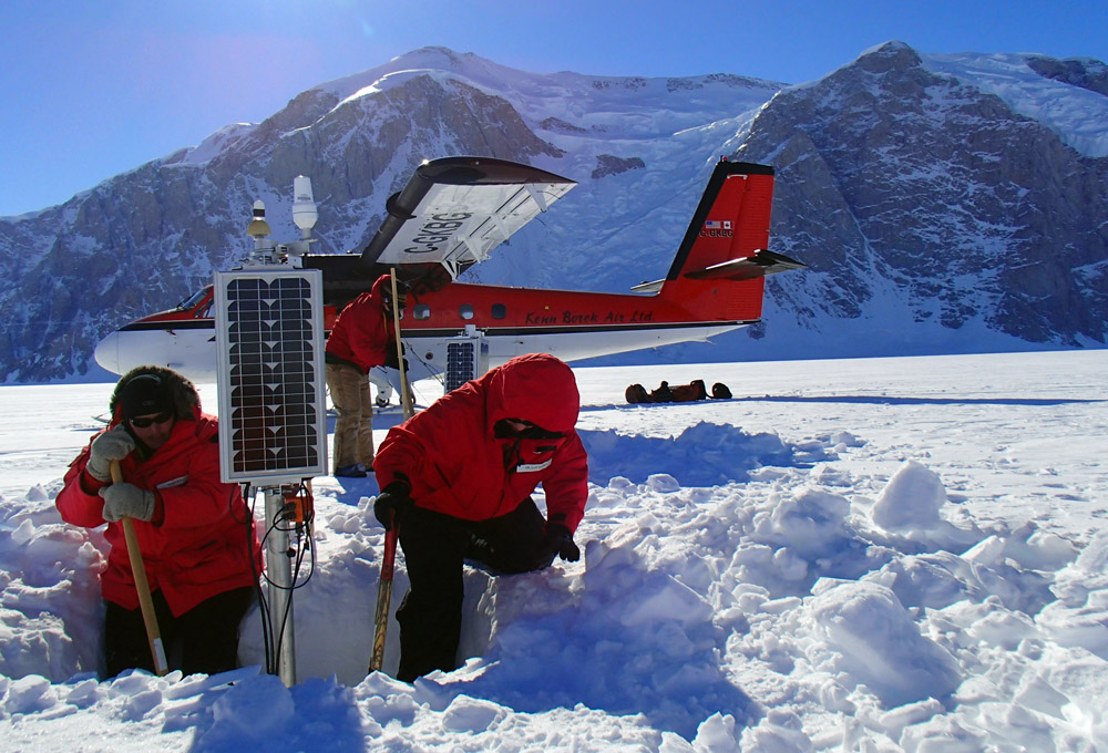
Hansen’s Transantarctic Mountains Northern Network (TAMNNET) is the latest project to use an array of seismometers to image the rock below the ice. Seismometers measure and record the size and force of underground energy, or seismic, waves from earthquakes. By studying the refracted and reflected seismic waves, the scientists can map the crust and upper mantle. “The idea behind this is to take data from this network – both independently and to couple it with other seismic networks like TAMSEIS and POLENET The TransAntarctic Mountains Seismic Experiment, or TAMSEIS, was a previous project that also sought to understand the structure of the mountain range farther to the south to answer similar questions about the origin of the Transantarctics. Hansen’s project takes that study farther north, with one station sharing the same location as one that TAMSEIS occupied at its northern extremity. “That’s why the network is where it is: We want to expand that coverage and see if you have the same mechanism everywhere,” Hansen said. POLENET is a bi-polar network of both seismic and GPS stations that also collect data on the structure of the Earth below the Antarctic and Greenland ice sheets. However, those continuously operating networks also measure the response of the bedrock as it “rebounds” from the weight of the ice sheets when they were even thicker about 20,000 years ago during a time known as the Last Glacial Maximum. [See previous article — Network building: POLENET project in Antarctica completes GPS/seismic array.] Hansen’s five-year grant includes maintaining TAMNNET for three years. This season was the first year she collected data, flying mainly fixed-wing aircraft to each site to download a total of about 200 gigabytes of data. Some stations required repairs, such as busted solar panels, or some heavy-duty shoveling to unbury equipment. The team finished its work about two weeks early. “We got a lot of good weather in a short period of time, so we lined them up and knocked them off,” Hansen said. “It was kind of a grueling pace this season. We hit it pretty hard.” The farthest site was about two hours away from McMurdo Station by Twin Otter aircraft. One station at more than 3,000 meters elevation required a helicopter to reach. Several sites are outside the mountains in an area of East Antarctica known as the Wilkes Subglacial Basin. It sounds like all that hard work will eventually pay off. “The data looks really nice,” Hansen said. “You can pick out some earthquakes pretty easily through a year’s worth of data. I think we’re going to have some good stuff to work with.” NSF-funded research in this article: Samantha Hansen, University of Alabama, Award No. 1139739 |


For USAP Participants |
For The Public |
For Researchers and EducatorsContact UsU.S. National Science FoundationOffice of Polar Programs Geosciences Directorate 2415 Eisenhower Avenue, Suite W7100 Alexandria, VA 22314 Sign up for the NSF Office of Polar Programs newsletter and events. Feedback Form |


