Transformative technologyCReSIS unmanned aerial systems, radars have big impact on ice sheet researchPosted June 13, 2014
Carl Leuschen “It seemed like an incredible opportunity. It seemed like the right thing to do: Come back and work with CReSIS and do this great stuff,” said, Leuschen, deputy director of CReSIS, for Center for Remote Sensing of Ice Sheets CReSIS has done great stuff over the last decade. Its radar systems have been instrumental in recent research that has shown that glaciers in West Antarctica’s Amundsen Sea Embayment have reached a tipping point. Scientists funded by NSF and NASA reported in May that ice melt in the region is likely unstoppable, with the potential to raise sea level around a meter in the coming centuries. [See previous article — Unstoppable: Two high-profile studies: Collapse of parts of West Antarctic Ice Sheet inevitable.] 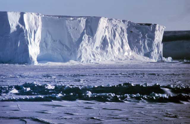
Photo Credit: Michael Van Woert/NOAA
The Ross Ice Shelf where CReSIS engineers and scientists targeted their 2013-14 fieldwork.
During the 2013-14 field season, engineers and scientists with CReSIS turned their attention to Antarctica’s largest ice shelf – the Ross Ice Shelf “The Ross Ice Shelf is probably quite stable. It’s the biggest ice shelf, and when things start to happen, they’re going to happen in a dramatic fashion,” noted Sridhar Anandakrishnan “The main interest is in the grounding lines,” Anandakrishnan said, where the grounded glacier ice lifts away and calves or, as more often happens in Antarctica, turns into an ice shelf. It’s the ice shelf that acts as the proverbial cork in a bottle, keeping the glaciers that flow into the ocean in check. Scientists have found that the major ice shelves in West Antarctica, including Thwaites and Pine Island, are thinning as warm ocean water intrudes on the relatively shallow continental shelf below. “The best way to change the flow speed of a glacier is to attack its ice shelf,” Anandakrishnan said. That “attack” is costing Antarctica up to 159 billion tons of ice per year, according to recent data from the European Space Agency Cryosat “It’s all about the ocean, the ice shelves and [their] effects on the glacier,” Anandakrishnan said. 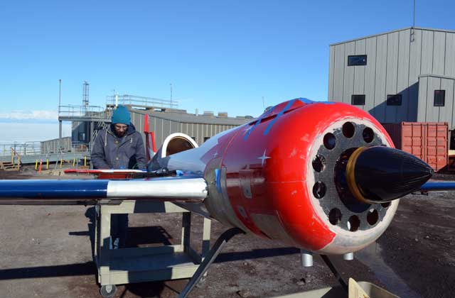
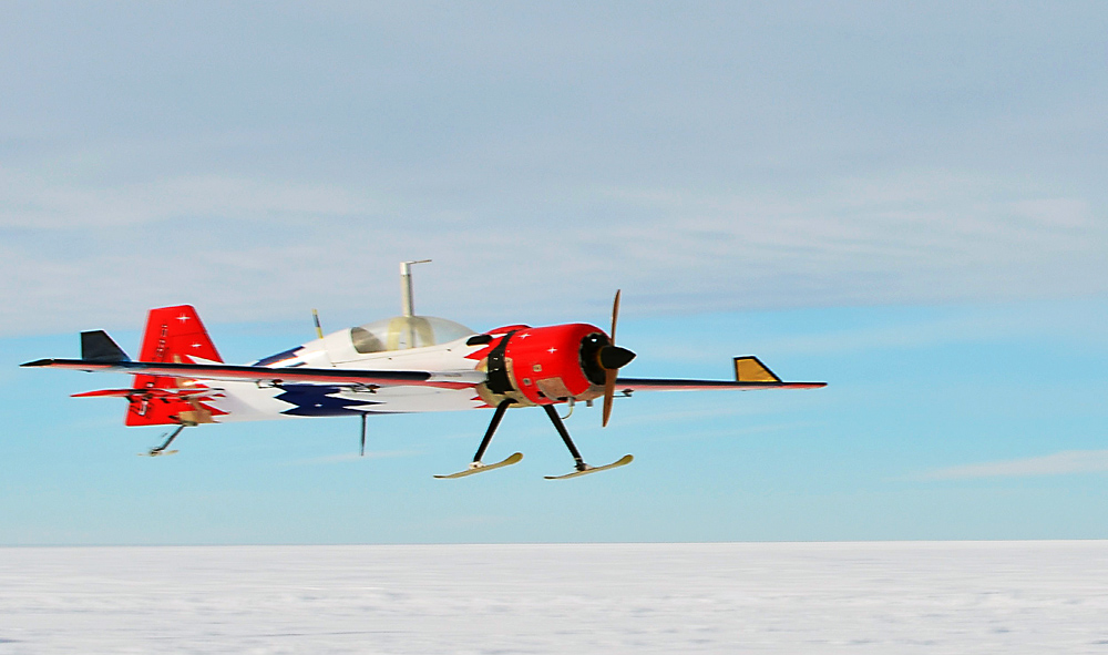
Photo Credit: Peter Rejcek
The G1X is prepared for its field mission at McMurdo Station.
Winging itLeuschen led this past season’s CReSIS field teams, which had three broad goals, including the use of a compact radar system integrated into small unmanned aerial vehicle (UAV). The measurements were the first-ever successful sounding of glacial ice with a UAV-based radar. [See NSF press release “This is the first year we’ve been able to miniaturize and lightweight the radars to the point where they can be placed on the smaller unmanned platforms,” said Richard Hale “We’re not here to test the platform. We’re here to test the integration of the sensor on the platform,” said Hale before he and the rest of the CReSIS team had left McMurdo Station The platform is a modified radio-control aircraft, called the G1X, with a wingspan of about five meters and a weight of about 38 kilograms, which includes the lightweight two-kilogram radar system that was integrated into the airframe itself. “You’re running on such a lightweight margin, that you basically have to build the systems into the aircraft rather than attach the systems to the aircraft,” Hale explained. One of the keys to integrating the instrument into the aircraft was lengthening the wingspan, according to Shawn Keshmiri “We totally redesigned it,” he said of the G1X, which included adding winglets to the wings. “Now the aircraft flies beautifully.” Said Anandakrishnan of the nascent capability of the UAV-based radar system: “That’s going to be transformative.” |

For USAP Participants |
For The Public |
For Researchers and EducatorsContact UsU.S. National Science FoundationOffice of Polar Programs Geosciences Directorate 2415 Eisenhower Avenue, Suite W7100 Alexandria, VA 22314 Sign up for the NSF Office of Polar Programs newsletter and events. Feedback Form |