Scanning the horizonLiDAR survey of McMurdo Dry Valleys to look for melting in the landscapePosted January 30, 2015
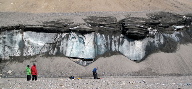
Are the McMurdo Dry Valleys melting? It may seem like a strange question to ask about one of the few regions of Antarctica famous by virtue that it is relatively ice-free. Numerous glaciers do intrude into the valleys like so much spilt milk, but bare rock and dirt are visible across much of its 15,000 square kilometers. Not so obvious – until lately – is the ice buried just below the dark sediment surface. Recent studies have documented the rapid disintegration of dirt-and-ice-mixed cliffs and river banks in valleys where the ice has been buried unperturbed for at least thousands of years. “The things that we are seeing we think are due to increased solar input,” explained Andrew Fountain, a professor at Portland State University and principal investigator (PI) on a project funded by the National Science Foundation (NSF) to use the latest in laser-based mapping techniques, among other tools, to assess the environmental changes already underway. NSF-funded research
Andrew Fountain, Portland State University, Award No. 1246342
Michael Gooseff, Colorado State University, Award No. 1246203 David Van Horn, University of New Mexico, Award No. 1245991 Joe Levy, University of Texas, Award No. 1245749 The Dry Valleys were first explored more than a century ago by the British under Capt. Robert Falcon Scott, whose men assumed the polar desert was lifeless and timeless. Since the 1950s, particularly in the last several decades, the valleys have proven to be more dynamic and diverse than first thought. Its ice-covered lakes, for instance, continue to swell in size from glacial melt. And while no Serengeti, the Dry Valleys are home to various microorganisms that inhabit the soils, lakes and streams. Scientists with the McMurdo Dry Valleys Long Term Ecological Research (LTER) program, also supported by NSF, have been studying the fragile ecosystem for more than 20 years. Fountain has been conducting research on his own and as a co-PI with the LTER since 1993. He said the changes now underway, especially in areas where sediment covers ice, is more dramatic than anything else he’s seen in the Dry Valleys. For example, a stream in southerly Garwood Valley that once meandered through a trench less than a meter below the surface is now about 10 meters deep. The river bank collapsed and exposed ice more than 10,000 years old. “The really big landscape change is going to be the places where ancient ice, from the last ice age, was stable and has melted away,” said Joe Levy, an expert in Antarctic permafrost and a research associate at the University of Texas at Austin’s Institute for Geophysics who is a co-PI on the project. 
Photo Credit: Peter Rejcek
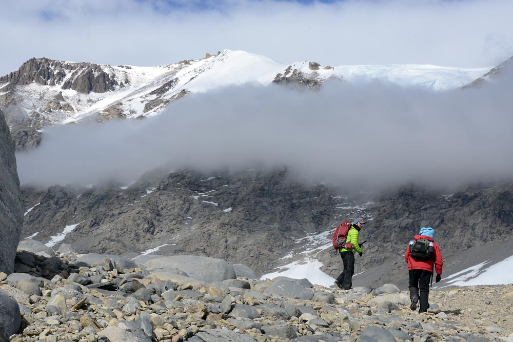
Scientist Joe Levy and field team member Lily Simonson work in Taylor Valley in the McMurdo Dry Valleys.
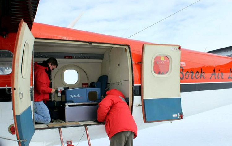
The reason behind the increase in solar radiation remains a mystery. It could be there are less cloudy days. Or perhaps the atmosphere itself is clearer, allowing more radiation to shine on the dark-colored surface, which more readily absorbs solar energy. Average temperatures, based on weather station data, have remained steady – but perhaps a spike in the heat on sunny days is another possibility. “The soil doesn’t care if it’s being heated by the sun or air temperatures,” Levy noted. Fountain said he did not think the increase in solar radiation is necessarily caused by climate change. However, climate models do predict that the Dry Valleys will eventually warm, as the current atmospheric circulation patterns that have helped isolate Antarctica in a blanket of cold air weaken with the healing of the ozone hole. In a sense, the patchy melting of Antarctic permafrost from solar radiation offers a window into the future of how the landscape may react to a warmer world. “It’s a process that would mimic climate warming,” Fountain said. LiDAR data to be compared against NASA survey from 2001The researchers believe significant changes have already occurred. To understand the extent of how the valleys have been reshaped – over at least the last decade-and-a-half – the team is taking to the air. The NSF-supported National Center for Airborne Laser Mapping (NCALM) at the University of Houston flew its most advanced LiDAR to date in a modified turbo-propped Twin Otter over the McMurdo Dry Valleys for about six weeks. LiDAR, for Light Detection And Ranging, emits tens of thousands of short laser pulses per second. The roundtrip travel time of the laser light and knowing the precise position of the aircraft allows researchers to compute three-dimensional locations of points on the ground. The Dry Valleys survey emits 225,000 pulses per second, taking up to 10 measurements per square meter of area along the plane’s flight path – on the ground and valley walls. “There’s a surface, and we’re kind of spray painting it with points, and you join those points,” explained Abhinav Singhania, part of a three-person team from NCALM working out of McMurdo Station, the largest U.S. research facility in Antarctica. “You can get a really high-resolution topographical map.” This is not the first LiDAR airborne campaign in the Dry Valleys. NASA flew a mission through the region in 2001 to calibrate instruments for a satellite designed specifically for cryosphere research called IceSat. Fountain and his team, which also includes Michael Gooseff at Colorado State University and David Van Horn at the University of New Mexico, will compare the NCALM dataset with the NASA map to identify landscape changes across up to 5,000 square kilometers. “We’re going to see a big difference between 2001 and today,” Levy predicted. This is the first time NCALM has worked in the polar regions, according to Singhania. It has flown campaigns over national forests scorched by fire and in support of earthquake research. More recently, archaeologists have employed its airborne LiDAR to study ancient ruins, such as the Mayan site of Caracol in Belize, because the lasers are able to penetrate the thick canopy of trees where such cities once flourished. In the case of Caracol, the LiDAR revealed extensive archaeological remains including roads and agricultural terraces. |


For USAP Participants |
For The Public |
For Researchers and EducatorsContact UsU.S. National Science FoundationOffice of Polar Programs Geosciences Directorate 2415 Eisenhower Avenue, Suite W7100 Alexandria, VA 22314 Sign up for the NSF Office of Polar Programs newsletter and events. Feedback Form |


