Photo Credit: Chad Seay
|
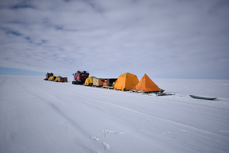
The traverse's two tracked vehicles pull sleds full of their supplies and tents towards the 88-South line of latitude.
|
Circumnavigating the Pole Hole
How Scientists Ground Truth an Ice-Detecting Satellite Before it Flies
By Michael Lucibella, Antarctic Sun Editor
Posted February 14, 2018
In January, researchers went for a more than 750-kilometer drive around the South Pole.
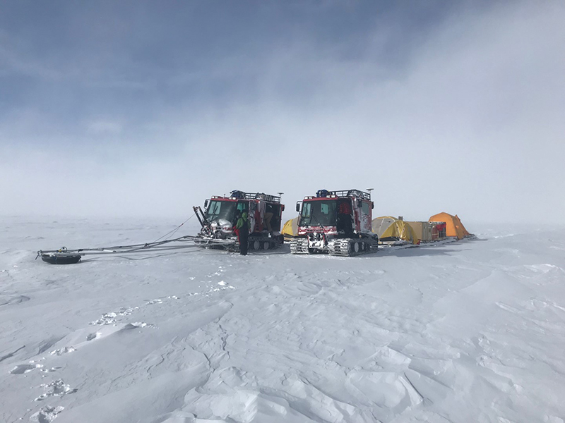
Photo Credit: Kelly Brunt
The team climb into their tracked vehicles in the fog. The ground penetrating radar boom on the left machine is used to look for crevasses in front of them.
The four-person team followed the arc of the 88th parallel for a quarter of its distance ringing the South Pole. Their cargo was a sensitive GPS unit to record the exact elevation of the ice sheet they drove over.
“We’re getting highly precise, highly accurate ground-based GPS data for validating satellite measurements,” said Kelly Brunt, a researcher at the NASA Goddard Space Flight Center through the University of Maryland and principal investigator on the project.
The effort is in support of NASA’s upcoming ICESat-2 satellite, a mission devoted to measuring ice levels around the world, particularly in the polar regions. The National Science Foundation, which manages the U.S. Antarctic Program, is supporting the Antarctic field operations of the project.
In September of 2018 the satellite should enter into a polar orbit and train the six-beam laser altimeter on the planet below. After a 60-day commissioning period, it will start recording data by shining its green lasers onto the Earth’s surface and timing how long it takes for those laser beams to reflect back, giving it a precise altitude.
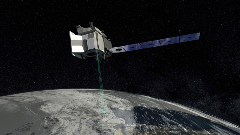
Photo Credit: NASA's Goddard Space Flight Center
ICESat-2 will measure the height of the Earth's ice sheets using six green lasers reflected back from the planet's surface.
“We’re interested in the polar regions ourselves because that’s what we do, but ICESat-2 is running all the time so are data sets associated with the oceans, with vegetation, the whole gamut,” Brunt said. “I’m sure there are folks doing other types of science that I’m not as familiar with that might be interested in the datasets.”
In order to know exactly how accurate that incoming data is, scientists needed to ground-truth the altitude of a stretch the ice sheet that the satellite will measure. They chose a partial ring around 88-degree south parallel because of the satellite’s particular orbital mechanics.
The polar orbit that ICESat-2 will enter won’t perfectly line up over the north and south poles, it’ll be off by about two degrees. That leaves a “pole hole” of about 450 kilometers across. This orbital offset means also that as the Earth orbits on its axis, the satellite will fly over a different part of the planet with each pass. The satellite’s orbit will take it on 1,387 unique orbits before it repeats a path.
All of its orbits start to overlap around 88-degree line of latitude north and south, at the edge of this pole hole. This makes it the ideal ring to get baseline measurements covering as many of the satellite’s orbital paths as possible over a relatively short period of time.
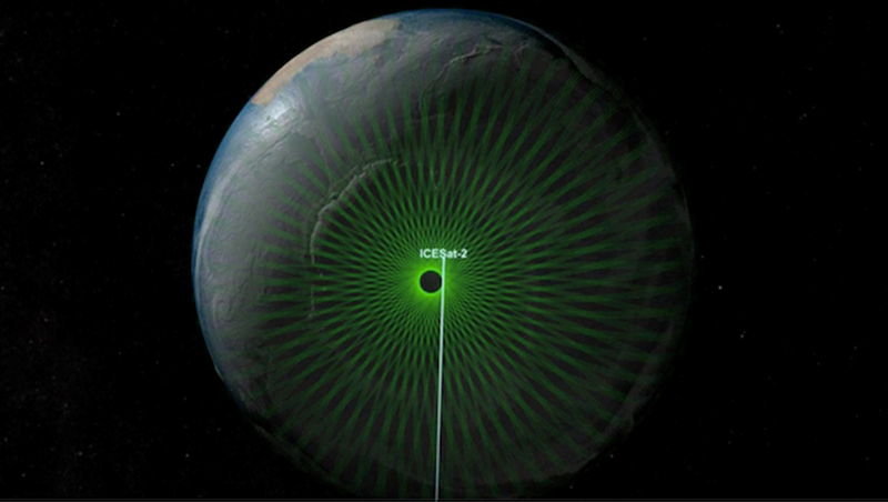
Photo Credit: NASA's Goddard Space Flight Center
ICESAT-2's polar orbit leaves a small hole around the north and south poles. The team's traverse followed the edge of about a quarter of the hole where the orbits converge and start to overlap.
“You just can’t do that easily from anywhere else. We have a lot of other validation efforts that strike one, two, maybe six orbits. This one is going to hit 277.” Brunt said. “Instead of driving say a quarter of the way all around the globe to hit a quarter of the orbits we can drive 350 kilometers to get the same assessments.”
The team drove directly under the satellite’s planned orbits to be sure that the ice altitude data they collected covered exactly the same patch of ice that the satellite will measure in the coming months, constantly checking the accuracy of the satellite’s data.
“We’re going to hit this little arc that we’re surveying every day, sometimes a couple of times a day,” said Tom Neumann, a researcher at the NASA Goddard Spaceflight Center and deputy project scientist for ICESat-2. “Every day we’ll get a look at this so if you’re wondering ‘How’s ICESat-2 doing today?’ you can do that comparison same place every day.”
The traverse took 15 days, and the team had to carry all their supplies with them. They started out driving 220 kilometers due south to the 88th parallel before turning and following the line of longitude for about 350 kilometers.
“All our primary science, which was collecting survey quality GPS data along the traverse, went really smoothly,” Brunt said.
They covered about 70 kilometers a day over about nine hours of driving each day.
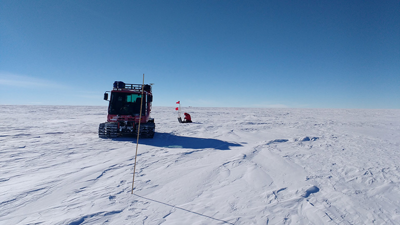
Photo Credit: Tom Neumann
Kelly Brunt installs one set of corner cube retroreflectors along the route that will reflect ICESat-2's laser altimeter back up to the satellite.
At a few points along the way they stopped to set up corner cube reflectors to help test the accuracy of the satellite’s aim. They look like hollow, reflective, diagonally sliced cubes on top of bamboo poles and work similarly to the rear reflectors on a car or bicycle. The incoming lasers bounce off two of its two precisely aligned mirrors and reflect straight back up into space.
“You kind of just put them in, survey them and then we’ll find out in nine months whether they worked if they show up in the data,” Neumann said.
The first ICESat flew from 2003 to 2009 on a slightly different polar orbit measuring the surface ice of the planet using a single green laser.
“It taught us all sorts of cool stuff about how ice sheets change including things like the loss and the thinning around outlet glaciers in Greenland as well as West Antarctica,” Neumann said.
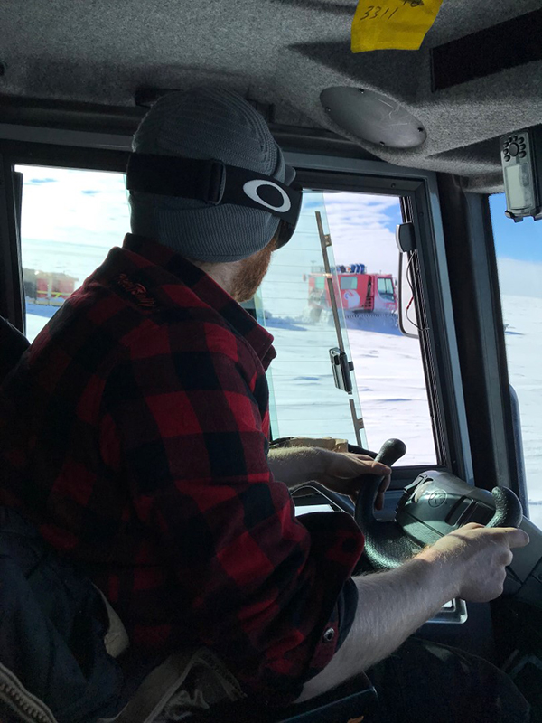
Photo Credit: Kelly Brunt
Vehicle technician Chad Seay pulls up next to the other tracked vehicle while driving along the traverse route.
Monitoring the planet’s ice sheets is hugely important as the Earth’s climate warms. Ice melting off the continent threatens to dump potentially vast amount of water into the oceans, raising sea levels around the world.
“What happens in the polar regions doesn’t stay in the polar regions,” Neumann said. “You lose ice from West Antarctica and it’s not like it only affects west Antarctica. It goes right back into the ocean and is a first order impact on sea level.”
In addition, the first-generation satellite discovered the massive subglacial Lake Whillans which was the focus of the Whillans Ice Stream Subglacial Access Research Drilling (WISSARD) project from 2010 to 2014.
ICESat-2 improves on the previous satellite in a number of ways. The biggest update is that it will have three pairs of lasers scanning Earth’s surface, as opposed to the single beam that the first ICESat had. The whole laser assembly can be aimed as well, so it’s easier to cover the same ground on different orbits and compare data at different times.
“ICESat-2 has pairs of beams so on any given pass we can measure what the slope is, and on a subsequent pass, as long as some part of those beams overlap, you can get an elevation change,” Neumann said.
The laser will also fire more frequently as it orbits to produce a more detailed map of the ice below it.
“ICESat used to pulse once every 170 meters, or once every football field and a half,” Brunt said. “ICESat-2 will shoot a pulse every 70 centimeters or every two and a half footballs.”
NASA’s other ice measuring mission, Operation IceBridge flew over the traverse path as well. The project uses planes equipped with lasers similar to the ones on ICESat-2 to measure the altitude of ice sheets in the years between the two ICESat missions.
“They flew our route a couple of weeks before we actually set out,” Brunt said. “The rates of change there are very small so we don’t expect any different from when they flew and when we drove there.”
Having one path measured by the three different methods provides a baseline to verify and make sure all the datasets correlate with each other.
This was the first of four planned traverses around 88-South.
“The nominal lifetime of ICESat-2 is three years, that’s its required performance period. So this will be its prelaunch dataset that we’re using for commissioning,” Neumann said. “Next year when we come back… it’ll be a month or so after commissioning has ended and then we’ll come every year.”
This project is supported by a joint NSF/NASA agreement.


