SALSA Part I: Scratching the SurfacePart One of a Two-part Series on the SALSA ProjectPosted November 5, 2019
Editor's note: This is the first of two Antarctic Sun articles chronicling the Subglacial Antarctic Lakes Scientific Access project. It looks at how scientists studied the ice and hydrology from above. The next installment will dive into whether microorganisms have survived in waters that haven’t seen the sun or atmosphere for thousands to perhaps hundreds of thousands of years, and what they might tell researchers about the history of the ice sheet. 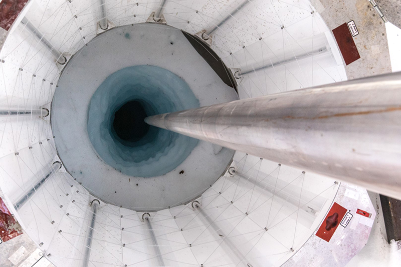
Photo Credit: Billy Collins
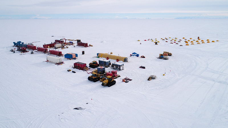
Using a clean, hot water drill, the drillers bored through nearly a mile of solid ice to access subglacial Lake Mercer.
There are hundreds of lakes all over Antarctica, but many, if not most, are deep under the ice, making sampling and studying them without disturbing or contaminating them complex and challenging. A team of researchers and drilling engineers recently spent six weeks in West Antarctica carefully drilling through nearly a mile of ice to study Mercer Subglacial Lake. This body of water is buried under an ice stream, and likely hasn’t seen the light of day for at least thousands and possibly hundreds of thousands, of years. The hope is that by learning about the current environments below the ice, scientists can glean insights into both the past and future history of the massive West Antarctic Ice Sheet, whose fate will play a major role in any future sea-level rise. Using a hot-water drill to cleanly melt through more than 1,000 meters of ice, the Subglacial Antarctic Lakes Scientific Access project, or SALSA, was able to penetrate the 15-meter-deep lake. This access offered researchers unprecedented scientific insights into the biogeochemistry of the lake and overlying ice. 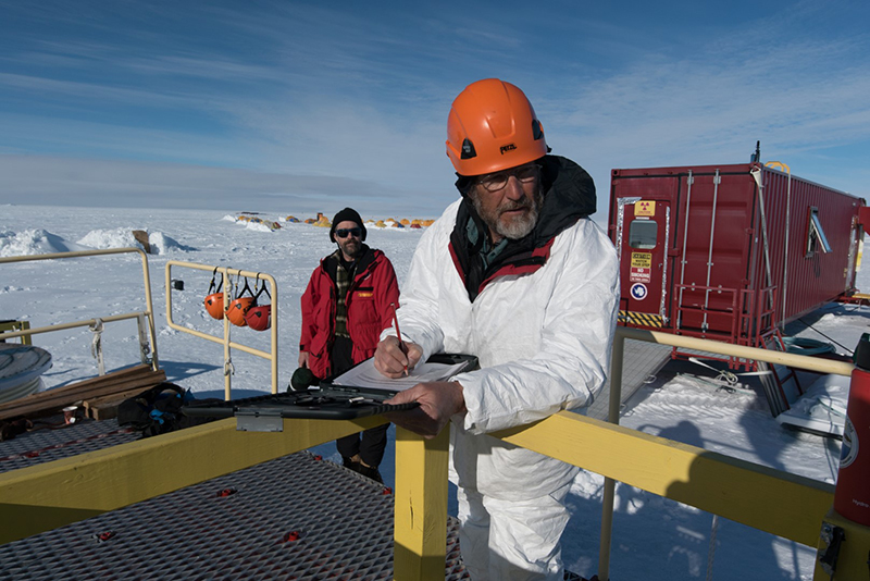
Photo Credit: Billy Collins
Principal investigator, John Priscu, monitors the drilling of the borehole from the deck of the drill.
They took samples of the water and sediments to study the biology of the microscopic organisms that live in the lake, and to study the chemistry, geophysics and ancient history of the lake and the overlying ice sheet, as well as future projections. "The Antarctic continent is the fifth largest on Earth. It influences climate, it influences gasses in the atmosphere, it influences ocean circulation, and there's a big carbon reservoir under here that we know nothing about," said John Priscu, an ecologist at Montana State University and chief scientist of the project. SALSA is supported by the National Science Foundation, which manages the U.S. Antarctic Program. A Lake Under the IceMercer Subglacial Lake covers about 143 square kilometers, an area about twice the size of Manhattan. Unlike other regions around Antarctica, the glaciers along the Siple Coast, where Mercer Subglacial Lake is located, have, so far, been relatively insulated from the most acute effects of climate change and haven't experienced the accelerated melting seen elsewhere. This isolation provides researchers a clear look at how these subglacial systems naturally function. Glaciers are dynamic, with many different factors interacting to speed up, slow down, stop movement altogether or even cause them to break apart. The constant movement of ice erodes away the bedrock they rest on, the flow of water at the interface of ice and rock can lubricate their flow and bring with it new sediment, altering the surface that the glacier flows over. Researchers designed SALSA to look at all of these influences, as well as how they can affect each other, and any microbial life that may live in the lake's waters. "The Siple Coast is a nice place to work because it is so boring on the surface," joked Matthew Siegfried, a geophysicist at the Colorado School of Mines. "It allows us to isolate processes and go to specific places to interrogate those processes. This happens to be a really boring, flat place where we have these subglacial lakes popping off, so we can really see the impact of the subglacial lake on the full system: on the ice, on the ocean, the subglacial geology [and] sediment." 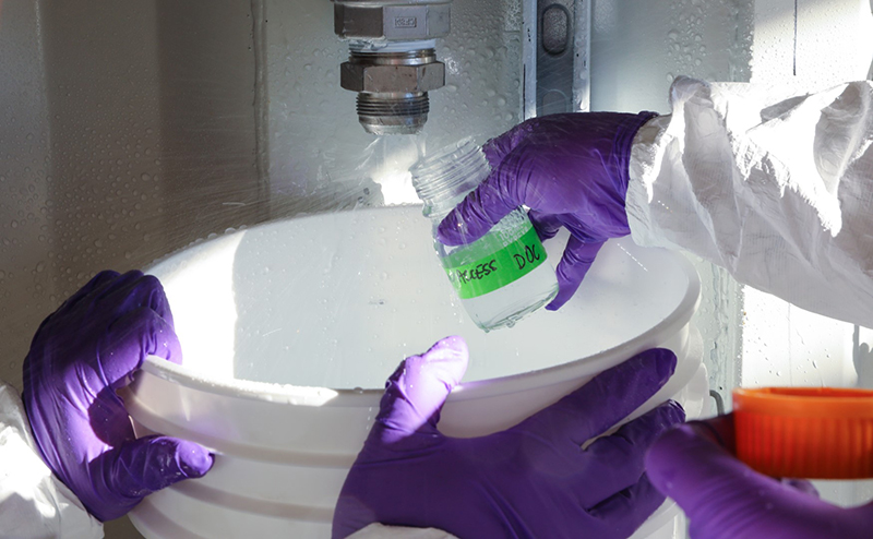
Photo Credit: Brent Christner
While drilling, the researchers took numerous samples to make sure that the hot water they were using was sterile and clean.
Subglacial WetlandsIt might seem counterintuitive for liquid water to exist under more than 1,000 meters of solid ice, but in fact there are more than 400 identified subglacial lakes across the continent. Multiple natural forces interact to keep the water in these spots liquid, but the key is the planet itself, which emits heat from its core. "So there's heat, and we have an overlying blanket. Think of it as a down blanket of ice thousands of meters thick. It insulates [the lake] from the cold air," Priscu said. "Also the weight of the ice here lowers the freezing point to almost minus one [degree Celsius]." All the pressure of the ice on the water not only lowers the water's freezing point but also moves it throughout the region. Water under a glacier doesn't flow downhill with gravity like it does at the surface, but actually is squeezed to areas where the pressure is less, even if it's uphill. "Subglacial water always 'wants' to be under thinner ice because that's less pressure," Siegfried said. "The way you create a subglacial lake like this is you go from thinner ice to thicker ice downstream so the water just ponds under that thinner ice. So that's exactly what we have here." The ice thickness is so much more influential than the pull of gravity that water will flow "uphill" if it's being pushed into a lower-pressure area. Most of the water exists as a thin liquid film moving under the ice, but at certain squeeze points, it collects and forms a relatively deep subglacial lake. It keeps pushing up the ice above it, until it hits a tipping point and its pressure is such that it starts to flow out and further "downstream." "It's wet all over. I really think it's wet throughout the whole continent," Priscu said. "I've called all the Antarctic subglacial biomes our planet's largest wetland." 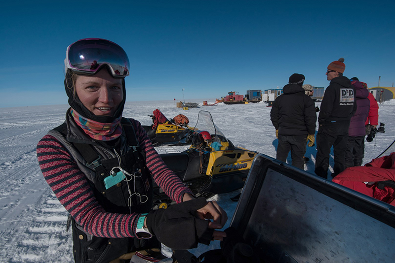
Photo Credit: Kathy Kasic
Chloe Gustafson returns from a survey across the ice sheet where she and her partner Matt Siegfried used electromagnetic readings to map the underside of the ice.
This movement of water is how Mercer Subglacial Lake and all other subglacial lakes were discovered. How these x-ray jets form might seem like a subtle point; however, it ties in with broader questions about the how matter behaves in extreme environments and under extreme circumstances. Pooling and Draining"We've only known about these sorts of lakes for about 12 years now," Siegfried said. "This set of lakes was found entirely by accident." Helen Fricker, a glaciologist at Scripps Institution of Oceanography and co-principal investigator on the SALSA project, discovered the lakes by looking at satellite data from NASA’s ICESat. The satellite used lasers to measure the height of the Antarctic ice and could map the landscape surface below to within a few centimeters. When crunching the data, Fricker and her colleagues found a number of anomalies around Antarctica, spots where the ice seemed to rise and fall over several years. "There're only a few things that can make it go up and down, and [one of them] is water pulsing through the system," Priscu said. Fricker's research team deduced that somewhere below the ice sheet, water was pooling under these spots, pushing up on the ice above it as it collected, then falling back down as the lake drained. This cycle of pooling and draining seemed to happen at relatively regular intervals at the different lakes located along the Siple Coast. Mercer Subglacial Lake seemed to pool and drain about every six years or so. "In the middle of the lake, the amplitude of that filling-draining cycle is about 18 meters," Siegfried said. However, these satellites could only tell researchers so much about the actual makeup of the lake. "From these surface measurements, we can only get change, we can’t get the actual depth of the lake," Siegfried said. "We didn't know how much water is there at [the lake’s lowest level]. For me, that was one of the big questions when we accessed [the lake]." 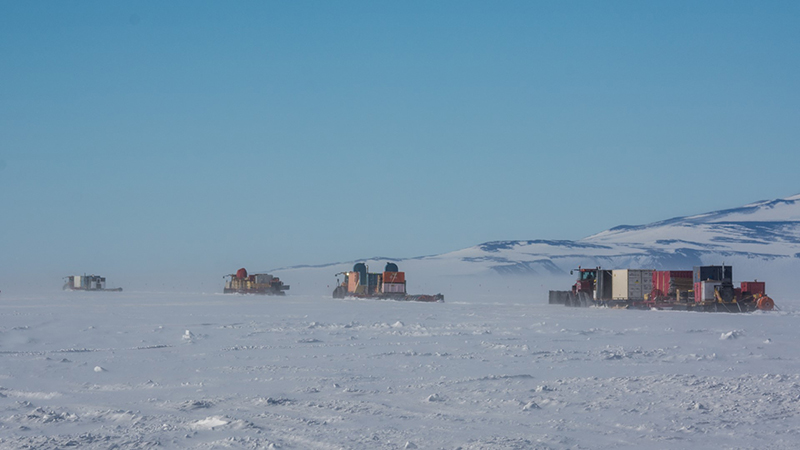
Photo Credit: Mike Lucibella
A fleet of tractors hauling gear and scientific equipment depart McMurdo Station bound for the Lake Mercer site. All together the tractors hauled more than a million pounds of cargo, 650 miles across the frozen West Antarctic Ice Shelf.
The team used equipment and expertise gained from a previous drilling project, WISSARD, which in January 2013 drilled through about 800 meters of ice to get into Whillans Subglacial Lake. "We're using the same drill, the same drilling technology and the same clean access methods," Priscu said. Measuring the IceMercer Subglacial Lake and its surroundings have been carefully studied since they were discovered. Knowing that it was an area worth a closer look because of its apparent changing water levels, researchers first visited the region to study the subglacial hydrology more than a decade ago, while preparing for WISSARD. "We've had GPS out here since 2007. This is where we have just the most on-the-ground information, so it's a good place to start when you’re thinking about subglacial lakes," Siegfried said. The GPS units were precise enough to measure the subtle rise and fall of the ice, confirming the cycle of filling and draining spotted by the ICESat satellite. These data were one of the big reasons that researchers decided that Mercer was the best site to study further. "We have this instrumentation out here and so it made sense to go after these lakes because it's where we know the most about lakes," Siegfried said. "And it helps that its right on the South Pole traverse route." 
Photo Credit: Mike Lucibella
Supplies that weren't hauled across the ice shelf were flown in on ski-equipped LC-130 airplanes.
In order to further understand how the ice sheet behaves, Siegfried left behind an instrument frozen into the now-sealed borehole to measure the changing temperatures over the year. It's a single fiber-optic cable that stretches down the entire length of the borehole. Temperature affects how laser light travels down silica fibers within the cable, and the record of these changes allows scientists to reconstruct a continuous temperature profile from the surface of the ice sheet all the way down the borehole and into and the lake column beneath the glacier. "This to my knowledge is the first subglacial 'observatory,' where we're taking long term measurements of the subglacial environment," Siegfried said. These measurements will let researchers see how the ice sheet reacts to the changing seasons, which could offer insights in the long term about how the ice sheet might react to a changing climate. NSF-funded research in this story: Amy Leventer, Colgate University, Award No. 1543405, Brad Rosenheim, University of South Florida, Award No. 1543347, Brent Christner, University of Florida, Award No. 1543396, W. Berry Lyons, Ohio State University, Award No. 1543453, John Priscu, Montana State University, Award No. 1543537. |
"News about the USAP, the Ice, and the People"


For USAP Participants |
For The Public |
For Researchers and EducatorsContact UsU.S. National Science FoundationOffice of Polar Programs Geosciences Directorate 2415 Eisenhower Avenue, Suite W7100 Alexandria, VA 22314 Sign up for the NSF Office of Polar Programs newsletter and events. Feedback Form |

