Tectonic evolutionGeologists study ancient Antarctic landscape as possible influence on climatePosted April 29, 2011
It seems a time machine would make geology so much easier to do. Then scientists like John Isbell and David Elliot They could then watch firsthand the tectonic processes unfold that scrambled plates of the Earth, shoved one block against another, stretched plains into basins, pushed mountains skyward and dumped sediments into ancient lakes and flood plains of large river systems. 
Photo Credit: Peter Rejcek
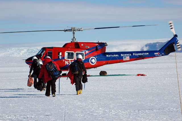
Members of the research team prepare to board a helicopter from the CTAM field camp.
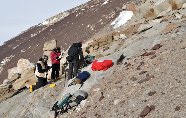
The story of how a region of the central Transantarctic Mountains (CTAM) evolved would be cut and dry. All that’s left would be to write the paper for a journal like Nature or Science. Instead, these researchers and their students spent weeks this past austral summer at a remote field camp, just north of the mighty Beardmore Glacier that slices through the Transantarctic Mountains from East Antarctica into the Ross Ice Shelf From that large field camp, home to more than 70 people at one time, they flew day trips aboard helicopters and camped next to exposed rock outcrops and mountain peaks, hiking countless kilometers to examine the layers of sediments or to collect rocks for later analysis. It's not an easy place to work: A katabatic windstorm tore through the team’s small tent camp at Bunker Cwm, a deep-walled cirque at Clarkson Peak, during an extended field excursion. Yet one would assume that Isbell and Elliot would eschew a time machine any day for another chance to tramp through Antarctica’s backcountry as they continue to refine the story of its geological and glaciological history. “Every time you come down, you learn new things,” said Elliot, who has made 25 visits to the Antarctic, beginning in the 1960s with the British Antarctic Survey He and others in the 1960s and 1970s did much of the original footwork in the Transantarctics, describing the layers of sediments that serve as a dipstick through time. Colleagues like Peter Barrett “Without the initial exploratory work of mapping, nobody would have known about the possibility of there being … all of these amazing organisms,” Elliot said. Such finds were the impetus for the first CTAM camp, often referred to as the Beardmore camp, in 1969-70. The 2010-11 camp was the fifth incarnation. “There’s been a slow evolution over time, from basic mapping and exploration to problem-oriented [studies], which is what we’re doing at the moment,” Elliot added. The particular problem that Isbell and Elliot are trying to understand is how this section of Antarctica evolved from the Devonian period some 400 million years ago through the Triassic, which ended about 200 million years ago. During that time, the Earth went into a deep freeze that lasted from about 350 to 275 million years ago when the climate passed into a greenhouse world that persisted until about 40 million years ago, the beginning of the present ice age. Part of the story that interests Isbell, a veteran of 15 Antarctic field seasons, concerns the tectonic extension under way that pulled apart the earth’s crust, forming great sedimentary basins. This was early Permian, about 290 million years ago, when much of the planet was still in an icehouse climate. 1 2 Next |


For USAP Participants |
For The Public |
For Researchers and EducatorsContact UsU.S. National Science FoundationOffice of Polar Programs Geosciences Directorate 2415 Eisenhower Avenue, Suite W7100 Alexandria, VA 22314 Sign up for the NSF Office of Polar Programs newsletter and events. Feedback Form |


