The Dry Valleys' Briny DeepScientists Map Antarctica’s Salty Subterranean Aquifers from the AirPosted April 22, 2019
Hunting for groundwater has come a long way from divining rods in the days of yore. This past austral summer, scientists in Antarctica used a sophisticated and highly sensitive instrument to look for water in one of the continent’s driest regions. 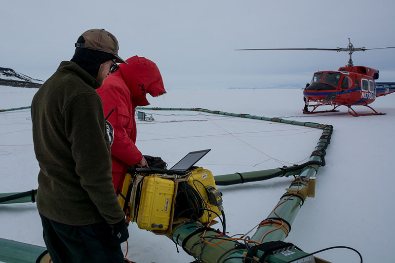
Photo Credit: Mike Lucibella
Denys Grombacher (foreground) and Lars Jensen make final adjustments to SkyTEM before it takeoff.
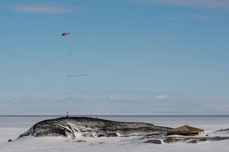
SkyTEM, looks like a 20-meter ring suspended from a helicopter and works like a gigantic flying metal detector. It allowed glaciologist Slawek Tulaczyk, of the University of California, Santa Cruz, and his team to map hundreds of square miles of liquid water buried under the McMurdo Dry Valleys in icy Antarctica. “We’re looking for groundwater, mostly saline ground water, which exists in Antarctica beneath glaciers and permafrost and within the ice shelf itself,” Tulaczyk said. “It’s kind of a new discovery that that exists, especially so close to the surface.” This research, building off an earlier version of the project in 2011, is changing the way scientists think about the lakes in the McMurdo Dry Valleys. “For the longest time, people kind of thought the Dry Valley lakes as isolated bubbles of water,” Tulaczyk said. “Our data shows that in the subsurface there’s a lot of connectivity between the lakes, and also there’s a hydrological connectivity all the way to the coast.” This evolving understanding about the interconnectedness of the Dry Valley’s underground water systems is giving researchers a new understanding into how the microorganisms that depend on the water in the dry valleys function. “It provides a window into what this subsurface world is actually like for the microbes,” said microbiologist Jill Mikucki of the University of Tennessee, Knoxville. Their research is supported by the National Science Foundation, which manages the U.S. Antarctic Program. Underground Reservoirs“Although we think of Antarctica as a place where water is frozen… the parts that have liquid water are of particular interest because the liquid water plays a role in a number of important processes like sustaining whatever little life there is there and also controlling how the ice sheet moves, providing a potential pathway through which nutrients and elements from the Antarctic continent get washed into the surrounding ocean,” Tulaczyk said. That this liquid water exist at all is somewhat of a puzzle. Only salt water, with its lower freezing temperature, can remain a liquid in the sub-zero temperatures of Antarctica. However the glaciers surrounding the Dry Valleys are all originally formed by snowfall and thus are freshwater, so it’s unclear where exactly this saline water is coming from. 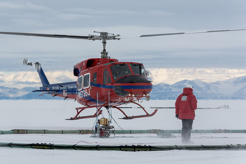
Photo Credit: Mike Lucibella
As the helicopter lifts off carrying SkyTEM, Lars Jensen makes sure the instrument gets off the ground safely.
“There’s a number of ideas that we have on where that saline ground water system originates, or what’s the process by which it’s formed,” Tulaczyk said. “One idea is that it is basically because the sea water is leaking from the ocean into the subsurface and being cryo-concentrated. Another idea is that actually that hypersaline water is being squeezed by the ice sheets from the rocks underneath.” Most of this liquid water is deep below the surface, making it difficult to access and nearly impossible to track as it flows underground. “There’s only two places that we can hypothesize this brine might come to the surface on land where we can walk up and collect it; that is Don Juan Pond and Blood Falls,” Mikucki said. “There appear to be connections with the waxing and waning of the lakes in the dry valleys to the subsurface features that we see, so these brines exist below the lakes.” She has spent much of her career studying Blood Falls and the microorganisms that live in it. The feature gets its name from the bright red, iron-rich briny discharges that sporadically flows from it. Don Juan Pond is a small lake in an adjacent valley, and the saltiest body of water in the world. 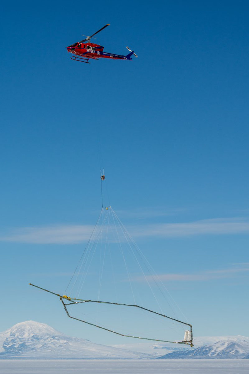
Photo Credit: Mike Lucibella
A Bell 212 helicopter lifts SkyTEM off the sea ice adjacent to McMurdo Station.
Mikucki hopes that by understanding where the water that oozes out of Blood Falls comes from, they can glean insights into what makes the falls flow, the kinds of environments that lay beneath and to what extent microbes living in them might extend throughout the valleys. “The below-ground processes, if they eventually leak to the surface like Blood Falls does, can help drive the ecology of the surface,” Mikucki said. “If we can find a way to get into some of these environments [someday] we can start asking questions ‘Are they the same as blood falls?’ because if they have microorganisms in them that are active that are interacting with the bedrock and liberating nutrients that could impact the surface world.” SkyTEMThe first step to someday accessing these subterranean environments, is knowing where the liquid brine is, and that’s why the team brought in SkyTEM, their giant water detector. “This project is all about liquid water, and we have the perfect tool for hunting down water that’s hiding in the subsurface,” Tulaczyk said. Added Esben Auken, a geoscientist at the University of Aarhus, Denmark, “we’re using some very high-power technology that was really developed for mapping of groundwater resources.” 
Photo Credit: Mike Lucibella
(Left to right) Lars Jensen, Denys Grombacher, Slawek Tulaczyk and Nikolaj Foged monitor the liftoff of SkyTEM from their fish hut near McMurdo Station.
Metal detectors work by inducing an electrical current into a piece of metal, then registering the magnetic field emitted by that current. SkyTEM operates the same way, but on a much larger scale. “One advantage of a technique like the airborne helicopter-based systems is that it’s entirely inductive,” said Denys Grombacher, also a geoscientist at the University of Aarhus. “It doesn’t require any physical link to the ground. We can induce a signal in the air, so you don’t actually have to have feet on the ground.” When the researchers charge up SkyTEM, electricity pulses through its large electromagnetic coil, creating a magnetic field that extends out for hundreds of meters. As SkyTEM flies over the Antarctic landscape, this magnetic field extends down below the surface and induces a very subtle electrical current into everything underneath. The current in SkyTEM then shuts off, while the induced current is still flowing through the landscape below. In that split second the giant coil transforms from an emitter to a receiver and can detect the faint magnetic signatures released by the landscape below. “It’s used both as a sensor to send the primary wave, then it turns off and detects the very weak secondary field that’s induced in the subsurface,” Tulaczyk said. This all takes place thousands of times of times a second. From the strength of the magnetic signatures detected from the below, the researchers can tell whether detector is flying over rock, liquid water, ice or some combination of all three. “This tool is great because it basically can detect down to maybe half a mile depth beneath the surface to see if there is liquid water,” Tulaczyk said. 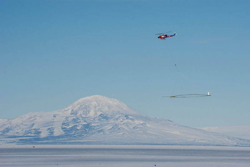
Photo Credit: Mike Lucibella
With SkyTEM in tow, a Bell 212 helicopter flies over the sea ice of McMurdo Sound on a practice run.
Electrical current flows more easily through objects with low resistivity, so they emit stronger magnetic fields. Salt water has low resistivity, so it shows up brightly in their instruments. Fresh water is a somewhat more resistive and shows up dimmer, while rock and dirt are quite resistive and emit weak signals. “It’s almost like this environment has been made for this technique because everything here, other than liquid water, is high resistivity,” Tulaczyk said. “Cold ice without water is high resistivity, rocks are high resistivity and frozen sediments are high resistivity. Only when you start having liquid water [does] that provide the low resistivity signal.” Though the magnetic signatures of the materials in the landscape vary greatly, they’re still relatively weak signals, so the detector has to be powerful to be able to detect them at all. “It’s really sensitive,” Auken said. “If I took a steel bolt and put that underground and I put the sensor over that steel bolt, at 30 meters height, with a velocity of 150 kilometers per hour, I would see it.” From the hundreds of miles flown over the landscape, the team is putting together an extensive map of subsurface water throughout the region. Salting the IceThough the Dry Valleys’ groundwater is the team’s primary focus, it’s not the only thing they were looking for. They flew the detector over the nearby McMurdo Ice shelf to see if they could find evidence of saline ocean water penetrating into the freshwater ice shelf. 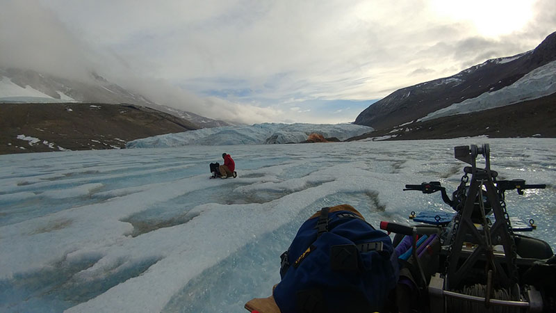
Photo Credit: Jill Mikucki
With Blood Falls in the background, Jill Mikucki takes a sample off the ice of Lake Bonney in the Taylor Valley.
“Up at the front of the ice shelf, the ice shelf gets so thin that what’s in contact with sea water is not just pure ice, but also snow and [compacted snow called] firn,” Tulaczyk said. “Snow and firn are permeable, so that sea water actually invades, [and] infiltrates into the McMurdo ice shelf. There’s a front of brine that has been penetrating deeper and deeper into the ice shelf.” As saline water works its way through the otherwise freshwater ice shelf, it could make the ice more prone to breaking apart. “Saline ice or an ice shelf that has been invaded by saline brine is definitely mechanically weaker,” Tulaczyk said. “So if you turn a fresh water ice shelf into a saline infiltrated ice shelf, it becomes much weaker and then it’s much more susceptible to climate warming.” This is the second time a version of this device has been to Antarctica. Eight years ago, Tulaczyk and his team brought SkyTEM down on a “dry run.”“2011 was a proof of concept,” Auken said. “I think we got much more data than we had expected, but it was a proof of concept.” The data collected during that test season changed the way scientists look at the subterranean hydrology of the Dry Valleys. It was the first to glimpse the extent of the interconnectivity between the bodies of water throughout the region. This year’s effort will greatly expand on those preliminary findings. Right now, the team is still going through their data, stitching together what they found to create a comprehensive map of the subterranean hydrology. NSF-funded research in this story: Slawek Tulaczyk, University of California, Santa Cruz, Award No. 1644187. |

For USAP Participants |
For The Public |
For Researchers and EducatorsContact UsU.S. National Science FoundationOffice of Polar Programs Geosciences Directorate 2415 Eisenhower Avenue, Suite W7100 Alexandria, VA 22314 Sign up for the NSF Office of Polar Programs newsletter and events. Feedback Form |