Finding the sticky spotStagnating glacier offers array of puzzles for glaciologists to solvePosted November 12, 2010
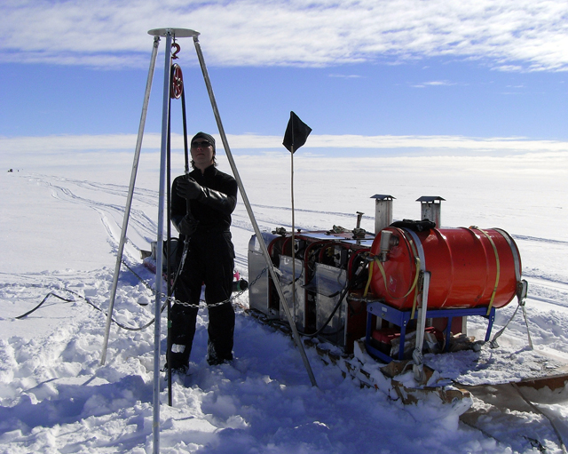
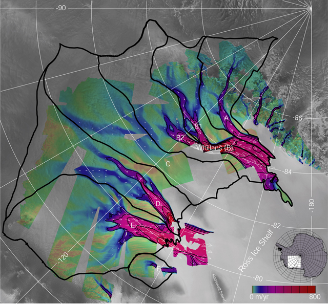
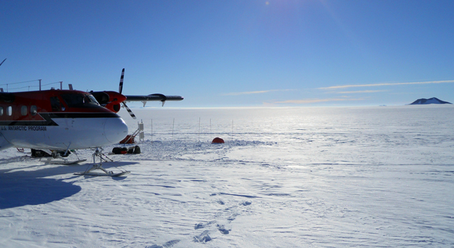
The Whillans Ice Stream in West Antarctica offers a sticky problem for glaciologists seeking to understand how ice moves from the interior of the ice sheet to the ocean. Whillans is one of about a half-dozen rivers of ice that flow along the Siple Coast of West Antarctica into the Ross Ice Shelf For starters, Whillans Ice Stream, which is a region within the ice sheet that moves faster than the surrounding ice, doesn’t flow much like a glacier. Instead of steady movement, the ice stream jerks forward like clockwork twice a day, kicked awake by tidal motion at the grounding line where the ice leaves the bedrock and floats. In 2008, glaciologists reported in the journal Nature that this stick-slip behavior produces a burst of seismic waves with each movement, each half-meter jump forward equivalent to a magnitude-7 earthquake. “The glacier acts more like an earthquake fault, like the San Andreas fault,” noted Sridhar Anandakrishnan Anandakrishnan and his colleagues believe the ice stream’s strange behavior is related to a “sticky” spot on the bed located right in the middle that measures 100 kilometers wide and 150 kilometers long. “The entire [glacier] doesn’t start moving simultaneously. It starts at a point and spreads out across the glacier,” said Paul Winberry And over at least the last half-century, the Whillans Ice Stream has been slowing down, with signs that it might actually stagnate in another 50 years. That sounds like good news for those worried about sea-level rise from the glaciers, though the ice streams are very minor players in that scenario. But if all the Siple Coast ice streams grounded to a halt, the Ross Ice Shelf that they feed into could cease to exist, much like damming a river that empties into a lake. No ice shelf means the Siple Coast ice streams, and glaciers from East Antarctica pouring down from the mountains, would speed their charge into the ocean. The neighboring Kamb Ice Stream stopped flowing about 200 years ago and is still in stasis. “We might be observing the same thing now that happened 200 years ago,” Winberry noted. Is the Whillans Ice Stream headed for a similar fate? What is this sticky spot, and is it the cause of the ice stream’s stagnation? These and other questions will send Winberry and small team of scientists to Antarctic this summer for the first of two field seasons to collect data that will help them answer some of those puzzles. At the top of the priority list is to translate decades-worth of seismograms — graphs of squiggly lines that recorded motion from the ice stream by seismographs hundreds of kilometers away — into how ice moves. “This will allow us to go back in time and understand the evolution and behavior of this glacier over time, so we can understand this long-term change that it is undergoing,” Winberry explained. To help with that job the team will install an array of seismometers and GPS units on the glacier this year. The GPS instruments on the ice stream will record its movements down to the millimeter. The seismometers on the ice stream will provide higher resolution data than in the past. The combined information should offer a sort of Rosetta stone for interpreting the historic data that dates back to the 1950s, Winberry said. The GPS network will also help the glaciologists pinpoint the sticky spot, believed to be about 10 kilometers in diameter. In 2011-12, the team will return to the glacier to determine why this feature of the bed offers so much resistance. That will require active seismics — detonating a small charge at the surface, which bounces off the boundary between the ice and bed, back to the surface where instruments record the signal. “The strength of that return will tell you what the material is because some materials will absorb more energy and certain materials will reflect more energy,” Winberry explained. For example, granite bounces more energy back. Based on the signal, the scientists can figure out details like whether the ice is sitting on dry or wet dirt. One hypothesis surrounding the sticky spot is that the topography of the ice below may have choked off the subglacial water upon which part of the glacier slides as a single block of ice. Water exists below the ice stream because the thick ice traps geothermal heat, meaning it’s relatively warm at the bottom of the glacier. Ice is less dense than water, so the topography of the belly of the glacier will dictate where the water goes. “Under the glacier water can flow uphill in the sense that it can flow up bedrock topography,” Winberry said. The role of this subglacial hydrology becomes even more complicated with the discovery of lakes underneath the ice stream. A separate team led by Penn State will use radar and active seismic techniques to map the largest lake and determine its depth as part of a large research program called WISSARD Understanding the basic physics between ice, water and bedrock on an ice stream like Whillans will assist the scientists in predicting how glaciers might behave in the future. “These little rivers of ice are constantly turning on and turning off,” Winberry said. “They’re not these static features of the ice sheet; they’re quite dynamic at the hundred-year timescale.”
NSF-funded research referenced in this story: Sridhar Anandakrishnan and Richard Alley, Pennsylvania State University, Award No. 0944286
|


For USAP Participants |
For The Public |
For Researchers and EducatorsContact UsU.S. National Science FoundationOffice of Polar Programs Geosciences Directorate 2415 Eisenhower Avenue, Suite W7100 Alexandria, VA 22314 Sign up for the NSF Office of Polar Programs newsletter and events. Feedback Form |


