Open waterBreak-up of sea ice in McMurdo Sound welcomes wildlife, nears airfield roadPosted February 28, 2011
If you walk down to where the volcanic dirt of Ross Island meets the sea at the foot of McMurdo Station The sea ice More Information
McMurdo Station Web cam
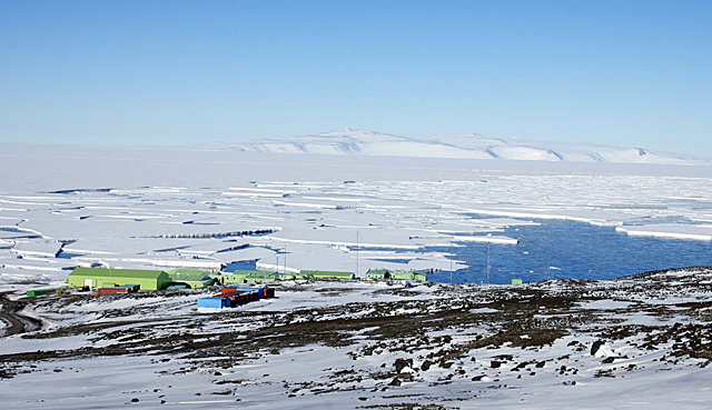
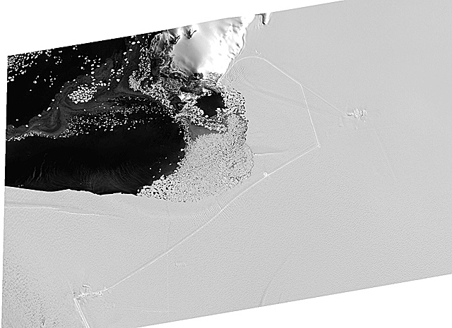
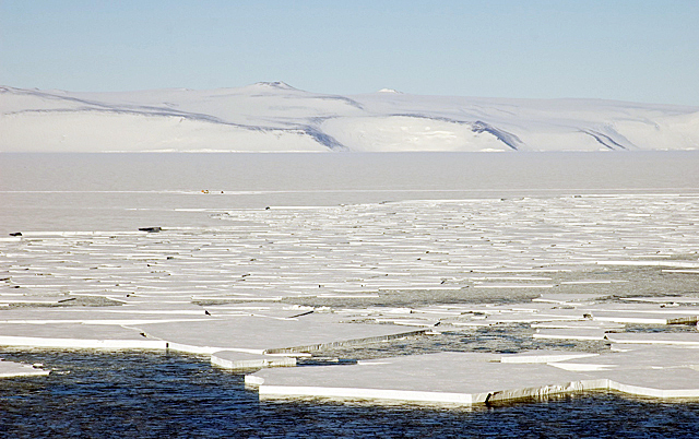
More pictures in the USAP Photo Library: Scott Base with tabular ice Scott Base with ice edge The channel that was opened by the Swedish icebreaker Oden In January, one had to walk up above McMurdo to see the small chunks of ice slowly but persistently breaking and blowing away out by the Erebus Ice Tongue and Tent Island. Broken ice became more visible from station proper as the Oden continually drove laps along the channel, breaking an even wider path, while the fuel tanker and annual resupply vessel made their port calls. All the while, more and more of the sea ice broke apart with the assistance of some strong southerly winds and occasional swells from the north. Before we knew it, the opening of water was extending past McMurdo and out around Cape Armitage, the southern most point of Ross Island. As the sea ice has blown away, the wildlife has returned. Emperor penguins have abounded this month, walking freely all along the snow road to Pegasus airfield Meanwhile, Adélie penguins played on the ice floes beneath Observation Hill, and Weddell seals sprawled in front of New Zealand’s Scott Base That’s right: Last week, in the calm after a rather fierce storm, designated with our most extreme rating of Condition 1, the winter-over crew of Scott Base stayed up late one night to watch tabular chunks of the ice in front of their station break away and quietly float out to the north. Scott Base station manager Troy Beaumont said they haven’t seen open water there since 1998. While this has been an exciting development here on Ross Island, it hasn’t necessarily been an altogether convenient one. In the course of just a few days, the extent of the ice breakup reached to within about a thousand feet of the Halfway Fuel Pumphouse on the road to the airfield, with several flights still to go before the end of the summer field season. On Feb. 24, members of the Fuels department (called “fuelies”) were heading out to the Halfway House to finish breaking down and winterizing the work area. They had just completed “pigging” the 13 miles of fuel lines, a process that involves sending a foam bullet called a “pig” under high pressure to purge the lines of their nearly 100,000 gallons of diesel fuel. After the storm, upon seeing breaking ice approach so close to their six large winter storage tanks at Halfway House, the fuelies had to scramble into high gear to transfer fuel from those tanks onto tank sleds and bring all of the fuel back to the airfield at Pegasus. Many fuelies and support personnel worked through the entire night to transfer all of the fuel safely, while a group of emperor penguins sat on a small snow mound nearby and enjoyed the show. And the cracks just continued to form. Heavy equipment operators from the Fleet Operations department, working on the Pegasus Road, said they could hear cracking noises under the ice along the road near places where cracks were starting to form. A new two-lane snow road of at least seven extra miles is being proposed to allow for safe passage to and from the airfield. If the plan is approved, it will take the nearly the entire winter for the Fleet Operations crew to complete this task. Despite the deterioration of the ice near the road, more than 200 people made it safely to the airfield, where they left for Christchurch on two U.S. Air Force flights on Feb. 27 and 28 (local time). Most traveled onward to Auckland aboard special flights operated by the Royal New Zealand Air Force, as rescue efforts continued in New Zealand’s earthquake-stricken city, which serves as the gateway for the U.S. Antarctic Program. [See New Zealand Earthquake: Updates and Impact on the USAP 
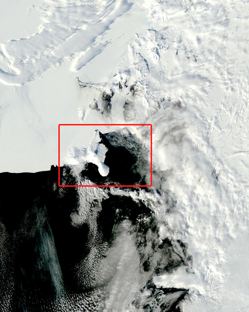
Photo Credit: NASA Terra Satellite
Area in red square denotes location of Ross Island and McMurdo Sound region.
With every single day now, satellite imagery of the Ross Island vicinity shows massive changes to the sea ice all the way across McMurdo Sound to the coast on the far western shore. Are we about to see a break up of the ice where it meets the shore near Scott Base? Station personnel are preparing for that possibility, with one last flight still scheduled for March 5 before winter operations begin. If the ice does separate, the only way to and from McMurdo from the airfield will become the recreational trail called Castle Rock Loop. Typically a route used for recreating skiers and hikers, Castle Rock Loop is a snow road that follows the spine of the Hut Point Peninsula and descends down to the sea ice at the base of a long hill beneath a prominent volcanic feature called Castle Rock. Despite the challenges of the ice breakup, everyone agrees that this is still a fascinating time to be down here. The sights, sounds, and wildlife that correspond to this dynamic time are just too exciting right now to dampen any spirits. Special thanks to fuelies Lisa Keller and Molly Kissner, and Fleet Ops operators John Harter, and Dustin Van Housen for terrific firsthand accounts.
|


For USAP Participants |
For The Public |
For Researchers and EducatorsContact UsU.S. National Science FoundationOffice of Polar Programs Geosciences Directorate 2415 Eisenhower Avenue, Suite W7100 Alexandria, VA 22314 Sign up for the NSF Office of Polar Programs newsletter and events. Feedback Form |


