IPY LegaciesScientific campaign brings new insights to East Antarctica, broadens international collaborationPosted April 3, 2009
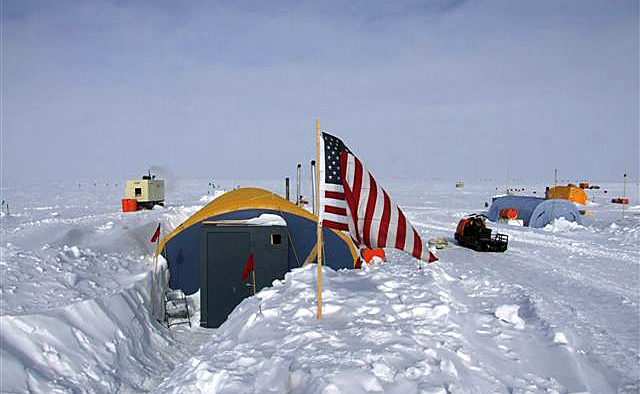
The International Polar Year (IPY) IPY scientists accomplished a dizzying amount of work in the Antarctic and Arctic — from mapping rugged mountain ranges buried hundreds of meters below the ice cap to making underwater observations below an ice shelf. They crisscrossed Antarctica on ski-equipped airplanes and on tracked vehicles. Ice-strengthened ships carried them to little-visited corners of the Southern Ocean, discovering new species in the frigid waters. The effort involved more than 60 countries and 10,000 scientists, including many funded by the National Science Foundation (NSF) “The glimpses I’ve had of the data sets from this season and last year are astounding. I’m very pleased with our investments in IPY,” said Antarctic Sciences Division Launched in March 2007, the IPY actually spanned a two-year period to encompass seasonal research in both polar regions. Several of the larger Antarctic projects will continue for several more years. One such project is ICECAP, for Investigating the Cryospheric Evolution of the Central Antarctic Plate ICECAP researchers used a converted World War II-era DC-3 aircraft, outfitted with a suite of geophysical instruments, to fly over a region of East Antarctica to measure the thickness of the ice sheet and the texture, composition, density and topography of the bedrock below the ice. The scientists — representing the United States, the U.K. and Australia — believe two subglacial basins that sit well below sea level, but hidden by the ice, could help speed the flow of ice into the ocean, raising sea level. Funding for the project came from NSF, the U.K. Natural Environment Research Council “This is a real IPY project, where everybody is chipping a lot in,” noted Don Blankenship, a research scientist at the Jackson School’s Institute for Geophysics Another IPY project, Antarctica’s Gamburtsev Province (AGAP) The sharp peaks showing in the raw data suggest the East Antarctic Ice Sheet formed quickly, because the slow grind of glacial movement didn’t wear down the mountains into a plateau. “People will be digesting those data and interpreting them for quite a while,” Borg said. “We can look forward, in the next year or two, to a lot of papers describing the data, and more importantly, inferring things about the subglacial continent and the ice sheet. “The AGAP and ICECAP projects are going to give us some very fundamental information about the continental surface beneath the ice cap. … Those are data sets that will be mined for decades into the future,” he added. The aerial surveys by both projects should also help scientists locate the continent’s oldest ice, estimated to be more than 1 million years old. The oldest ice core recovered to date is about 800,000 years old, coming from the European Program for Ice Coring in Antarctica (EPICA) One-million-year-old ice isn’t just a big number. It represents a time when the duration of glacial cycles more than doubled. Some time before 1 million years, ice ages waxed and waned on a 41,000-year cycle. Now, it’s a 100,000-year cycle. Understanding what flipped the switch is important for climate change researchers trying to model the pull-and-tug between temperature and greenhouse gases. “That’s why people are interested in getting a hold of this old ice,” Borg said. “The radar data sets will define areas where there is likelihood [of old ice].” |


For USAP Participants |
For The Public |
For Researchers and EducatorsContact UsU.S. National Science FoundationOffice of Polar Programs Geosciences Directorate 2415 Eisenhower Avenue, Suite W7100 Alexandria, VA 22314 Sign up for the NSF Office of Polar Programs newsletter and events. Feedback Form |


