IceBridge Flies HighNASA’s Operation IceBridge Returns to McMurdo StationPosted June 26, 2018
In late 2017, a specially modified airplane contracted by NASA crisscrossed Antarctica, mapping the ice below and filling in a data gap left by a now-defunct NASA satellite called ICESat, which measured the elevation of the ice surface using a laser. Operation IceBridge flights are bridging the gap between ICESat and its successor, ICESat-2. 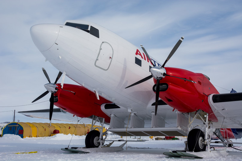
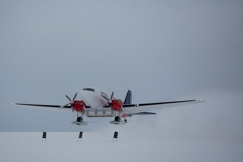
Photo Credit: Mike Lucibella
NASA’s Basler airplane, a DC-3 converted for use in below freezing-temperatures, sits on the runway of McMurdo’s Williams Airfield before taking off.
This past Antarctic research season was the first time in four years that the team flew missions from NSF’s McMurdo Station, and the first time ever from both Amundsen-Scott South Pole Station and Shackleton Glacier Camp. NASA supports the IceBridge flight operations. The National Science Foundation (NSF), which manages the U.S. Antarctic Program supports the Antarctic field operations of the project. “Antarctica is changing. The ice sheet is currently losing mass overall,” said Joseph MacGregor the deputy project scientist for Operation IceBridge at NASA’s Goddard Space Flight Center in suburban Maryland. “We want to understand not just how much mass it’s losing, but why it’s losing that mass.” In 2009, NASA’s ICESat ceased operations and shut down. Its polar orbit, which flew it within a few degrees of the north and south poles, allowed it to measure ice loss throughout the Arctic and the Antarctic. Its successor, ICESat-2, is scheduled to launch later this year with an upgraded laser system. 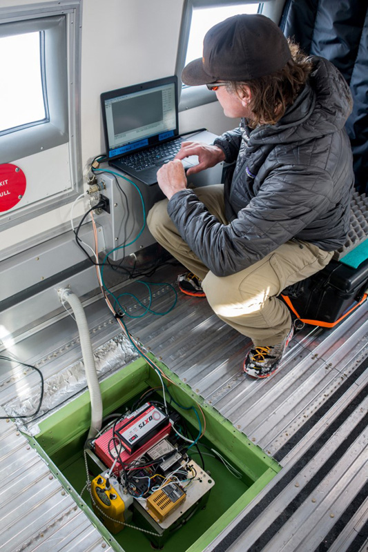
Photo Credit: Mike Lucibella
Christopher Larsen, of the University of Alaska, Fairbanks, installs the laser altimeter into the Basler. It shoots a green laser pulse down at the ice through a hole cut into the plane.
During the interim, NASA’s Operation IceBridge, has been flying several different airplanes over select areas of the polar regions to keep tabs on some of the most important and sensitive ice on the planet. “The main goal of IceBridge is to survey – as comprehensively as possible – both the Arctic and the Antarctic, each year, so we can know how the elevation of the ice sheets are changing each year, and also how the thickness of sea ice in the Arctic and the Antarctic oceans is changing each year,” MacGregor said. Using a freshly converted Basler airplane, equipped with a laser altimeter akin to what will fly on ICESat-2 and an ice-penetrating radar, the IceBridge team flew a total of sixteen flights out of McMurdo Station, South Pole and Shackleton Glacier. Despite an occasional weather delay, the team members said they had a tremendously successful season, accomplishing all of their high-priority flights early on and collecting data on a number of new areas as well. “We’ve flown all the way around South Pole at 88 degrees south latitude, and we’ve flown up and down the Transantarctic Mountains and across the East Antarctic plateau,” MacGregor said. 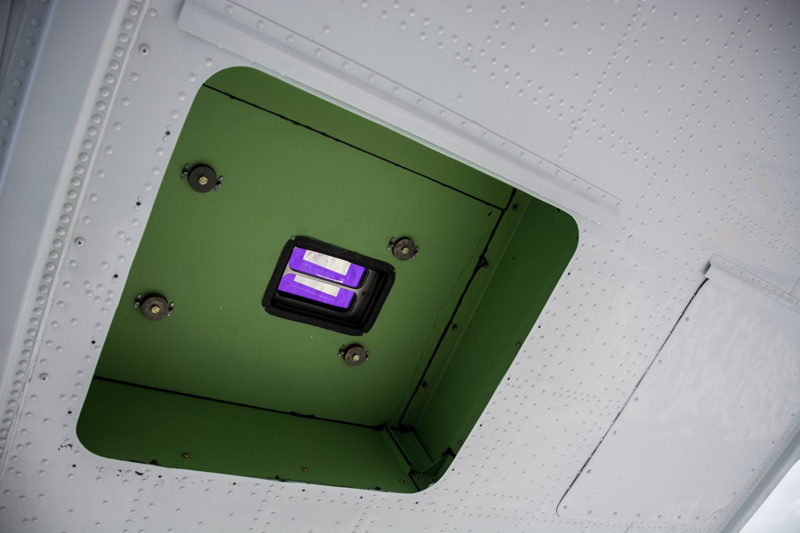
Photo Credit: Mike Lucibella
Underneath the plane, the installed laser altimeter peeks out through a specially-cut hole in the plane.
As the planet continues to warm, scientists want to gauge how much ice mass glaciers and ice sheets are losing as it has major implications all over the world. “When that ice melts, it goes into the ocean and that ocean may not be right next to where you live, but it’s right next to where a lot of other people live. So, if sea levels rise, that means that storm surges will just have a higher place to start from, and that can potentially displace a lot of people,” MacGregor said. “What happens at the poles doesn’t stay at the poles.” IceBridge’s primary tool to track these changes is a laser altimeter. It pulses a laser beam thousands of times a second then calculates height of the ice to an accuracy of about 5 centimeters based on how long it takes the signal to bounce back. Once ICESat-2 is operational, it will fire a set of six similar laser beams down to the planet’s surface from orbit. Though central to the effort, the altimeter is not the only instrument onboard the IceBridge planes. “When you have a plane flying over the polar regions, it takes a lot of time, money and effort to make that happen. So, when you get that plane there, you tend to want to have as many instruments on board as possible,” MacGregor said. “You want a very good laser altimeter, but you usually have room for other things as well.” 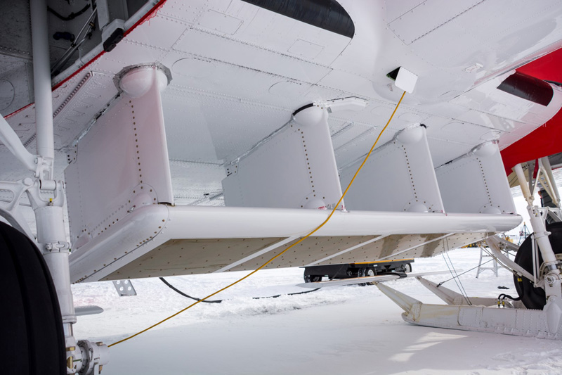
Photo Credit: Mike Lucibella
Between the front landing gear, the team also installed an ice penetrating radar system to see what’s below the surface.
For the Basler flying out of McMurdo and South Pole, the team slung an ice-penetrating radar system beneath the belly of the airplane and between the two landing skis of their plane. “We’re flying a wide bandwidth ice penetrating radar,” said Carl Leuschen, a professor of remote sensing at the University of Kansas “We can use that to get the fine internal layering [of the ice]. It has a resolution about half of a meter, and it can look through four plus kilometers of ice to map the bedrock.” These data, when paired with satellite images, gives researchers a comprehensive look at the glaciers below. “The depth sounder will give us a profile of the bottom, the laser will give us the top, and through satellite interferometry, we can measure the velocity of the ice going through them, so we get a cross-section plus a velocity,” Leuschen said. Most of IceBridge’s past Antarctic missions flew a jet-engine DC-8 out of Punta Arenas at the southern tip of Chile. Its range is such that it can easily stay aloft for 12 hours, cross the Drake Passage, between South America and Antarctica, and fly multiple lines along the peninsula side of the continent before returning to South America – without ever touching down on the continent. This year was a little different. Instead of flying from Chile with the DC-8, IceBridge operated NASA’s P-3 Orion turboprop out of Ushuaia, Argentina. The shorter range of that aircraft meant that it couldn’t reach some key targets like the South Pole. IceBridge operated a plane out of McMurdo Station to access those more remote areas. To take full advantage of the season, it required a different plane—the Basler--with more versatility than the others they had been using. 
Photo Credit: Mike Lucibella
Joseph MacGregor from NASA’s Goddard Space Flight Center, prepares to fly a mission into the Transantarctic Mountains.
Effectively an upgraded DC-3 propeller plane that can also fly in Antarctic conditions, Baslers are significantly smaller than the DC-8. However, they can also land on skis rather than wheels, which opens access to many more remote areas the continent. Wheeled airplanes like NASA’s DC-8 and the P-3 could only land on McMurdo Station’s frozen runways at the very beginning and end of the research season. Around the peak of the austral summer, the compacted-snow airfields soften and can’t support the wheeled aircraft. Ski-equipped planes can fly in and out of Williams Airfield, near McMurdo Station, all season and can land at the South Pole and Shackleton Glacier as well. This was the second time the IceBridge team operated out of McMurdo Station and the first time out of South Pole. The team had been down in 2013 but after only a handful of flights, had to cut their research season short because of a shutdown of the federal government between Oct. 1 and October 17 MacGregor said that they were “mostly attempting to refly the half-dozen flights we were able to get in 2013 with the P-3 and some new targets that have increased in scientific interest since then.” 
Photo Credit: Mike Lucibella
NASA’s IceBridge plane, operated by the company AirTec, takes off from Williams Airfield.
These flights included lines around the South Pole, through various parts of the Transantarctic Mountains, the Ross Ice Shelf and Victoria Land. “Our most important missions were the flights around 88 degrees south,” MacGregor said. “Once ICESat-2 launches, all of its orbits will graze 88-degrees south, so they won’t go all the way through the pole, but they all effectively intersect around that circle. If you want a reference point in an area over ice, where there’s not much snowfall and the area itself isn’t changing much, 88-degrees south is a great reference point.” IceBridge wasn’t the only NASA project this season to travel along the 88-south parallel. Another NASA team, led by researchers Kelly Brunt and Tom Neumann both at NASA Goddard Space Flight Center, spent two weeks driving along the track in two tracked vehicles, collecting precise GPS data of the ice height. NASA will use their GPS data and the altimeter data collected by IceBridge to precisely calibrate ICESat-2’s laser altimeter once it’s in orbit. “Their ground campaign really speaks to the overall importance of our combined efforts,” MacGregor said. “This is the reference that will be essential for ensuring the fidelity of ICESat-2.” In addition to glaciers and ice sheets, the laser altimeter and the radar system can elucidate what’s going on within ice shelves, thick plates of floating ice caused when glaciers flow into the ocean. “The ice shelves are really the canaries in the coal mine of what’s going to happen in the future with glaciers,” MacGregor said. Vast ice shelves act as a buttress for glaciers, slowing their progress into the ocean. As these shelves thin and weaken, they could collapse, allowing glaciers to flow faster into the ocean, and increasing the rate of sea level rise. “The bottom of the ice shelf gives us a really strong reflection, so we’re able to map bottom,” Leuschen said. “In some instances, we’ve shown how this system can also measure bottom melt.” Though the data collected is primarily to track the rate of ice sheet loss, many scientists have found a wide range of uses for the data. They’re used by scientists all over the world,” MacGregor said. “Within six months of collection, they’re submitted to the National Snow and Ice Data Center in Boulder, Colorado, the NSIDC. Then various processing levels of those data are archived and then they’re shared with the world and are freely available.” |

For USAP Participants |
For The Public |
For Researchers and EducatorsContact UsU.S. National Science FoundationOffice of Polar Programs Geosciences Directorate 2415 Eisenhower Avenue, Suite W7100 Alexandria, VA 22314 Sign up for the NSF Office of Polar Programs newsletter and events. Feedback Form |