|
Around the Continent—Calling on the Vessels
Tag along with the researchers and ship crews who ply the Southern Ocean in search of scientific discovery. Reports by Peter Rejcek. RVIB Nathaniel B. Palmer More Information on Vessel Science and Operations |
|
Posted November 9, 2012
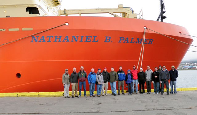
The research vessel Nathaniel B. Palmer Scientists and other personnel working on the NASA IceBridge IceBridge is a six-year campaign by NASA to survey the icescapes of both Antarctica and Greenland. It began in 2009 after the ICESat satellite |
|
Posted November 9, 2012
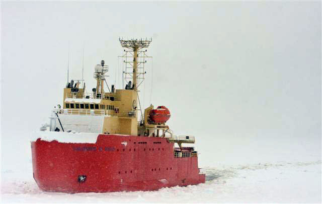
Winds, weather and ice — lots of ice — made the month of October a challenging one for the latest research cruise by the Laurence M. Gould It was an ambitious schedule to start for theU.S. Antarctic Program’s The next stop was Palmer Station 
Photo Credit: Stacie Murray/Antarctic Photo Library
Thick pack ice greets the GOULD as it approaches Palmer Station.
The ship also carried a half-dozen scientists participating in the LARISSA (LARsen Ice Shelf System, Antarctica) project The crossing of the famously rough Drake Passage between the tip of South America and the Antarctic Peninsula was uneventful. But that was just the proverbial lull before the storm. Winds in excess of 40 knots met the vessel as it reached King George Island, temporarily delaying the deployment of small Zodiac boats to transfer people and cargo to the Copacabana field camp, until they subsided later in the day. Continued strong winds slowed the ship, forcing the scientists to scuttle plans to install a new GPS station in the region for the LARISSA project. Instead, they satisfied themselves with a survey of the seafloor for an operation to collect sediment cores later in the cruise. The Gould finally headed to Palmer Station on Oct. 16, only to be greeted by an unusually thick band of pack ice that delayed the ship’s ability to enter Hero Inlet by about eight hours. Leaving the area proved even harder the next day, as the ship only made it about three miles from the station over 11 hours before turning back to the safety of Arthur Harbor. “Sea ice conditions in and around the Danco Coast, Gerlache [Strait] and Bismark Strait are reminiscent of the 1980s, with fast ice clinging to the fjords and embayments all the way north to Hughes Bay. This condition is not the pattern we have seen in the last decade or so,” wrote Eugene Domack Pack ice has proven to be especially troublesome for the LARISSA project. In 2010, a large science team aboard the research vessel Nathaniel B. Palmer It wouldn’t be until Oct. 21 before the Gould could find enough open leads to leave Palmer Station. Scientists were able to eventually collect several valuable sediment cores from the seafloor in the region, but strong winds and ice conditions generally prevented them from reaching islands to install or repair GPS stations. Even the Drake got into the act in the last couple of days as the Gould returned to Punta Arenas, Chile, when winds kicked up to more than 50 knots per hour and in excess of 60 knots in squalls. Wave heights were in the 10-meter range before the ship reached the safety of the port at the end of the month. |
Home /
Around the Continent /
Vessels Update
"News about the USAP, the Ice, and the People"


For USAP Participants |
For The Public |
For Researchers and EducatorsContact UsU.S. National Science FoundationOffice of Polar Programs Geosciences Directorate 2415 Eisenhower Avenue, Suite W7100 Alexandria, VA 22314 Sign up for the NSF Office of Polar Programs newsletter and events. Feedback Form |


