The core truthLARISSA component to drill into ice sheet may reveal past abrupt climate changesPosted September 18, 2009
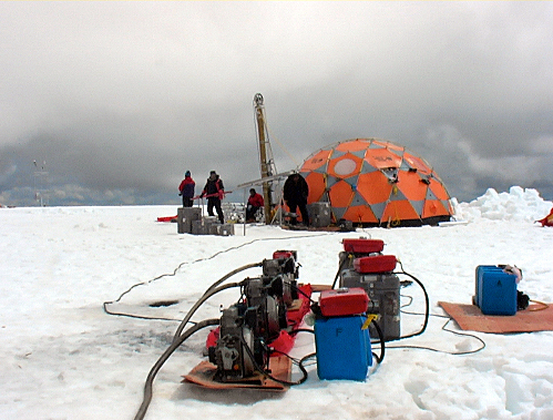
It turns out you can’t just drill an ice core in any old place in Antarctica. You have to plan the logistics — how do you get there and how do you support an operation for weeks at a time? You have to flesh out the science goals — do you want detailed annual layers of climate history or a record hundreds of thousands of years old? And then you rely on decades of ice-coring experience around the globe — and a little bit of luck. The Thompsons from Byrd Polar Research Center (BPRC) Yet Ellen Mosley-Thompson “If we get the core to bedrock, I’ll be thrilled,” said Mosley-Thompson during a phone interview from her office at BPRC, while colleague and husband Lonnie Thompson “Weather dominates,” Mosley-Thompson said of ice-coring expeditions. “It doesn’t matter how well you plan, probably the plan will change. It always does, but you have to have a starting point.” The starting point for the LARISSA ice core — which will provide insight to the climate history of the Antarctic Peninsula region and provide context for the Larsen B Ice Shelf breakup in 2002 — is 66.04 degrees south and 64.003 degrees west. Dubbed Site Beta, that’s the point on the 2,000-meter-high Bruce Plateau where the scientists believe they’ll have the best success of finding an ice core with distinct and thick annual layers. It will actually be up to glaciologist Ted Scambos “They’re going to pick the exact spot,” Mosley-Thompson said. The ideal site should have thick, annual layers of ice, which provide a detailed year-to-year record of climate, recorded by dust particles, chemical compounds such as sulfate and nitrate, and the isotopic ratios of oxygen and hydrogen. The properties of the ice can discern dry, cold conditions or warm, wet conditions in the past. The abundance of dust, sulfate and isotopes change over the course of the year, and can be used to help date the core. Gases trapped in bubbles in the ice can also be measured and provide a history of the atmosphere’s past gaseous composition. Smooth bedrock is also important, Mosley-Thompson explained, otherwise the ice core record becomes convoluted. “That’s going to keep the layers pretty horizontal. Flat bedrock is critical. “It was a challenge,” she added. “We spent a lot of time looking at different locations, looking at all of the different radar profiles, looking back at shallow cores that had been drilled in the region.” While the high snow accumulation rate on the ice ridge — possibly more than a meter per year — is good for that “high-resolution” detail, it could mean the record left in the ice is somewhat brief, according to Scambos. “That’s part of the problem. It’s warm; it’s very high snow accumulation, so the ice near the bottom flows away more rapidly,” said Scambos, lead scientist at the National Snow and Ice Data Center (NSIDC) |


For USAP Participants |
For The Public |
For Researchers and EducatorsContact UsU.S. National Science FoundationOffice of Polar Programs Geosciences Directorate 2415 Eisenhower Avenue, Suite W7100 Alexandria, VA 22314 Sign up for the NSF Office of Polar Programs newsletter and events. Feedback Form |


