Page 2/2 - Posted April 29, 2011
Minerals in rocks help pinpoint timeline of landscape evolutionMonstrous glaciers poured over Antarctica and extended into the other southern continents of Gondwana, including Africa, Australia, South America and India. The ice would have affected sea level and climate, according to Isbell. But the story isn’t as simple as a giant ice sheet blanketing all of Antarctica, not based on studies of the ancient glacial deposits and the fossil floras that emerged in the Permian, indicating forests thrived. Isbell believes tectonic forces related to the formation of the basins played a big role in glaciation, probably leaving some areas ice-free. “I think probably today is more glaciated than then, at least for Antarctica,” he said. “[Antarctica] was more tectonically active than previously thought. That tectonism probably played a role in the formation of those glaciers.” 
Photo Courtesy: John Isbell
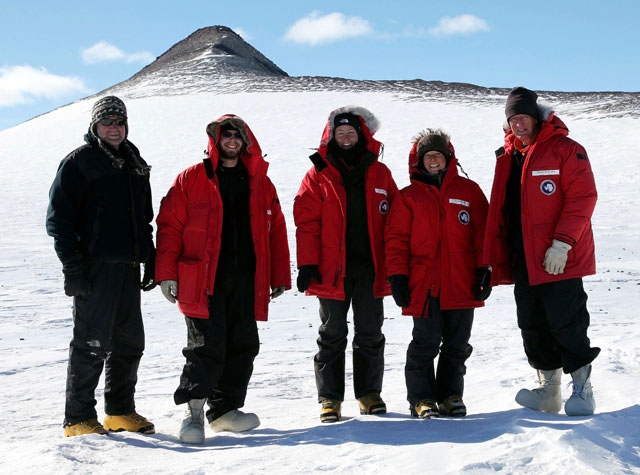
Members of the team, from left: John Isbell, Sam Hulett, Danielle Sieger, Zelenda Koch, and David Elliot at Mount Bowers.
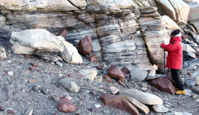
And the basin tectonics continued to influence the climate into the Triassic, which marked a change in climate from warm and wet to warmer and drier. But even that conventional interpretation is being fine-tuned. “I think we’re all finding that it wasn’t as arid as people thought, and that the observed changes were likely due to basin forming,” Isbell said. Elliot, Isbell and their team of graduate students are partly able to fine-tune the picture of tectonic evolution by examining the strata of the rocks — the sediments that eventually poured into the basin — to try to identify the environments in which they formed. That information provides clues about the physical conditions of the time, such as dry versus wet. In addition, structures in the rock can indicate from what direction the sediments were transported by rivers responsible for their deposition in the basin, which helps to track the material back to the source terrains. “[It] comes back to the basins, changing depositional environments and what they tell you about changing physical conditions on the surface of the Earth,” Isbell said. The researchers can also learn something from the rocks back in the lab. Elliot, collaborating with Mark Fanning at the Australian National University Zircon contains trace amounts of uranium that can be used to determine the age of the mineral due to its radioactive decay over time. The mineral is particularly attractive for these types of measurements because it is highly resistant to erosion and chemical weathering. 
Photo Credit: David Elliot
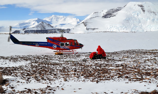
A helicopter picks up team members near Tillite Glacier. Mount Elizabeth is in the background.
Other isotopic measurements using zircon can help match the Antarctic terrain to other landmasses that once abutted the continent. For example, working on time scales even deeper back in time, other researchers have been able to connect Antarctica with North America. “Since we’re dealing with ice-covered areas, we’re starting to fill in information about what might be present underneath the ice sheet, which we otherwise can’t get to,” Elliot said. But not just any old rock sitting above the glaciers and ice sheet will do. That’s where Isbell’s work on the sediments comes in. It’s a symbiotic collaboration, Elliot explained. “It requires careful examination of the rocks to pick the right rock unit from which you extract a sample,” he said. “I can’t do my research without [Isbell’s] expertise in sedimentology. He can’t get at details of the source terrains, without my component of this project.” NSF-funded research in this article: David Elliot, Ohio State University, Award No. 0944662 |


For USAP Participants |
For The Public |
For Researchers and EducatorsContact UsU.S. National Science FoundationOffice of Polar Programs Geosciences Directorate 2415 Eisenhower Avenue, Suite W7100 Alexandria, VA 22314 Sign up for the NSF Office of Polar Programs newsletter and events. Feedback Form |


