Page 3/3 - September 18, 2009
Getting to the core of climateNot all of the action will happen on the ship. Ellen Mosley-Thompson and Lonnie Thompson How far back in time will they travel? It’s difficult to determine, Mosley-Thompson said, but the hope is the core will reach into the Last Glacial Maximum (LGM), about 20,000 years ago when Earth’s major ice sheets advanced to their most recent extent. “If [the glacial ice is] not there and we’ve drilled to bedrock, that’s going to be a real conundrum,” Mosley-Thompson said. The absence of LGM ice would mean one of two things, she explained. One explanation would be that ice didn’t cover the northern tip of the Antarctic Peninsula during the LGM, which seems unlikely. The other option is that a previously warm period during the Holocene — the last 12,000 years of stable climate in which human civilization has emerged — melted it away. That would present an interesting paradox if the ice had indeed melted yet the Larsen B Ice Shelf had survived. “If there’s glacial stage ice that means our core to bedrock will contain more than 10,000 years,” Mosley-Thompson said. However, she said it’s still possible — in fact, quite likely — that the subsequent studies of the ice core will reveal previous periods in the Holocene that were as warm as the 20th century. Again, the head-scratcher would be why the Larsen B persevered during those times but collapsed in 2002. It’s a problem the Thompsons have encountered before, such as with Mount Kilimanjaro, where an ice core drilled there revealed that the mountain’s largest ice field has remained intact throughout the Holocene, including a 300-year-long drought event about 4,200 years ago. “Why are they not surviving today? What’s different?” Mosley-Thompson mused. Since 1912, about 85 percent of Mount Kilimanjaro’s ice cover has disappeared. “Our projections are within two decades [Mount Kilimanjaro’s ice fields] will all be gone,” she said. Between a rock and a hard placeMeanwhile, while the Thompsons and their six-member team labor on an ice ridge, Greg Balco 
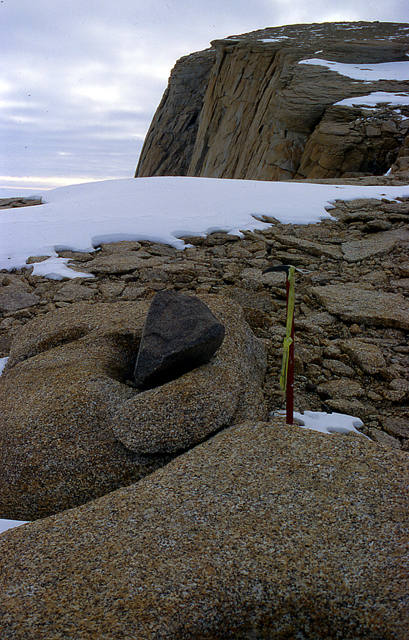
Photo Credit: Greg Balco
Glacial "debris" left from the retreat of a glacier will help date the movement of ice in West Antarctica.
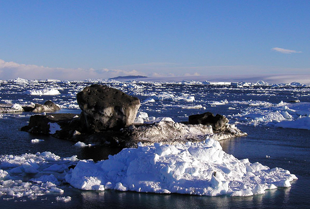
A postdoc at the Berkeley Geochronology Center In particular, Balco is interested in collecting glacial debris — rocks left behind when glaciers retreated since the LGM — and dating how long they’ve been exposed at the surface of the nunataks. “We find exposure ages of glacial debris near the top of these things are older than it is at the bottom,” he explained. “That’s because the ice sheet surface has been gradually lowering and exposing consecutively more and more rock.” In essence, Balco will be able to say how quickly the ice in this region retreated and when, which will complement other climate history records taken in other parts of Antarctica using similar dating methods. “We’ll look for these glacial deposits over as great an elevation range as we can, which is equivalent to a time range,” Balco said. “We’re basically going to do what we’ve done in a lot of other places in Antarctica before.” There are some differences, however. “One challenge of the Antarctic Peninsula is it’s really rugged,” Balco said, adding that the heavily crevassed glaciers require air support from the ship. He hopes to find suitable samples at several sites, but that may require visiting 10 or more areas to ensure success. “That’s the big challenge with this kind of a project. We haven’t been to these sites; we don’t know what’s there.” They’ll soon find out. NSF-funded research in this story: Eugene Domack, Hamilton College, Award No. 0732467 |


For USAP Participants |
For The Public |
For Researchers and EducatorsContact UsU.S. National Science FoundationOffice of Polar Programs Geosciences Directorate 2415 Eisenhower Avenue, Suite W7100 Alexandria, VA 22314 Sign up for the NSF Office of Polar Programs newsletter and events. Feedback Form |


