Page 2/2 - Posted January 9, 2015
Waving goodbye to the Ross Ice Shelf?The team led by Bromirski includes co-PIs Peter Gerstoft, also at Scripps, and Ralph Stephen from Woods Hole Oceanographic Institution. Their seismometer array consists of 16 stations mainly aligned perpendicular to the front of the ice shelf along an area where previous research has shown the ice flows fastest toward the sea. “The objective of our array is to measure the spatial variability of the RIS response characteristics to ocean wave-induced vibrations away from the shelf front, which can be used to estimate physical strength properties,” Bromirski explained. Three stations are located just a couple of kilometers from the edge of the ice shelf, including one on what’s called Nascent Iceberg, where scientist Doug MacAyeal from the University of Chicago and colleagues had installed a seismometer exactly a decade ago in November 2004. 
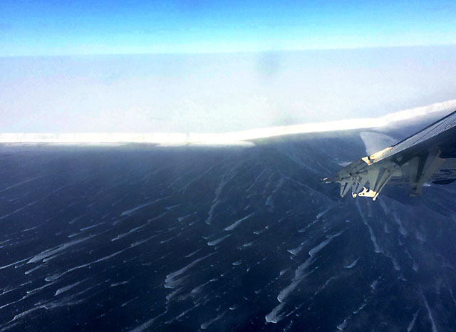
Photo Courtesy: Doug Wiens
Yesterday Camp
“These shelf front stations establish the reference RIS response to be compared with that at more interior stations,” Bromirski said. MacAyeal’s three-year experiment, which included setting up seismic stations on icebergs as well, was designed to detect sources and identify mechanisms for harmonic signals believed to be emanating from the icebergs in the Ross Sea. However, the researchers unexpectedly discovered a variety of ocean-wave gravity signals, including from tsunamis generated by large earthquakes far from Antarctica. Bromirski said that study was partly the impetus for the current project A weakening or collapse of the Ross Ice Shelf would allow those glaciers to flow faster into the ocean, raising global sea level. “Making baseline measurements is critical to identify the rate at which changes in the ice sheet are occurring, especially the subtle changes that can be recorded by seismometers that may escape detection by satellite altimetry or other remote-sensing methods,” Bromirski said. At this point, it is unclear how the ice shelf responds to the effects of ocean swell and what are known as infragravity waves. These waves, transformed in shallow water from swell along coasts, might provide enough force to expand fractures at weak points in the ice shelf. However, preliminary analysis of about two weeks of broadband data collected indicates that signals from very long-period ocean waves originating in the North Pacific that affect the Ross Ice Shelf can be detected 100 kilometers south of the shelf front. “Wave-induced signals with these characteristics have not been observed previously at interior RIS locations, validating important expectations of the ice shelf-ocean interaction in our proposal,” Bromirski said. Mapping the interior of the earthWiens, Aster and co-PI Andy Nyblade from Pennsylvania State University have been using seismic instruments to reveal deep-earth properties beneath the ice-covered continent for years now. However, this is the first opportunity to look deep below the Ross Ice Shelf. “It’s a hole in seismic coverage the size of Texas,” Aster said. “That data will provide a unique perspective on the interior structure of the Earth and to some extent underneath the structure of Erebus.” Their principal component of the array mainly consists of 18 seismometers farther from the front of the ice shelf across its width. The instruments provide a way to map the interior of the Earth, not unlike how a CT scan images the inside of an object using X-rays. The experiment relies on natural seismic activity like earthquakes to produce the sort of data that scientists can use to develop a better picture of the mantle structures in the region. That includes the plumbing system that feeds into Erebus, a 3,794-meter-tall volcano that dominates Ross Island, which is attached to the Ross Ice Shelf. “How deep does the anomaly that causes Erebus come from?” Wiens said. “We can’t image that with seismographs on only one side of Ross Island. We need the seismographs on the other side to get a sort of CT scan of the Earth beneath this area.” New details are also expected to emerge about the mantle under the West Antarctica Rift System, where the crust has been slowly stretched and thinned over the past 100 million years. But it takes time – and signals from big earthquakes around the world – to build that picture. Tremblers of at least 6.0 magnitude are usually required, according to Aster, and about 100 earthquakes of that energy scale occur every year. “We have to wait for these earthquakes to happen,” he said. “You have to wait for years to get enough signals coming in from enough different angles to figure out where the structures are located.” Seismic studies on the other side of Ross Island and elsewhere have provided many new details about the mantle structures in other areas. Aster describes the mantle as a “rich place,” with many “hot and cold blobs.” “It’s a lava lamp basically. It’s convecting at centimeters per year, but it’s behaving like a lava lamp,” he said. “These are grand structures. These are structures that are hundreds of kilometers across and hundreds of kilometers deep,” he added. “No one has ever seen them before. It’s a golden age of discovery of the geophysical Antarctica because we’re seeing these things for the very first time.” Added Bromirski, “The high quality of the data collected is very encouraging, and indicates that both the Ross Ice Shelf and deep mantle projects will be successful in achieving their goals. This wouldn’t have been possible without the effort of the combined team from both projects in the deployment, and the extensive logistical support from the staff at McMurdo.” |

For USAP Participants |
For The Public |
For Researchers and EducatorsContact UsU.S. National Science FoundationOffice of Polar Programs Geosciences Directorate 2415 Eisenhower Avenue, Suite W7100 Alexandria, VA 22314 Sign up for the NSF Office of Polar Programs newsletter and events. Feedback Form |