A good pointSouth Pole geographic marker changes with the timesPosted January 1, 2010
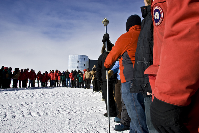
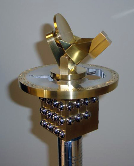
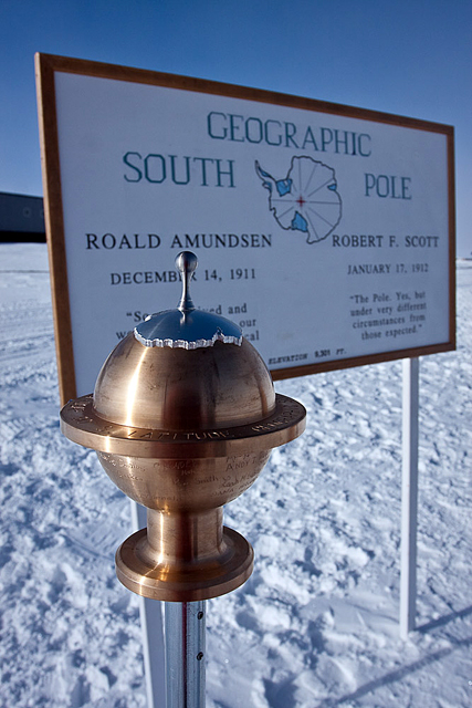
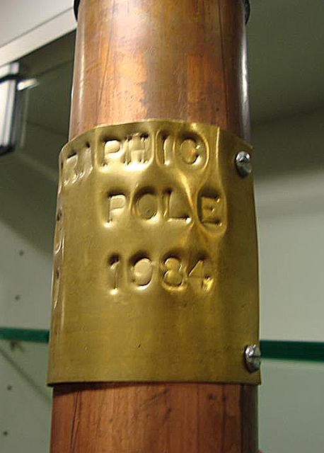
On the first day of January each year, the South Pole moves. Well, that’s not entirely accurate. The geographic South Pole — 90 degrees south latitude — doesn’t really go anywhere. But the place on the ice sheet where a specially designed geographic marker sits on a metal stick pitched in the ground doesn’t stay put after Jan. 1 of each calendar year. That’s because the ice sheet on which the entire South Pole Station At that rate, in about 140,000 years, the current geographic marker and the rest of the research station will slip into the Weddell Sea. Another thing that changes at the South Pole is the geographic marker itself. Each crew that winters over at the station designs and builds a new marker, which the following summer crew places during a ceremony to reposition the marker on Jan. 1. Over the years, the markers have grown in complexity from simple brass discs. For example, for the 2009 marker, winter-over Polie David Postler designed and fabricated a brass marker in the shape of a globe, with the continent of Antarctica raised above the surface. This particular marker doubles as a time capsule, as the top can unscrew, and with enough room for a jump drive containing various electronic files — not to be downloaded until 2058. The new 2010 marker also breaks the mold on the traditional disc shape. Polie machinist Steele Diggles designed and fabricated a bronze and aluminum marker that features the South Pole’s two premiere science experiments — the South Pole Telescope A replica of the telescope sits on top of the neutrino detector, connected through a cut-out of the continent to a cube below, with 43 IceCube detectors raised on the surface to represent all the winter-overs in 2009. It was set in a place during a ceremony on Jan. 1, 2010 (local time) at 90 degrees south. Marking timeThe first geographic marker created for the South Pole was never meant to be placed at 90 degrees south but inside the station back in 1959. In an Associated Press story dated Nov. 6, 1959 — and later reprinted in the December 1959 Polar Times — the government announced it would set up a permanent three-inch bronze marker at its station “next door to the South Pole.” An image of the disc — its whereabouts today unknown — shows the station at latitude 89 degrees, 59 minutes, 43.6 seconds south and longitude 24 degrees, 8 minutes west. That was about 1,650 feet north of the South Pole at the time. The U.S. States Coast and Geodetic Survey — now the National Geodetic Survey under NOAA “Maj. Mogensen made his observations through a slot in the roof of the station hut. At times the temperature was 100 degrees below zero outside the hut and zero inside the hut,” the AP report said. Bill Spindler, a long-time Polie and unofficial historian on everything South Pole While the whereabouts of the original 1959 marker are unknown — though it’s possibly buried in the ice-entombed International Geophysical Year (IGY) Scott Sturiale found a similar geographic marker to the 1959 piece in his grandfather’s collection among survey equipment dating to the 19th century. Edmund Duringer was a machinist for the U.S. States Coast and Geodetic Survey 50 years ago, according to Sturiale. He contacted Spindler about the find, unaware of the historical significance. “I’m assuming he made this. He worked for the government, as a machinist downtown (in D.C.),” Sturiale said. The pieces aren’t identical. Part of the longitude is missing on Sturiale’s copy, and the words “South Pole” appear at the top of his marker. In the one apparently sent to southernmost research station, the words are at the bottom. “It may have been a mistake, or it may have just been practice,” Spindler said of the differences between the two bronze discs in an e-mail to Sturiale. “In any case, it is unique among the extant Pole markers in that it was NOT intended to be placed at the geographic pole, but rather inside the station. Well, otherwise it would have said 90° South!” Other machinists have been known to make multiple markers, perhaps in case they would make a mistake, or perhaps to keep or give away.1 2 Next |


For USAP Participants |
For The Public |
For Researchers and EducatorsContact UsU.S. National Science FoundationOffice of Polar Programs Geosciences Directorate 2415 Eisenhower Avenue, Suite W7100 Alexandria, VA 22314 Sign up for the NSF Office of Polar Programs newsletter and events. Feedback Form |


