Robots in AntarcticaUse of autonomous vehicles grows as technology improves and science needs increasePosted May 15, 2009
Antarctica is more accessible than ever before to scientists studying its climate, ecosystems and glaciological processes. But there are still places too dangerous, too remote or simply too expensive to send people and standard equipment to conduct polar research. Instead, robots are carrying out some of the scientific work today, from diving under ice shelves to flying low over vast ice sheets to mapping the hidden realms below ice-covered lakes and seas. These aren’t necessarily the robots of popular science fiction that accompanied Buck Rogers into space, but instead are unmanned airplanes capable of flying pre-programmed routes or automated submarines that venture far below ice shelves where people can’t go. “We want people to focus on the best science, and we see these things as potentially good tools,” said Antarctic Sciences Division Only 20 years ago, there were relatively few sophisticated instruments, robotic or not, on the continent, according to Borg. To keep an automated weather station operational in the polar winter was a minor miracle. Now there are scores of continuously operating observatories, collecting not only weather data but also information on the flow rates of glaciers and the vertical rebound of bedrock as the ice sheets shed weight while they drain into the ocean. Power systems improved. And real-time communication and data transfer via Iridium satellites meant scientists no longer have to revisit every instrument strewn across a continent as large as the United States and Mexico combined. “The robots that you’ve seen are kind of an extension of that [innovation],” Borg said. “NSF as a whole has been encouraging the development of these technologies.” Pre-fab versus built from scratchSometimes these instruments are simply existing technologies that polar scientists bring to the Ice because they are the best tools for the job. For example, a small, unmanned aerial vehicle (UAV) used for studying hurricanes and other weather phenomena will fly out of McMurdo Station this year for research on the atmospheric conditions surrounding polynyas, areas of open water surrounded by sea ice. [See related story: Pulse on Polynyas.] “We’re using their technology to make measurements in an equally harsh environment in the Antarctic, a place we wouldn’t be able to fly otherwise,” said John Cassano
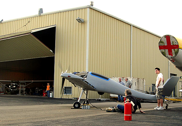
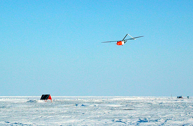
The UAVs fly a pre-programmed route using GPS waypoints, though a pilot can alter the flight plan at any time. The instruments aboard the plane, with a wingspan of about three meters, measures conditions like wind speed and temperature, but the aircraft also carries a camera, a laser altimeter and an infrared thermometer, depending on the mission. Interestingly, the high-tech robot has a very low-tech method for takeoffs and landings. “The AUVs get launched off the top of a pickup truck,” Cassano said. The ground crew sets the plane in a rack on top of the truck, and then drives across a flattened ice runway at about 60 mph to get the Aerosonde MK4.4 into the air. On its return to the airfield, the plane slides to a stop on its belly. “It’s a smooth surface. We don’t have any sastrugi, any drifts of snow,” Cassano noted. “When they touch down on the ground, we’re pretty confident it will be a smooth landing.” On the other end of the spectrum is the Meridian “It’s a complex thing to design an entire aircraft. It would have been ideal if we could have found an aircraft that could satisfy this mission but that wasn’t the case when we started designing this,” said Richard Hale, an associate professor at the University of Kansas, who is leading the team developing the new aircraft. At more than half a ton in weight and with a wingspan of eight meters, the Meridian will be the first heavy fuel engine UAV to fly in Antarctica when Hale and his crew test its capabilities this coming field season. Most UAVs carry about 2 kilograms of equipment, Hale said. The Meridian can lug 60 kilograms with a range of about 1,600 kilometers. “This is a science platform that’s readily adaptable to current state-of-the-art instrumentation needs,” Hale said. |


For USAP Participants |
For The Public |
For Researchers and EducatorsContact UsU.S. National Science FoundationOffice of Polar Programs Geosciences Directorate 2415 Eisenhower Avenue, Suite W7100 Alexandria, VA 22314 Sign up for the NSF Office of Polar Programs newsletter and events. Feedback Form |


