Ocean profilerArctic instrument to be adapted, slimmed down for PIGPosted July 10, 2009
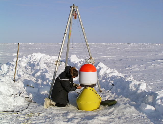
The instruments the scientists will use to study the interaction between the ocean and the ice shelf that slows the flow of Pine Island Glacier into the Amundsen Sea are based on technologies that the Ocean Turbulence Laboratory at the Naval Postgraduate School Tim Stanton, who leads the team, explained he wanted to develop a more compact, affordable instrument package after a successful, yearlong $20 million ice camp project in the Arctic about 10 years ago convinced him of the need to develop unmanned turbulence observation systems that could be widely deployed for multi-year periods in polar regions. More on PIG
“As a result of that experiment, I realized that we had to develop cheaper, autonomous systems that didn’t require that magnitude of field effort if we were really to understand the Arctic system in this way,” he said. The result was the autonomous ocean flux buoy “We’ve been able to demonstrate that we can make this relatively sophisticated measurement robustly and remotely,” Stanton said. “Now we can look at the influence of the ocean as it interacts with the ice, and it’s that balance that really determines the ice cover that we are seeing changing up in the Arctic regions.” In the Antarctic, Stanton’s team has developed the small-hole ocean flux profiler This profiler will move vertically along a cable spanning a vast ocean cavity once a day to measure the water column. Its instruments include a high-precision acoustic altimeter on the top of the profiler. It can tell the profiler where to “park” each day, just a few meters below the bottom of the ice shelf, so the scientists can measure ice melt rates. They believe winds are drawing warm, deep ocean water near the surface, which becomes part of the Antarctic Circumpolar Current (ACC) that chugs around the continent and hugs the seafloor particularly close to the coast of West Antarctica. That warm water apparently does serious melt damage where the base of the glacier comes afloat, called the grounding line. The researchers also know that some of that water, now mixed with fresh glacial melt, works its way up the underbelly of the ice shelf. But how warm is it? How intense? How fast is it moving? What happens at the glacial boundary between the ice and the ocean when this turbulent exchange of heat and salt occurs? “As that fluid rises, it’s going to entrain more and more warm water in from the circumpolar current under the glacier, to do more melting, which will accelerate and accelerate,” Stanton said. “The turbulence is very important in generating the high melt rates.” Of course, there’s more than one way to punish an ice shelf. David Holland “It’s still to be determined if each region has its own personality,” he said. Robert Bindschadler “The real key is underneath the ice,” said Bindschadler, the project’s And that’s where they’re going. |


For USAP Participants |
For The Public |
For Researchers and EducatorsContact UsU.S. National Science FoundationOffice of Polar Programs Geosciences Directorate 2415 Eisenhower Avenue, Suite W7100 Alexandria, VA 22314 Sign up for the NSF Office of Polar Programs newsletter and events. Feedback Form |


