On the ice edgeANDRILL gathers data to drill through moving ice shelf into ancient seafloor sedimentsPosted July 29, 2011
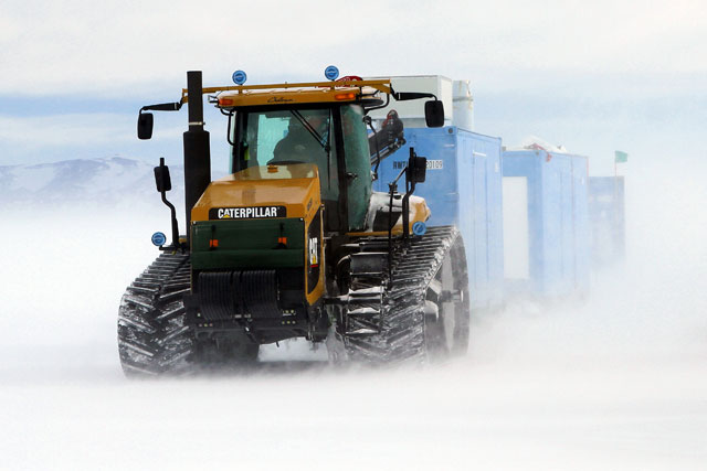
For some scientists, Antarctica’s ice is the main focus of their research. For others, the continent’s vast cover of frozen water is an obstacle to be overcome, an impediment to the secrets buried below. In the case of a team of researchers hoping to recover sediments tens of millions of years old in the Ross Sea region, the Ross Ice Shelf The answer appears to be “yes” based on the results of a three-month operation that required driving tractors and sleds through crevasse fields and melting multiple holes through ice more than 250 meters thick. “It was a good test of the full capability of the ANDRILL hotwater drill system,” said Frank Rack at McMurdo Station 
Photo Credit: Peter Rejcek/Antarctic Photo Library
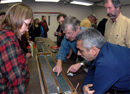
Scientists examine a section of ANDRILL sediment core during the 2006-07 field season.
ANDRILL, for ANtarctic geological DRILLing Sediment cores — composed of things like glacial rocks, sand, volcanic ash, siltstone and mudstone — represent layers of time millions of years in the past. Physical and chemical analyses of the sediment can tell scientists what environmental conditions dominated and how the ice sheets responded at a given interval in the past. For example, glacial rock types represent periods when the ice sheets were large, while the presence of fossil diatoms (planktonic algae) indicates marine conditions when ice sheets had retreated, and the oceans were too warm to freeze. ANDRILL scientists drilled two sediment cores near McMurdo Station in 2006 and 2007, each more than a kilometer long, covering about 20 million years. [See Nov. 26, 2006 issue of The Antarctic Sun 
Photo Credit: Frank Rack, ANDRILL Science Management Office, UNL
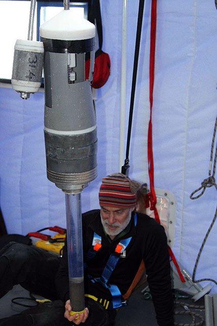
Scientist Richard Levy examines the sediments retrieved by a gravity core instrument sent below the Ross Ice Shelf.
Now the target is much deeper in time, more than 34 million years ago when Antarctica went from the so-called greenhouse world to the current icehouse where it has remained relatively frozen through the millennia. “Now we’re truly trying to step back to the period before Antarctica got glaciated,” said Rack, principal investigator for the site survey project on the Ross Ice Shelf at a location called Coulman High “If we can get back in the Eocene, we can look at what ice-free Antarctica looked like,” added Rack, who serves as executive director of the ANDRILL Science Management Office at the University of Nebraska-Lincoln The problem is that those sediments sit underneath the 250-meter-thick Ross Ice Shelf, which spreads northward toward the ocean at a rate of about 2 meters per day. ANDRILL’s drilling platform, which sits on the ice, sends a riser through the ice after first melting a hole with a hotwater drill. The riser drops down through the ice and the ocean below before hitting the seafloor. The drill string itself then snakes down this protective tube and begins its work collecting cores. The shifting shelf means that the riser will bend over time, eventually stopping the drilling. Rack and his team need to understand the fine details about how quickly the shelf truly moves and in which direction. The oceanographic conditions below the ice shelf are also important variables as they develop a drilling strategy.1 2 Next |


For USAP Participants |
For The Public |
For Researchers and EducatorsContact UsU.S. National Science FoundationOffice of Polar Programs Geosciences Directorate 2415 Eisenhower Avenue, Suite W7100 Alexandria, VA 22314 Sign up for the NSF Office of Polar Programs newsletter and events. Feedback Form |


