|
Challenging orthodoxyScientists believe Transantarctic Mountains evolved from ancient plateauPosted December 26, 2008
A team of scientists working around Byrd Glacier The researchers, led by Audrey Huerta That would challenge the commonly held theory that the mountains were uplifted through geologic forces. The plateau theory, if correct, would have significant implications in not only how scientists interpret Antarctica's geologic evolution but also its glaciological history. “Yeah, actually it is pretty significant, and there are those who don’t believe it,” Huerta said shortly before heading south to the Ice. “It would change our ideas of how that region evolved. It would seriously change our ideas of how the Transantarctics [formed]. It’s a serious changing in the way we think about it.” Scientists had assumed the mountains popped up during the Eocene, which began about 59 million years ago. The East Antarctic Ice Sheet came along much later, and its glaciers supposedly began carving their way through the mountains, grinding away like slow-moving bulldozers. Today, numerous glaciers slice through the mountain range, pouring into the West Antarctic Ice Sheet, the Ross Sea and the Ross Ice Shelf 
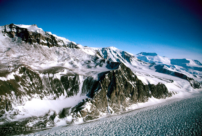
Photo Credit: Ed Stump
Mount Quackenbush on the north side of Byrd Glacier, where Huerta's team will collect samples.
Instead, Huerta and colleagues have found evidence that Byrd Glacier didn’t start as a glacier-carved valley but as a river flowing in the opposite direction, from west to east. That idea would relegate the glaciers to a minor role in the formation of the valleys that cut through the Transantarctics, a 3,500-kilometer-long mountain range that splits East and West Antarctica. “That’s going to change the way people think about how glaciers work,” Huerta noted. “It’s looking like in this case they haven’t done much.” And if those outlets pre-date the glacier, then the East Antarctic Ice Sheet has always been able to drain through the mountains, Huerta said. “That kind of changes how we would interpret the dynamics of [the ice sheet] and try to understand the past variations in it.” Part of the evidence for the plateau theory comes from three major tributaries of the Byrd Glacier that form acute angles that point upstream of the current east-to-west drainage, meaning that at some time in the past West Antarctica was higher than East Antarctica. “It would be hard to understand if [Byrd] was formed by rivers, how it could be going in a different direction,” Huerta said. Previous analysis of the cooling history of the mineral apatite from the region, from methods such as fission-track thermochronology with samples collected by colleague Ed Stump at Arizona State University, suggest the mountains predate the Eocene by tens of millions of years, according to Huerta. 
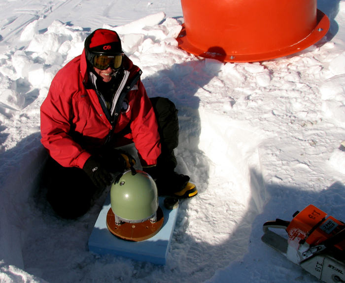
Photo Courtesy: Audrey Huerta
Audrey Huerta installs a seismometer for a different project called POLENET.
The Transantarctic should have started eroding about 55 million years ago after uplift, but Stump’s samples are about double that age, according to Huerta. “It makes them sound like they were old mountains a long time ago and didn’t all of a sudden pop up in the Eocene.” Fission tracks are preserved in minerals like apatite that contain small amounts of uranium, according to information from the U.S. Geological Survey By determining the number of tracks present on a polished surface of a grain and the amount of uranium present in the grain, scientists can calculate how long it took to produce the number of preserved tracks. As long as the mineral has remained cool, near the earth’s surface, the tracks will accumulate. If the rock containing these minerals is heated, the tracks will begin to disappear. The cooling history from minerals on the east and west sides of the mountains would be fairly symmetrical if they had been created by uplift, according to Huerta. “If there was a plateau, then you would expect to see a lot of old ages on the East Antarctic side, where the rivers would have carved through at the edge of the plateau and run down onto East Antarctica,” she explained. Huerta’s team includes co-principal investigator Ann Blyth The seven-person team will spend 10 days at Byrd Glacier collecting apatite for additional analysis, making long vertical transects of the region with the help of helicopter support. The group will work out of a nearby Antarctica New Zealand The plateau theory begs all sorts of additional questions. What happened to the plateau? How did it erode? How tall was it? Was the slope gentle or ruggedly steep? “We’re just starting to think it was actually there. Hopefully, with this study, we can get a better idea of how it was shaped and how the rivers cut through it,” Huerta said. NSF-funded research in this story: Audrey Huerta, Central Washington University, Award No. 0739713 |


For USAP Participants |
For The Public |
For Researchers and EducatorsContact UsU.S. National Science FoundationOffice of Polar Programs Geosciences Directorate 2415 Eisenhower Avenue, Suite W7100 Alexandria, VA 22314 Sign up for the NSF Office of Polar Programs newsletter and events. Feedback Form |


