A new standardU.S. 'raises the bar' on using personal names for geographic features in AntarcticaPosted July 18, 2014
Those seeking immortality in Antarctica will find the bar has been raised – at least when it comes to being honored by having a geographic feature named after them. A couple of years ago, the U.S. Board on Geographic Names “In the old days, just going to Antarctica was a lot of effort. These days there are large national programs, there’s a tourist industry – it is much easier to go there,” noted Scott Borg, head of the Antarctic Sciences Section Borg is currently the chairperson of ACAN, which is composed of active and retired federal employees from the National Science Foundation (NSF), NASA The new policy, citing the differences between the ‘old days’ and modern era, says the “honor of having a geographic feature named for individuals should now be based on some significant contribution that goes well beyond successful participation in some Antarctic-related enterprise.” “More recently, we have turned things down,” Borg said, adding that while proposals will still be reviewed case by case, people who are put forward for a geographic feature should be at or near the end of their Antarctic career. “We felt it was appropriate to say, ‘If we really want this to be honorific, we should raise the bar,’” Borg said. “The new policy in no way means to diminish the contribution of those honored previously or implies that those people were any less deserving of the recognition of having a feature named after them. In fact, many names that had been applied would have passed the threshold we have today.” 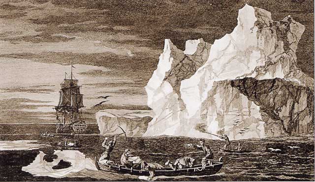
Image Credit: William Hodges/Wikipedia
Capt. James Cook was the first to name features in Antarctica. A drawing by William Hodges of Cook in Antarctica.
Started with CookThe naming of places in the Antarctic and sub-Antarctic goes back to 1775 when Capt. James Cook discovered South Georgia and the South Sandwich island groups, according to the UK Antarctic Place-names Committee The South Shetland Islands and northern Antarctic Peninsula were first sighted in 1819 and 1820–21 by William Smith and Edward Bransfield from the Royal Navy ship Williams. They named about 20 major features, including King George Island (after George IV) and Smith Island (after Smith). Royal Navy admirals lent their names to Cornwallis and Clarence islands. Not all features were named after people: Tower and Desolation islands are descriptive designations. These categories of place names – important figures and sponsors, expedition members and descriptive features – set the tone for place-naming in the region ever since, according to the article “Naming the un-named” in Geographical Magazine by Adrian Fox and Kate Bazeley. “The place names on the Antarctic Peninsula are shorthand for its history,” they wrote. “The jigsaw of clusters of related names shows how the geography of the region was slowly pieced together – first by successive exploratory expeditions and later by surveyors and scientists. Many of the names evoke the adventures and hardships of these pioneers.” Scientific era dawnsA new era in Antarctic exploration was ushered in during the 1950s by the International Geophysical Year (IGY) Nations like Britain, Argentina, Chile and Australia put aside their territorial claims with the signing of the treaty. The need to name geographic features, however, grew in importance as more of the continent was explored and mapped. More than a score of nations that are members to the Antarctic Treaty system have national names committees, from major players like the United States and Britain to countries with smaller programs like Bulgaria. Since 1996, naming activities have been coordinated by the Scientific Committee for Antarctic Research (SCAR) 
Photo Credit: Olav Loken/Antarctic Photo Library
The International Geophysical Year ushered in a new age of scientific discovery, and the need to create maps and designate geographic features across Antarctica.
The SCAR Composite Gazetteer of Antarctica Early mapping effortsOf course, one of the main reasons behind naming a feature is to ensure it accurately refers to a particular place. Antarctic maps created before the age of satellites and high-precision GPS technology were certainly useful and accurate to a remarkable degree. But today’s high-resolution satellite imagery has enabled Antarctic cartographers to make maps with features geo-located within tens of meters of their actual locations. Previously, such locations may have been off by hundreds of meters or more. “They were doing their absolute best to place the names accurately,” said Brad Herried Traditional survey methods using tools like the transit and theodolite to measure both horizontal and vertical angles produced excellent local maps at the time, Borg noted. A reference point called “camp area datum” at McMurdo Station, established using astronomical observations, helped make maps for areas of scientific interest such as the McMurdo Dry Valleys However, charting more remote locations on the continent was not practical without introducing systematic errors in latitude, longitude, and elevation. |

For USAP Participants |
For The Public |
For Researchers and EducatorsContact UsNational Science FoundationOffice of Polar Programs Geosciences Directorate 2415 Eisenhower Avenue, Suite W7100 Alexandria, VA 22314 Sign up for the NSF Office of Polar Programs newsletter and events. Feedback Form |

