|
Mountainous MysteryAn international research team will head to the high plateau in East Antarctica to probe subglacial feature with cutting-edge instrumentsPosted November 15, 2007
A mountain range the size of the European Alps, but buried below hundreds of meters of ice and snow, has puzzled and enticed Antarctic scientists since its discovery 50 years ago. How did it get there? What does it look like? How tall is it? What role did it play in the formation of the ice sheet? Those are a few of the questions an international team of researchers will attempt to answer beginning this season, as they venture into the Antarctic Gamburtsev Province (AGAP) “We don’t know why that mountain range is there. It’s really a mystery,” said Robin Bell, a principal investigator for AGAP’s aerogeophysical component, nicknamed GAMBIT. “It’s kind of like finding a mountain range in the middle of Canada.” A Soviet overland traverse discovered the Gamburtsev subglacial range during the International Geophysical Year in 1958. Scant other data exist aside from a few aerogeophysical surveys dating back to the 1970s. A multi-nation effort to study the subglacial mountain range in more detail came together as a result of the International Polar Year (IPY) “A project of this size, really, can only happen in the framework of IPY because it requires so many people to support a project of this magnitude,” noted Michael Studinger, co-principal investigator for GAMBIT. Both Studinger and Bell are researchers at Lamont-Doherty Earth Observatory of Columbia University AGAP is the flagship of the U.S. IPY program, said Tom Wagner, program manager of Antarctic Earth Sciences in the Office of Polar Programs at the National Science Foundation (NSF) GAMSEISThe science campaign to discover the nature and origin of the range includes three field seasons to install and retrieve 25 seismic stations around the Gamburstev Province. Doug Wiens of Washington University in St. Louis heads up this end of the project, dubbed GAMSEIS Wiens said a six-member field team plans to install 10 seismographs this season and 15 next year. The instruments will provide information on the structure of the mantle and crust beneath the mountains to learn more about the history of the subglacial range. .jpg', 'sunImages', 500, 316, 'yes');)
Photo Credit: Doug Wiens
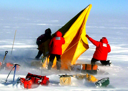
A Twin Otter aircraft will be used to ferry scientists and equipment for the AGAP project.
“The basic question is: What’s holding them up? What’s causing the high elevations there?” he explained. “That’s related to the issue of how old the mountains are, which is really important for reconstructions of the climate of Antarctica in the past, and even the whole world.” France, China and Japan all have plans to install additional seismic stations as part of the effort, which encompasses an area about 1,000,000 square kilometers. The Chinese, working out of Zhongshan Station, will conduct a traverse that includes setting up a seismograph at Dome A, a plateau about 1,200 kilometers inland and more than 4,000 meters above sea level. The Italians and Australians may also participate, Wiens said, but are waiting for funding to materialize. The American scientists will establish a field camp near Dome A, but closer to 3,500 meters in altitude. They will use a Twin Otter aircraft to carry people and equipment to the 10 seismic sites, hoping to knock out two each day. The work is not without its challenges. “We’ve rarely worked at elevations this high and cold, and [Raytheon Polar Services] has made a major effort in planning for this project with multiple camps and complex acclimatization schedules to accomplish it safely,” Wagner noted. The GAMSEIS network will operate in concert with another IPY project, POLENET One of the main goals of that project is to measure the rate of terrestrial rebound from the loss of ice in West Antarctica since the last glacial maxim 20,000 years ago, when there was much more ice there than today. That will help scientists more precisely determine ice mass and create better models to predict sea level rise in a global warming scenario. [See related story: Moving experience.] “Also, the GAMSEIS data will be combined with POLENET data to give us a more complete view of the earth’s interior from the Antarctic crust all of the way to the core,” Wagner said.
|

For USAP Participants |
For The Public |
For Researchers and EducatorsContact UsU.S. National Science FoundationOffice of Polar Programs Geosciences Directorate 2415 Eisenhower Avenue, Suite W7100 Alexandria, VA 22314 Sign up for the NSF Office of Polar Programs newsletter and events. Feedback Form |