Two for onePair of projects examine Ross Ice Shelf from top to bottom and beyondPosted January 9, 2015
The most ambitious and extensive network of seismographs ever deployed on an ice shelf promises to reveal new information about two very different subjects. One team of scientists hopes to learn more about the structure and flexibility of the ice shelf itself in response to different types of ocean-wave energy. Meanwhile, the ice shelf serves as an opportune platform from which a second group of researchers will investigate the structure of the deep earth. The two studies, both funded by the National Science Foundation’s Office of Polar Programs, will share data and logistics support to install and maintain more than 30 seismometers on the Ross Ice Shelf for the next two years. NSF-funded research
Doug Wiens, Washington University, Award No. 1142518
Richard Aster, Colorado State University, Award No. 1141916 Andrew Nyblade, Pennsylvania State University, Award No. 1142126 Peter Bromirski and Peter Gerstoft, Scripps Institution of Oceanography, Award No. 1246151 Ralph Stephen, Woods Hole Oceanographic Institution, Award No. 1246416 “No one has deployed these instruments at this scale on an ice shelf. It’s the largest network of floating seismographs that has ever been deployed,” noted Rick Aster, head of the Department of Geosciences in Colorado State University’s Warner College of Natural Resources. Aster is a co-principal investigator (co-PI) on a project using the seismometers to delve deep into the Earth’s mantle in a region where little information exists about the layer of the planet located below the crust. For example, the study will address whether the center of active volcanic activity in the region – smoking Mount Erebus – is part of a relatively shallow magma system or linked deeper into the mantle through a structure called a mantle plume. “The data at this point is equivocal. That’s why we have to do this project,” said Doug Wiens, a professor at Washington University in St. Louis and the PI on the seismic survey into the mantle structure under the Ross Sea. Peter Bromirski, a researcher at Scripps Institution of Oceanography and the PI of the other project, is enthusiastic about the possible discoveries to be made about the proverbial nuts and bolts of the Ross Ice Shelf (RIS) – how the world’s largest ice shelf responds and flexes to the various types of swells and waves that roll across its 800-kilometer-wide front. “There’s no question that we’re going to find out new and exciting things,” Bromirski said. Projects share camp and logisticsThe two projects may diverge in their focus – fire versus ice – but the data from the broadband seismometer array will be shared by both groups, according to Aster, who is also a collaborator on the project led by Bromirski. 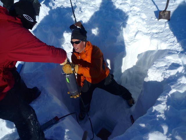
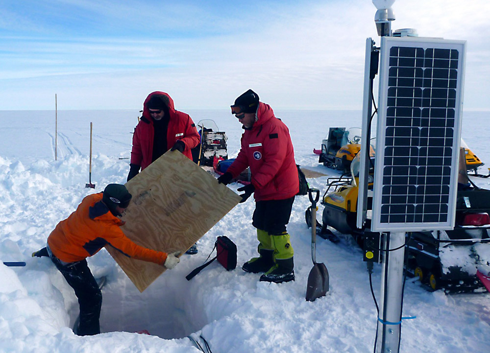
Photo Courtesy: Doug Wiens
PASSCAL's Doug Bloomquist installs a seismic sensor on the Ross Ice Shelf.
“It was a chance to put in a much denser array with a richer array of PIs than you could normally do,” he said. Seismometers measure and record the size and force of different types of wave energy, such as from distant earthquakes. The broadband sensors on the Ross Ice Shelf are capable of sensing ground motions over a wide frequency band. The instrumentation is supported by IRIS (Incorporated Research Institutions for Seismology), a university research consortium partly funded by the National Science Foundation, through IRIS’s Portable Array Seismic Studies of the Continental Lithosphere (PASSCAL) program. The two teams shared the same field camp – dubbed Yesterday Camp due to its location just across the International Dateline from McMurdo Station – and used a Twin Otter aircraft to install the most distant seismic stations over the course of several weeks. Sites closer to Yesterday Camp were installed via snowmobiles. Each seismometer is powered by a combination of lead-acid batteries and solar panels during the summer, and specially engineered lithium batteries for winter operation. The experiment is designed to run continuously for two years, though team members will return next austral summer to retrieve the first year’s data, as the volume is too large to transmit across the Iridium satellite stream from Antarctica. “All along we were planning to collaborate and work together,” Wiens said. |

For USAP Participants |
For The Public |
For Researchers and EducatorsContact UsU.S. National Science FoundationOffice of Polar Programs Geosciences Directorate 2415 Eisenhower Avenue, Suite W7100 Alexandria, VA 22314 Sign up for the NSF Office of Polar Programs newsletter and events. Feedback Form |