Thwaites Glacier – PresentScientists Take a Close Look at the Current State of the Glacier of Greatest ConcernPosted May 03, 2021
Thwaites Glacier is melting fast because of climate change, causing sea levels to rise the world over. Of all the world's glaciers, it's the one that scientists are most worried that a catastrophic collapse could happen quickly and affect coastal regions everywhere. 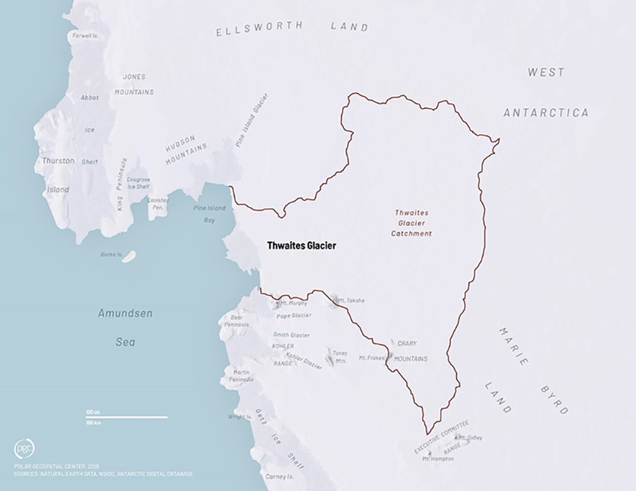
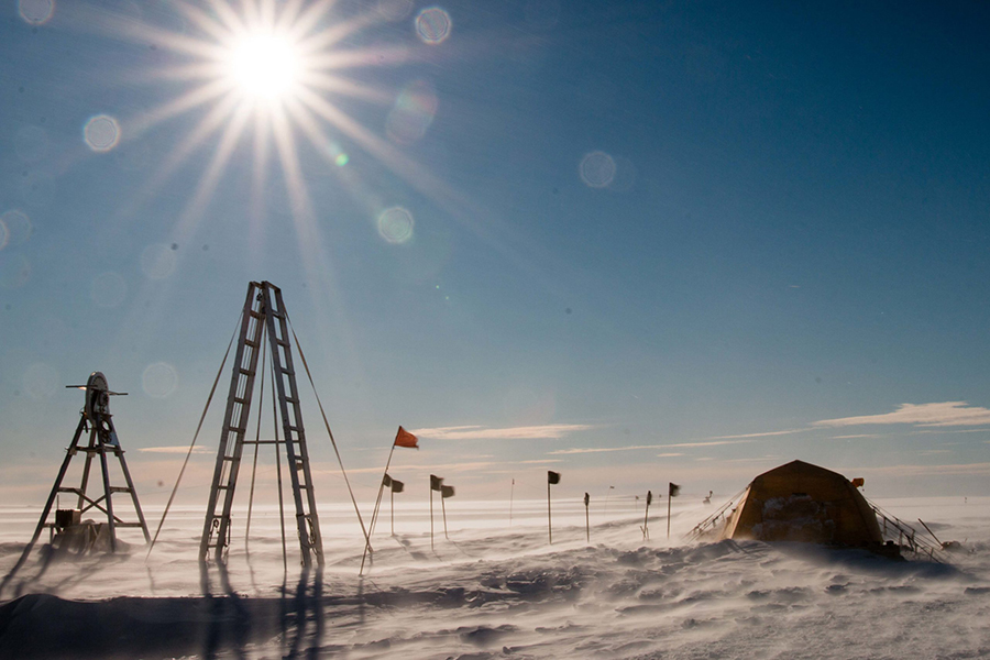
Photo Credit: The Polar Geospatial Center
The Thwaites Glacier is a vast expanse of ice in West Antarctica, covering an area about the size of Florida.
"It's not ‘If sea level is going to go up,' it's ‘When and how much,'" said Erin Pettit of Oregon State University. "The Thwaites project is focused specifically on the sea level rise question and trying to narrow down that." Thwaites Glacier is a mass of ice the size of Florida along the coast of West Antarctica. It's gradually flowing into the ocean, and since the 1970s, scientists have watched as its pace is speeding up, adding more grounded ice into the ocean each year. "There's a very intimate connection between sea level and glacier volume," said Sridhar Anandakrishnan of Pennsylvania State University. "These two exchange water continuously, water goes from the ocean to the ice sheet and from the ice sheet back to the ocean… If that exchange is unequal, and in this case if more water leaves the glacier and goes into the ocean, than comes back from the ocean to the glacier, then sea level rises." That sea level rise isn't confined to remote areas of the globe, but spreads out and affects every coastline in the world. So far the glacier has only contributed a few millimeters of sea level rise, but scientists worry that if the whole West Antarctic Ice Sheet collapses, it could rise significantly more. "There's been a lot of work in the last several years emphasizing the potential instability of the Thwaites Glacier and its drainage basin which contains up to one meter of sea level rise in it," said Slawek Tulaczyk of the University of California, Santa Cruz. Likely it would take decades or centuries for the entire sheet to collapse. But there's a great deal of uncertainty about how fast a collapse might happen, how much could fall into the sea and how much oceans will rise as a result. These are questions with potentially major impacts to coastal communities all over the world. 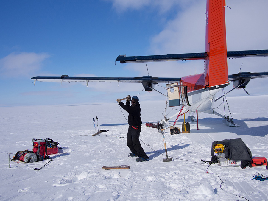
Photo Credit: Kiya Riverman
Glaciologist Sridhar Anandakrishnan first traveled to Thwaites Glacier in 2018 with the MELT team, but plans to return in the future as part of GHOST to collect data about the bedrock under the glacier.
Part of the reason there are so many uncertainties is that the glacier is difficult to reach. Located in remote Marie Byrd Land along the coast of West Antarctica, the glacier is many hundreds of miles from the nearest research station. To answer these questions, the U.S. Antarctic Program (USAP), the British Antarctic Survey (BAS) and other international partners are working together to study the glacier like never before. Under the banner of the International Thwaites Glacier Collaboration (ITGC), the programs are sending researchers to the remote region to analyze the mass of ice from the land, sea and air. This is part two of a three-part series taking a deep look at the past, present and future of Thwaites Glacier, its potential impact on the planet and the international effort to understand this rapidly thinning glacier. These efforts, eight complimentary resaerch projects, make up the International Thwaites Glacier Collaboration and are supported by the National Science Foundation, which manages the U.S. Antarctic Program, and the Natural Environment Research Council, which operates the British Antarctic Survey. The combined science effort, including meetings, discussion, outreach and supporting data, is being facilitated by the ITGC Science Coordination Office. Subglacial GritThwaites is continuously flowing into the ocean. Though it's been speeding up in recent years, there are a number of factors holding the glacier back and keeping it from flowing even faster. 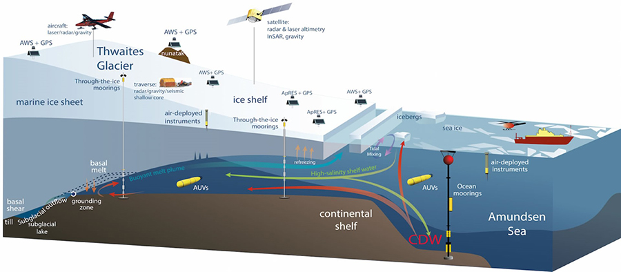
Photo Credit: The International Thwaites Glacier Collaboration
An illustration of Thwaites Glacier shows how its ice shelf floats on the ocean. Researchers are studying Thwaites Glacier from land, sea and air.
"What we're really interested in with this project is what's beneath Thwaites glacier," Sridhar Anandakrishnan said. "Obviously that ice is sitting on something. Some kind of rock is there underneath the glacier. What kind of rock is it?" Anandakrishnan, along with Andy Smith at the BAS, are the principal investigators of GHOST, short for Geophysical Habitat of Subglacial Thwaites. They and their teams use advanced techniques to see through the glacier and understand how the underlying bedrock, known as the bed, is affecting the glacier's flow. "The reason that it's so important to characterize the bed is that Thwaites, like many glaciers, slides over the rock that is beneath it, and what type of rock makes a huge difference. Is it smooth? Is it bumpy, is it wet? Is it dry? Is it hard rock like granite or is it a softer rock like a sedimentary rock?" Anandakrishnan said. "It's those sorts of questions that the modelers need answers to so that they can build better models." Rougher terrain can act like gritty sandpaper, slowing the ice's advance, but a smooth, wet underlayer can let the ice slide into the ocean more easily. Because of the scale of the glacier, getting a complete picture of the ground beneath the ice is difficult. Thwaites is big, stretching more than 400 kilometers from one end to the other and covering an area the size of Florida. "You can imagine that the rock changes from place to place," Anandakrishnan said. "So not only do we need to know what rocks are underneath and the properties of those rocks under the glacier, but we need to know what it looks like in different places." 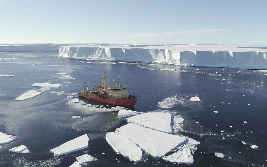
Photo Credit: Alex Mazur
TARSAN sailed to the edge of Thwaites Glacier on the research vessel Nathaniel B. Palmer.
With the glacier as thick as three kilometers in some places, it would be impractical to drill through that much ice at all of the places the team wants to measure the bed. Instead, they're going to use a combination of radar and seismic equipment to measure the ground below remotely. "We set up radars on the surface of the glacier, we point them downwards, the radio waves go down through Thwaites Glacier, they hit the bottom they come back up, and we measure how long it took, and what the characteristics of that echo are and that tells us a lot about the bed. Then we move the antenna to a new place, do it again, move the antenna to a new place, move it again, so that way we can learn a lot about the bed in different places," Anandakrishnan said. "It's very easy to move around, it gives us a great deal of information very quickly, but it doesn't tell us everything we need to know about the bed." Radar can produce detailed information about the ice itself and the surface of the rock below, but to get a complete picture of what the bed is made of, they need to be able to see through the rock itself. That's what the seismic equipment is for. "It's similar to radar in that you put out a signal and you listen for the echo, but instead of putting out a radio wave into the ice, we put out a sound wave into the ice," Anandakrishnan said. "We use a small explosive to generate a sound wave or a seismic wave that travels down through the ice, hits the bottom of the ice and comes back up with the advantage that it doesn't just stop at the bottom of the ice, it goes deeper into the rocks beneath and keeps bouncing off of different layers below within the rock that are below the ice." Together, the two instruments will produce a detailed map of the interior of Thwaites glacier, as well as the bed on which it sits. "[That] will help us to characterize what the bottom of Thwaites glacier looks like in a number of places and that should improve our ability to model and project what Thwaites will do in the future," Anandakrishnan said. 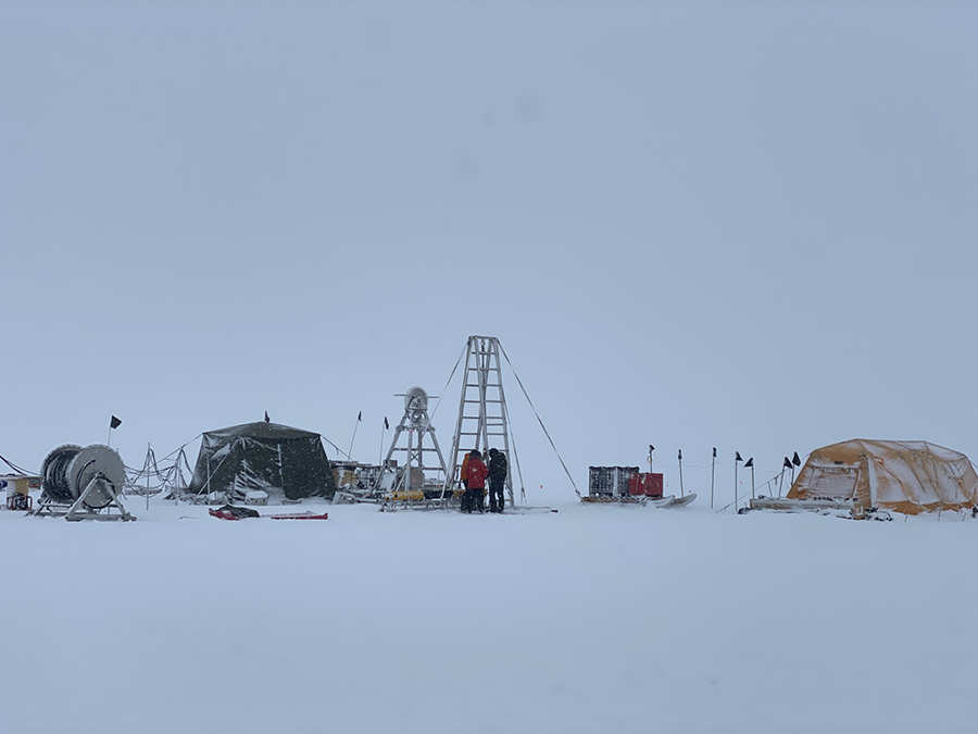
Photo Credit: Denise Holland
The field camp at Cavity Camp under cloudy skies with the drilling rig visible in the center along with the robot control tent on the right.
The team was originally supposed to travel to Antarctica for their first major field season in late 2020, but because of the COVID-19 pandemic, their work has had to be pushed to a future season. However, despite the setback, they've continued to work with and refine the data they already have. "There are modelers who are part of our project and so they've continued to do their modeling with the information that we have at hand." Anandakrishnan said. "We have some data from previous years that we're reanalyzing. And that's been helpful." Freezing ButtressIt's not just the ground below that's restraining the flow of Thwaites Glacier. The glacier's own floating ice shelf is holding it back as well. Erin Pettit, along with Karen Heywood of the University of East Anglia, are the principal investigators on the Thwaites-Amundsen Regional Survey and Network Integrating Atmosphere-Ice-Ocean Processes project, known as TARSAN. "We're asking, ‘How quickly is this ice shelf going to go away?'" Erin Pettit said. "If that ice shelf goes away, it is like removing a dam on a river, the glacier will likely start flowing faster into the ocean." An ice shelf forms when ice from a grounded glacier reaches the ocean, lifts off from the bedrock and starts floating on top of the water, creating a frozen shelf over the seafloor below. If just the shelf breaks apart, ocean levels won't immediately rise because the shelf is floating and the ice has already displaced its mass of water. Instead, its presence acts as a buttress, holding back the grounded glacier and slowing its flow into the ocean. 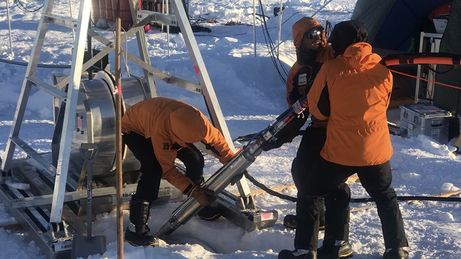
Photo Credit: Daniel Dichek
The British Antarctic Survey drilling team lowers a hot water drill into the ice hole to drill through the glacier and reach the ocean below.
However, this reinforcement at Thwaites Glacier is under threat. Warm water from the ocean depths is eating away the underside of the Thwaites ice shelf, thinning it and weakening it. It's one of the indirect results of the planet's warming climate. "Over the last 50 years there's been an increase in the circumpolar winds that go around. That's due to the atmosphere warming," Pettit said. "Those winds in the atmosphere, they go across [the ocean] and as they go across and push water… those surface currents have to be backfilled by deep water coming in." This deep water is slightly warmer than the frigid polar surface water, just enough so that when it contacts the ice shelf, the water warms the ice and melts it away from below. "Our project is really looking at that ice, ocean and the atmosphere connection," Pettit said. "The ice shelf stability in terms of how it's being attacked by the ocean and by the atmosphere." To find out exactly what's happening to the shelf, the team is taking a multifaceted approach, reaching the glacier by land and by sea. 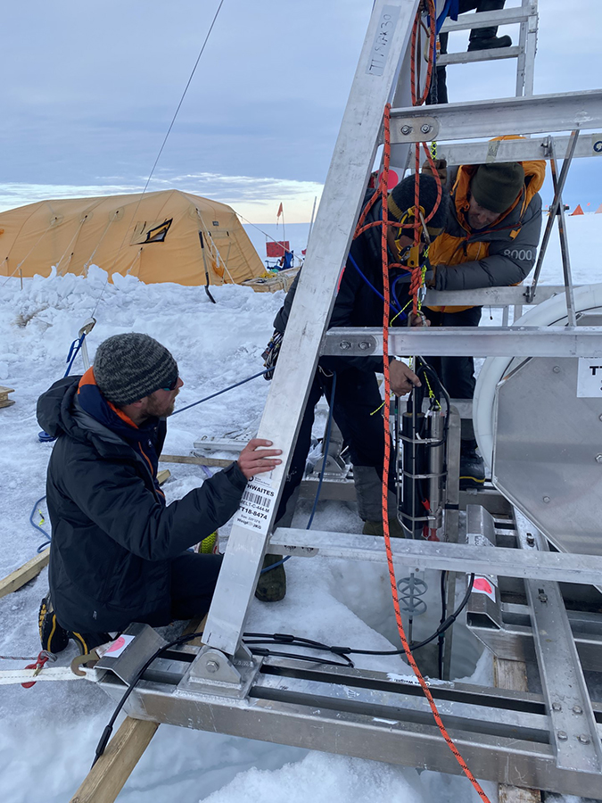
Photo Credit: Denise Holland
Members of the MELT team deploy an ocean mooring through the ice hole down to the ocean below. The mooring is measuring a range of oceanic conditions to better understand how warm ocean water is melting out the glacier.
Members of the team have twice sailed to the region on the research vessel Nathaniel B. Palmer, carrying a range of different instruments to measure everything they could about the ice shelf. They took the temperature and salinity of the water column leading to the glacier and deployed turbulence profilers to see how much the different temperature water layers are actually reaching the ice. They've even attached small data-collecting devices to some of the seals living in the region who routinely swim under the ice shelf. "The seals just swim around and get us all sorts of information on the properties of the ocean throughout the seasons so we can get that broader picture of when and where the circumpolar deep water is [and] how it's moving," Pettit said. Also during the 2019/2020 Antarctic summer, members of the team visited the grounding zone of the ice shelf, the spot where it first starts floating off of the bedrock. They probed beneath the ice in conjunction with another project, MELT, who drilled a hole through the ice shelf into the ocean below. The TARSAN team installed a string of autonomous instruments known as AMIGOS, to monitor the ocean and atmospheric conditions and collect data from under the ice for several years to come. In future seasons, they're planning on returning to the ice edge and sending Britain's autonomous underwater vehicle Boaty McBoatface to swim farther under the ice shelf. It will collect even more readings from below and ultimately tie the data from both sides of the ice shelf together. "That's when the ship is going to come back and the idea is that they will send the AUV underneath to kind of kiss our ocean string and provide a little bit of a spatial context for where this single ocean sensor string is," Pettit said. The team is also studying other features holding back the glacier's flow. This includes the strength of the ice itself, and how the underlying bedrock's landforms can stick up and restrain the ice. 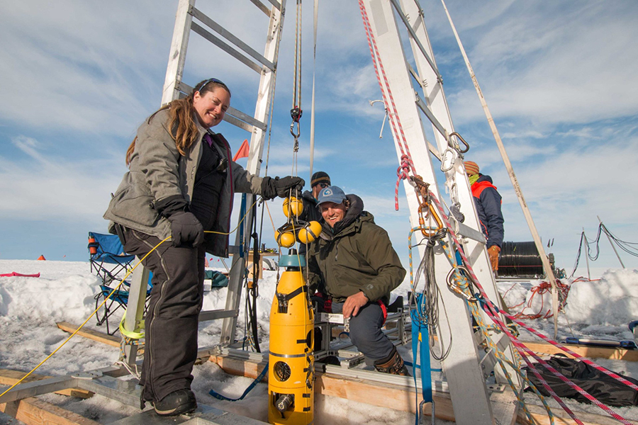
Photo Credit: Daniel Dichek
Britney Schmidt (left) and Andy Mullen prepare to lower their autonomous underwater vehicle Icefin down the ice hole into the ocean.
"You have to have both a hold on the rock and you have to have structural integrity from there up into the glacier," Pettit said. "What we're looking at is both of those pieces. Where are those pinning points, how strongly are they on there, what's weakening those specific holds, and what's weakening the ice shelf, its structural integrity." The team also operated two radar systems on the surface of the glacier to look down through the ice to the bottom of the shelf. One of the radars primarily tracks how quickly the ice is melting away, but its signals reflect off of the glacier's internal strata as well, offering insights into the strength of the ice itself. A different radar system maps out the geometry of the ice shelf and the pattern of the ice's internal layers. "We're going to be looking at those internal radar layers, and ask questions such as where does it seem like it is cohesive and how does that compare to this history of flow and fracture that we see from all of the [satellite] imagery that shows us what's been happening over the last several decades," Pettit said. "We can use those clues of the internal structure to connect back with the history and get an idea of where it's thinning the most now [and] where it's weakest the most now." A Glacier UngroundedThe spot where the glacial ice first lifts off the bed and starts to float is a critical part of the glacier, and it's also one that scientists don't have a lot of data about. "We are really focused on one area, the grounding zone where the ocean, the ice sheet and the rock meet," said David Holland of New York University. 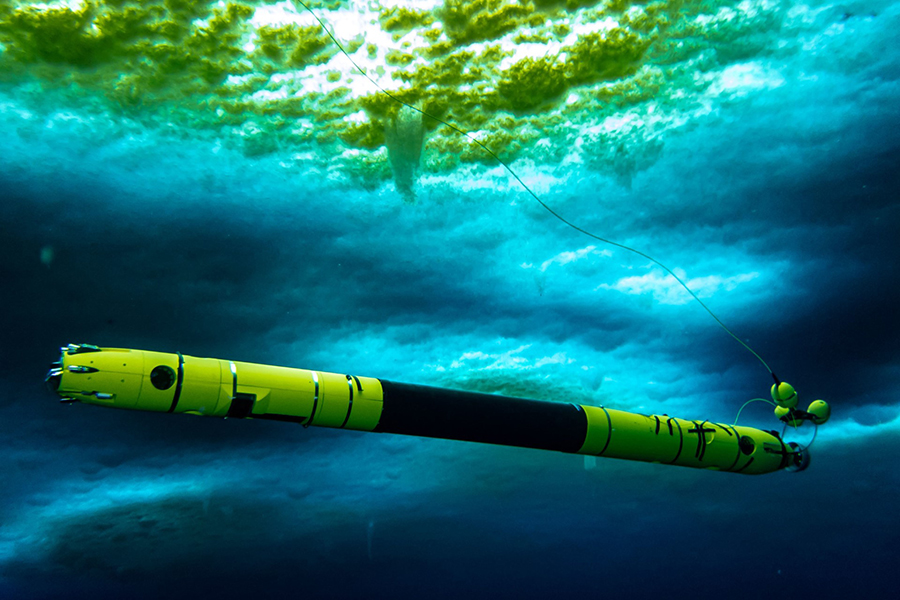
Photo Credit: Rob Robbins
Taken under the sea ice near McMurdo Station, the autonomous underwater vehicle Icefin collects oceanographic data as it swims through the water.
Holland, along with Keith Nicholls at the British Antarctic Survey, are the principal investigators of the Thwaites MELT project which is zeroing in on what's happening to the glacier's grounding zone. "Melting at the grounding zone is key, and getting that right is really important for modelers," Nicholls said. "They tell us that their modeling is totally stymied by the fact that they really don't know what's happening at the grounding zone. They don't know how to make any real solid forecast without knowing how fast the ocean is melting the ice in the grounding zones and that's really the big drive of the project." Thwaites's grounding zone is besieged by the incursion of warm ocean water that's been melting out from the underside of the ice shelf. Though only a few degrees above freezing, this "warm" water is melting out the grounding zone and causing it to retreat farther up the glacier at an alarming rate. Ice moves much faster on top of water than grounded ice and as that grounding zone melts away and gets pushed farther and farther back, the faster the masses of once-grounded glacial ice push into the ocean. Satellite data indicate that the grounding zone has been changing dramatically over the last decade. Though difficult to measure precisely from orbit, it seems that since 2011 the grounding zone started retreating by as much as a few hundred meters each year. "Depending what melt rate you impose on the grounding zone, you see vastly different amounts of overall mass loss of the glacier," said Aurora Basinski-Ferris of New York University. "We really want to pin down what's happening at the grounding zone because that will have the most impact on what's happening overall in the next 100 years." What makes the underside of Thwaites especially concerning is that its grounding zone lies along a bedrock ridge under the glacier. Behind it, a vast subglacial canyon opens up and drops away. Scientists fear that if the grounding zone gets pushed back beyond that ridge, warm water could spill over and flow into that canyon, eating away at the glacier even faster. 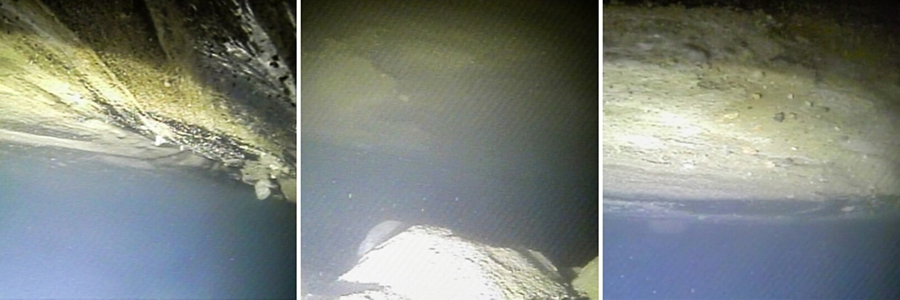
Photo Credit: Britney Schmidt
Images taken by Icefin from below the Thwaites Glacier's grounding zone show sediments on the underside of the ice.
"The bed of the bedrock slopes away, it gets deeper as you go inland," Nicholls said. "As the warm water gets in beneath the ice, it melts more, then it lifts off the bed… and accelerates back simply because of the nature of the topography." To get a better understanding of what exactly is happening in this critical region, the MELT team went straight to the source. Using a special hot water drill, they bored a narrow shaft straight through the glacier and into the ocean next to the grounding zone. Once the shaft was open, they dropped down a number of instruments to freeze into place under the ice and to measure the subglacial water for several years. "The key instruments are in the ocean, and they're looking at turbulence in the boundary layers – turbulence in the water column quite close to the ice base. They'll also be measuring the water temperature and salinity," Nicholls said. "Knowing about the turbulence tells us how quickly warmer water can mix from deeper in the water column up to the ice base and have it melt the ice. Tying that with the actual measured melt rate using the radar is quite a powerful combination." In addition, they also used the same radar systems as TARSAN, called an ApRES, to look through the ice above the grounding zone. They used it to bounce radar signals off the bottom of the glacier to measure the way the ice itself is changing and the precise rate that the underside is melting. "The radar is complementing the ocean data in as much as the radar will tell us the melt rate and the ocean data will tell us essentially what's causing that melt rate, so we can link the two together," Nicholls said. 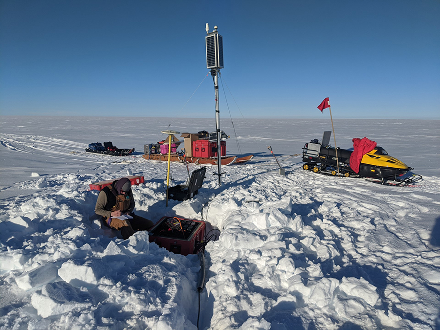
Photo Credit: Jacob I. Walter
Stephen Veitch installs a long-term seismic station on Thwaites Glacier.
To further add to the ocean data, the team also sent an underwater robot down the shaft to swim as close to the grounding zone as possible. Known as Icefin, the pencil-looking robot was designed to fit through a narrow borehole in the ice and swim through tight spaces. "Basically, it's an underwater oceanographer," said Britney Schmidt of the Georgia Institute of Technology and leader of the Icefin robot team. "The robot is a way to understand the three-dimensional context that the long-term, single-point measurements are going to make." In addition to the robot's thermometer, two of its most important instruments are devices that measure how salty the water is, and how much dissolved oxygen is present. "Those two actually tell us about the history of the water column. Different parts of the ocean, different depths of the ocean, different histories and different types of water have a different chemical signatures," Schmidt said. "Things that have been exposed to the open ocean, could be very rich in oxygen for instance, things that are coming from the back of the glacier may not be." Analyzing the robot's data, the team found the grounding zone surrounded by warm, salty, oxygenated water from the deep ocean that's melting the glacier from below. It's a worrying confirmation of what researchers had long suspected, but the data that the team collected will let them better understand the dynamics of the grounding zone, and what that will mean for the glacier overall. "This system is changing very quickly, and it's going to accelerate as far as we can tell but we don't know by how much," Schmidt said. "Part of that is because we don't have any observations of this area of the system. We can't predict what it's going to do because we've never made observations this close." Going Sideways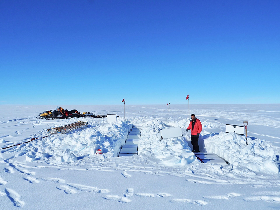
Photo Credit: Eliza Dawson
TJ Young installs a radar antenna array that measures ice deformation rates along the eastern shear margin of Thwaites Glacier.
It's not just the underside of the glacier that's a concern, but what's happening along its sides. Led by Slawek Tulaczyk and Poul Christoffersen of the University of Cambridge, the Thwaites Interdisciplinary Margin Evolution team, abbreviated to TIME, is investigating the glacier's shear margin. It's the area along the edge of a fast-moving glacier where its ice abuts a neighboring, slower-moving ice mass, separating it from Pine Island Glacier. This shear margin is effectively what separates fast sliding ice from a slowly creeping ice sheet, but its boundaries aren't necessarily set in stone. Depending on Thwaites itself and conditions within the shear margin, that boundary could shift and spread any potential collapse into the glacier next door. "In the most dramatic scenario, the eastern shear margin would migrate out and the basins of the Pine Island Glacier and the Thwaites Glacier would merge and create a large flowing feature that probably would be discharging much more ice than is coming out of both systems right now," Tulaczyk said. It's a serious worst-case scenario, but it's also possible that the shear margins are more stable boundaries and any collapse in Thwaites would be self-contained. "We can see either one happening right now because we simply don't understand enough about the physical processes that take place in these shear margins in order to say ‘Well this is impossible or this is impossible,'" Tulaczyk. "What we want to do is characterize the ice within the shear margin and the bed underneath it." 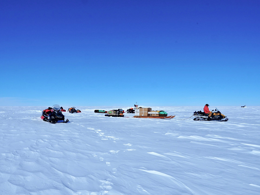
Photo Credit: Eliza Dawson
The TIME field team takes a break during a traverse aimed at installing long-term seismic and GPS stations.
One of the things researchers are looking at is to see how warm and wet the glacial ice is. As the moving ice of Thwaites Glacier slides against the stationary ice sheet separating it from Pine Island Glacier, it causes friction which generates some heat within the ice. Depending on how much heat there is, it can change the ice's properties, and affect how well it bonds the two glaciers together. "If it's warm and wet, then the ice within the shear margin is already weak so it will be harder to shift that shear margin somewhere else. If it's already weak because it's warm and wet, then it tends to be fixed," Tulaczyk said. "But if it is not really warm and wet, then the system is much more free to shift that margin to somewhere else." If there is a shift, it could potentially push out into the Pine Island Glacier increasing the amount of ice entering the ocean, or inward, effectively shrinking Thwaites Glacier and limiting the encroaching ice. To glean insights into what the shear margin might do, the team will be monitoring the region with a suite of instruments collecting data. GPS units will be installed in pairs on different sides of the shear margin to track the movement of Thwaites Glacier relative to its neighbor. Seismic receivers buried in the ice can hear ice breaking within the glacier while radar instruments will track what's happening within at the base of the ice sheet. The team's initial field season in late 2018 and early 2019 laid out the first of a series of GPS tracking units to monitor the glacier along its edges. The following year, the team installed more GPS units and conducted a preliminary radar survey along a section of the shear margin, dragging a radar unit behind a snowmobile. 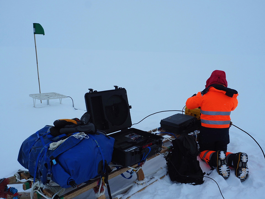
Photo Credit: Eliza Dawson
TJ Young takes a measurement of internal ice deformation using a radar along Thwaites Glacier.
Though most work on the glacier has been temporarily curtailed because of the pandemic, technicians were able to briefly travel to the sites and recover the data from some of the instruments which the team is now analyzing. The team is planning a return in future seasons to complete their work, including an innovative seismic survey technique that should produce a three-dimensional image of the bedrock below. NSF-funded research in this story: Sridhar Anandakrishnan, Pennsylvania State University, Award No. 1738934; Erin Pettit, Oregon State University, Award No. 1929991; David Holland, New York University, Award No. 1739003; Slawek Tulaczyk, University of California-Santa Cruz, Award No. 1739027. |

For USAP Participants |
For The Public |
For Researchers and EducatorsContact UsU.S. National Science FoundationOffice of Polar Programs Geosciences Directorate 2415 Eisenhower Avenue, Suite W7100 Alexandria, VA 22314 Sign up for the NSF Office of Polar Programs newsletter and events. Feedback Form |